Washington County Durham
HOME WHAT'S WHERE THEN & NOW PAGE 6/8 PAGE 8/8
Memories of Washington
Then & Now Collection ( 7/8 )
- Coxgreen Footbridge
- Royal William
- Alice Well
- Worm Hill Terrace
- Biddick Inn
- North Biddick Club
- Bonemill Lane
Coxgreen Footbridge
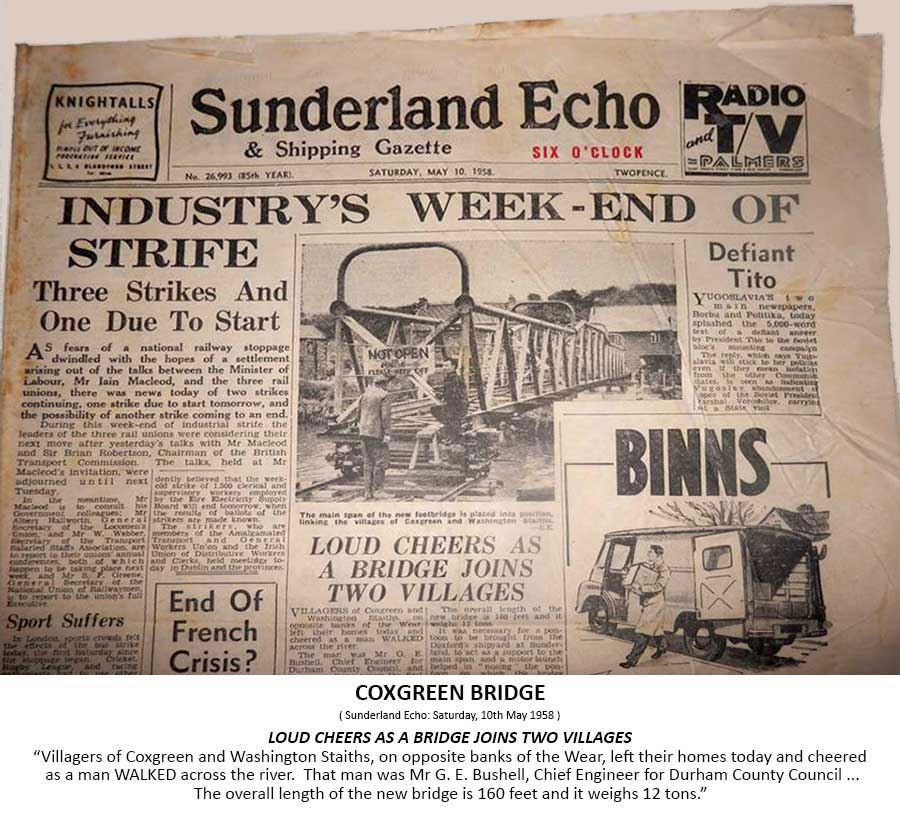
SUNDERLAND ECHO PRESS CUTTING
( Saturday, May 10, 1958 )
• • ◊ • •
THEN 1
( Industrial )
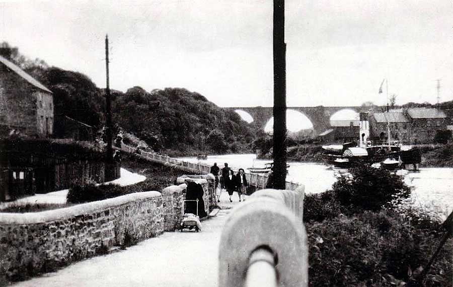
Coxgreen Footbridge nearing completion. Is that a rather subdued Ferryboat Man sitting at the bottom of the Boat Ramp?
Up the Bank (centre-picture) to Washington Station, via Wilden Terrace and Footbridge over the Railway Tracks.
• • ◊ • •
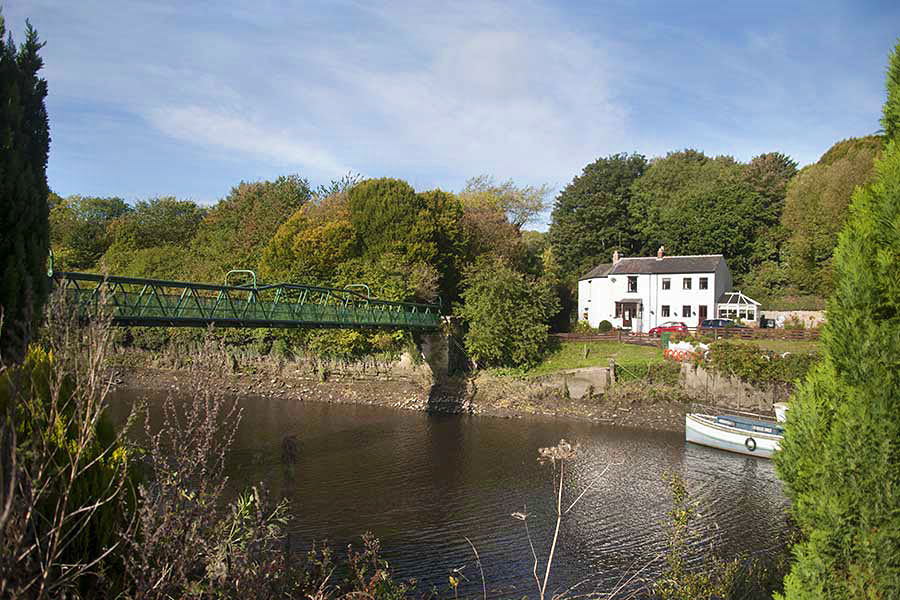
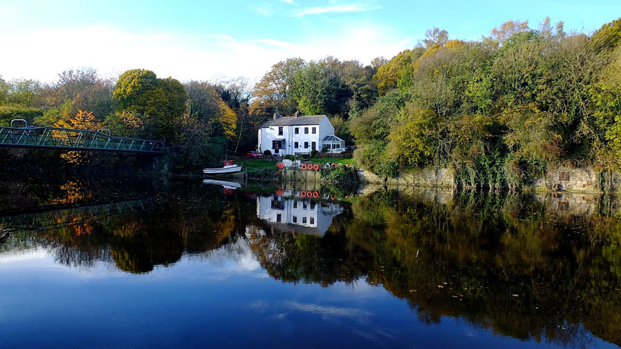
NOW 1
Coxgreen Footbridge and The Ferryman's House
[ Photo: J.G. 3rd September 2017 ]
• • ◊ • •
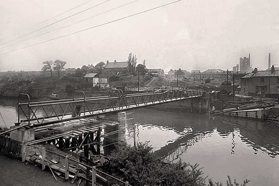
THEN 2
( Industrial )
L/R: Valerie Cook, Ann Thompson & Ann's baby sister, Janice. Victoria Viaduct is upstream to the left.
Blast Row is above the bridge and the Chemical Works spoil heap is above the white house.
• • ◊ • •
NOW 2
( Idyllic )
Coxgreen Footbridge and The Ferryman's House
[ Photo: Keith Cockerill, 30th October 2020 ]
• • ◊ • •
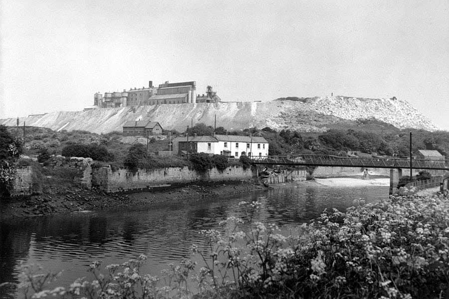
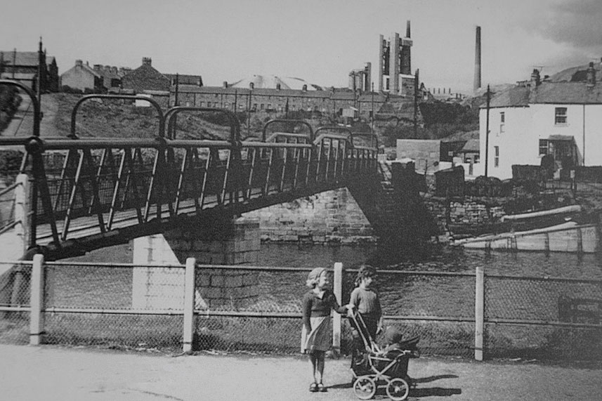
THEN 3
( Industrial )
Coxgreen Footbridge - The Ferryman's House - Washington Chemical Works
Looking downstream from the south bank of the River Wear.
• • ◊ • •
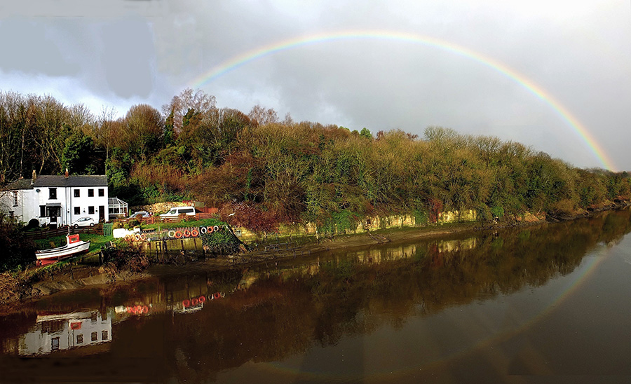
NOW 3 / 4
( Compare with images of the Chemical Works Spoil Heaps, above & below. )
Maybe it's not too late to save the Environment!
[ Three Pictures merged together by Photographer Keith Cockerill, 6th December 2020 ]
• • ◊ • •
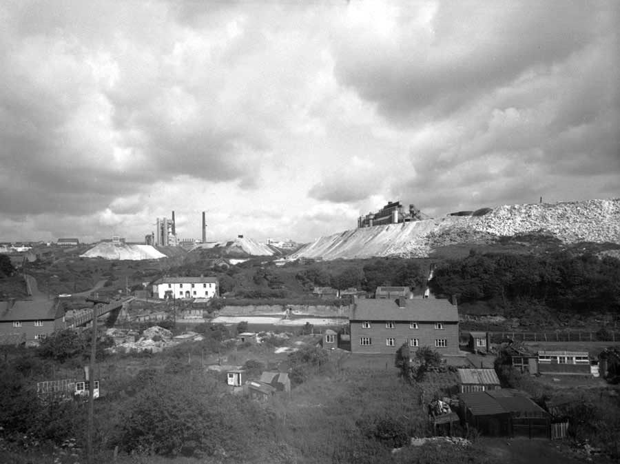
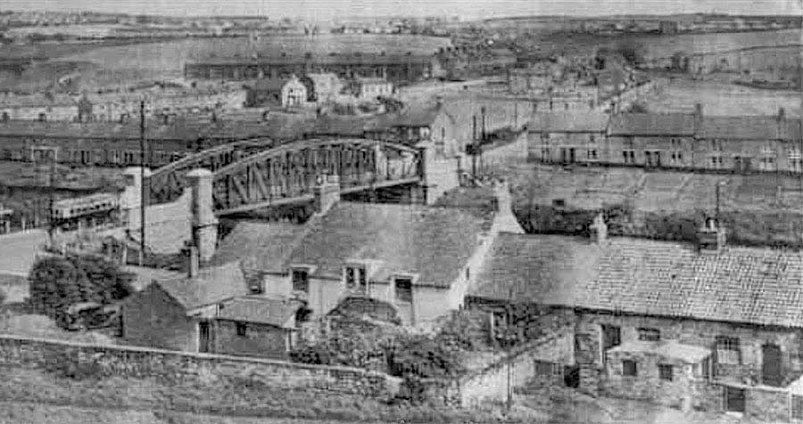
THEN 4
( Industrial )
View from the high ground, south of Cox Green Village.
• • ◊ • •
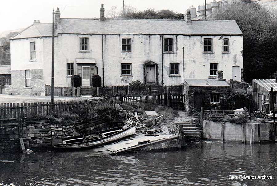
THEN 5
( Industrial )
The Ferryman's House - White Door between the two Bushes.
[ Thanks to Sunderland Antiquarian Society - Holders of the George Edwards Archive. ]
• • ◊ • •
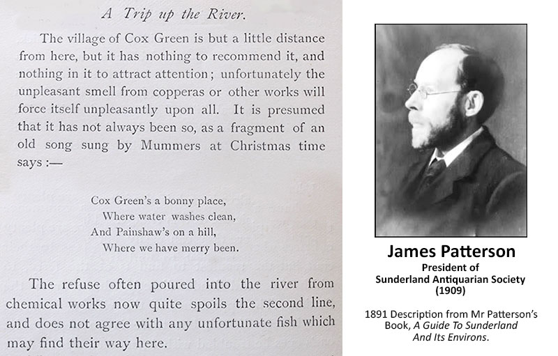
THEN 5
( Book Extract )
A Sunderland Historian's view of the River Wear and the Village of Cox Green in 1891.
This contrasts starkly with the view expressed in the much earlier song.
Without the copperas and the Chemical Works waste,
Cox Green is once again 'a bonny place'.
[ Book extract from Keith Cockerill. Photo supplied by Sunderland Antiquarian Society to Sunderland Echo. ]
• • ◊ • •
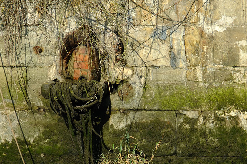
THE 'GASSY GUTTER' OUTLET
Located in the wall of the Staith that was originally used to transfer coal from Urpeth Colliery into Keel Boats.
The 'Gassy Gutter' outlet can be seen in pictures 'THEN 3' and 'THEN 4', above.
[ Information & Photograph contributed by Keith Cockerill, 10th October 2018. ]
• • ◊ • •
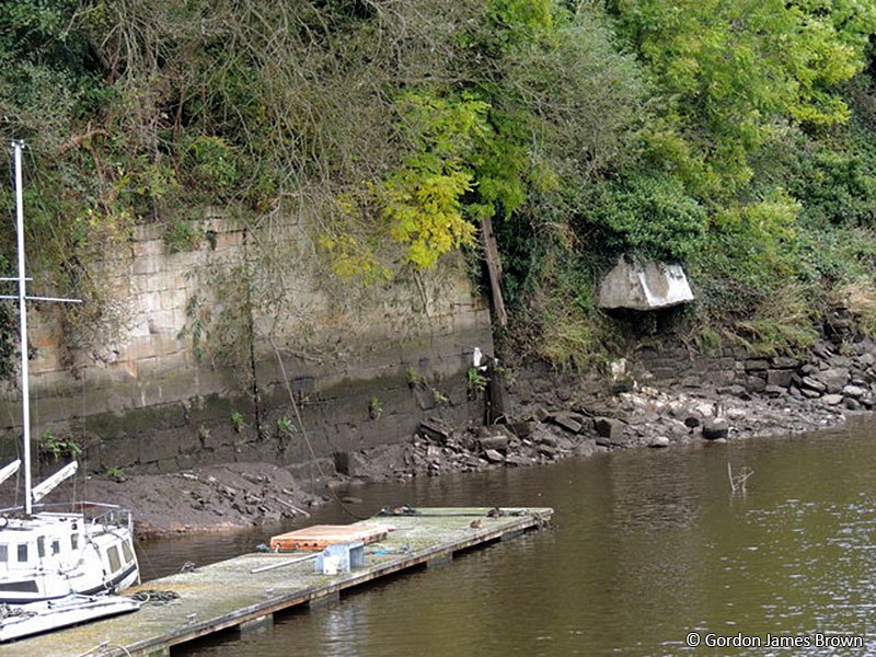
THE 'SEAWATER EFFLUENT' OUTLET
Located just downstream from the 'Gassy Gutter' outlet.
The route of the 'Seawater Effluent' to the River Wear can be seen in picture 'THEN 4', just above the houses.
From 1940 to 1970, seawater was pumped 8.5 miles, from Sunderland South Docks, crossing the Queen Alexandra Bridge,
to Washington Chemical Works where magnesia was extracted for various manufacturing purposes.
The remaining liquid was dumped into the River Wear!
[ Photograph posted in accordance with Mr Brown's on-line copyright instructions. Thanks also to Keith, local resident Howard, and the Sunderland Echo. ]
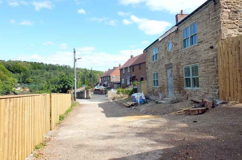
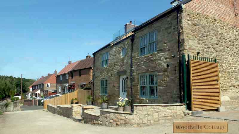
Royal William Public House
... in Coxgreen Village.
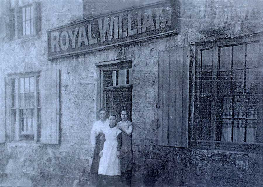
THEN
The Royal William was situated on the south bank of the River Wear, at the western end of Coxgreen Village.
[ Photo supplied by Keith Cockerill ]
Liquor Laden Landlady!
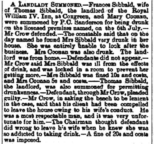
THEN
Durham County Advertiser, 21 August 1896
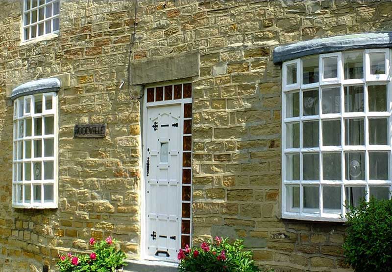
MANY YEARS LATER
A Private Residence
[ Photographer: Keith Cockerill ]
30 May 2025
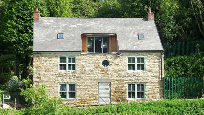
[ Photographer: Keith Cockerill ]
July 2025
[ Photographer: Keith Cockerill ]
18 July 2026
[ Photographer: Keith Cockerill ]
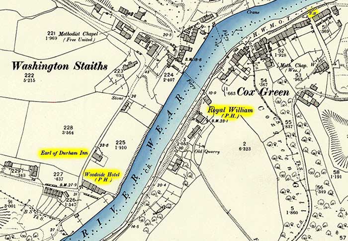
Drinking Establishments in/near Cox Green - before the Footbridge was installed in May 1958.
Earl of Durham Inn - Woodside Hotel - Royal William - Oddfellows Arms
Former Royal William & Alice Well
... in Coxgreen Village.
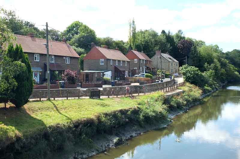
NOW
August 2025
The Wall Recess housing Alice Well is just visible between the Man and the Red Post Box.
[ Photographer: Keith Cockerill ]
THEN
The private residence on the left is the former Royal William public house at Coxgreen.
The young ladies are a couple of minutes walk from the Oddfellows Arms.
The Earl of Durham is on the right. Note the paddle steamer.
Alice Well is just behind the lady with the pushchair.
[ Photo posted by Christine Scott ]
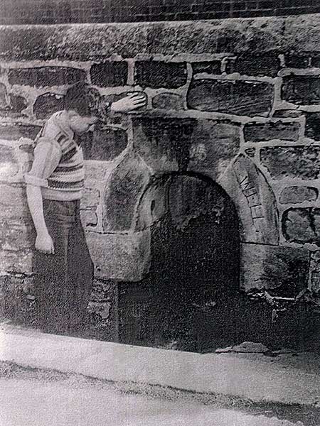
Unidentified Young Lad at Alice Well.
[ Photo supplied by Keith Cockerill ]
Alice Well
Centenary Tankard
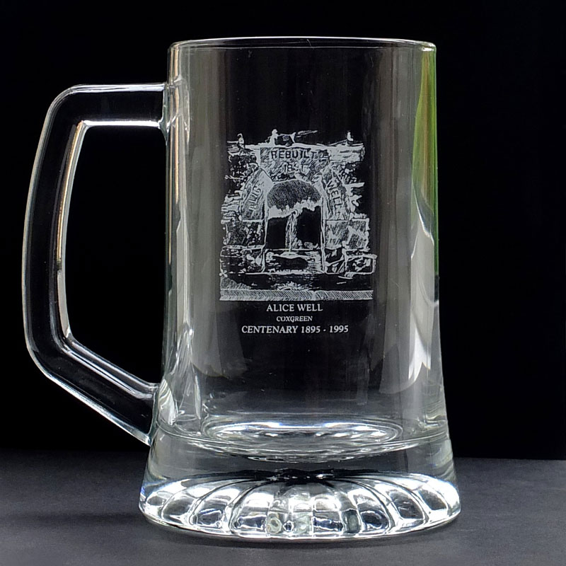
ALICE WELL
A 'Half-Pint' Tankard issued to commemorate 100 years since Coxgreen's Alice Well was REBUILT (1895).
[ Owner & Photographer: Keith Cockerill ]
• • ◊ • •
KEITH SAYS:
"A Coxgreen resident kindly gave me the Tankard a few years ago. I wonder when the original Well was built, and who Alice was?"
Keith tells me that there are stories connecting the original Alice Well with the character in Lewis Carroll's 1865 novel.
No proof, however, so Alice could just as well ( No pun intended! ) be the wife or daughter of the Builder.
"Another question crossed my mind ... has the Well always been at the same location? Could it, for example, have once been behind the present
row of houses in the old part of Coxgreen, now demolished. The water course runs down to the river from there.
This area is called 'Painshaw Bogs' on John Rennie's 1826 river map."
If anyone has any factual information regarding the Naming or 'possible earlier location' of Alice Well,
I'm sure a lot of our visitors will be delighted to hear about it.
• • ◊ • •
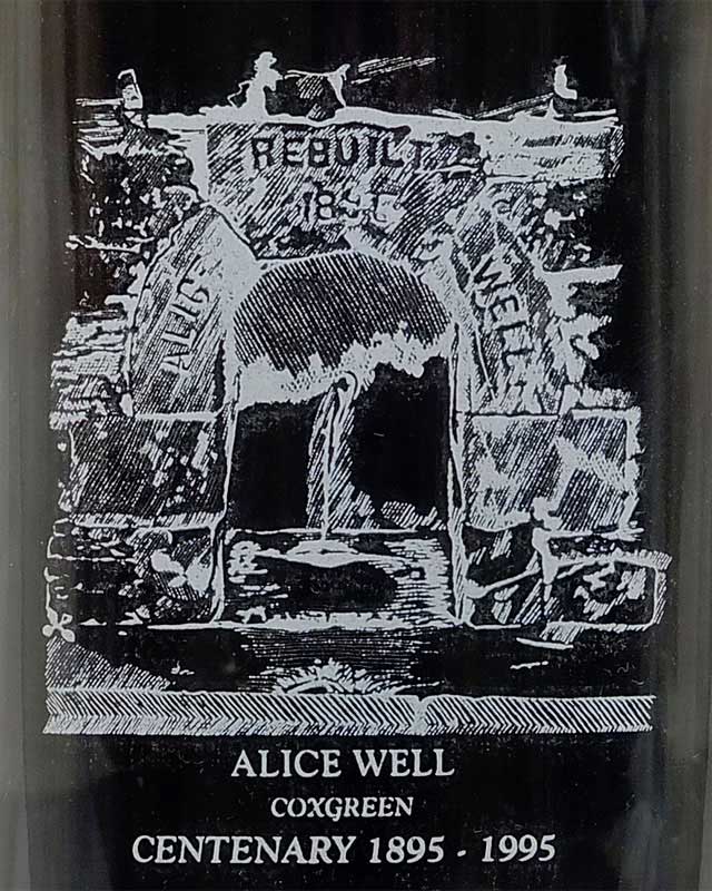
Close-up of Centenary Glass
[ Photographer / Owner: Keith Cockerill ]
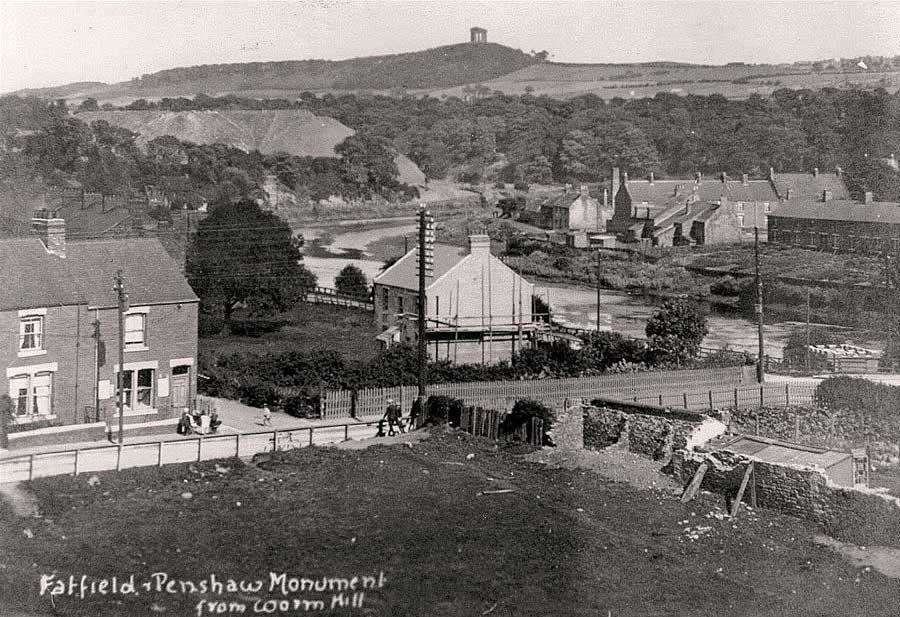
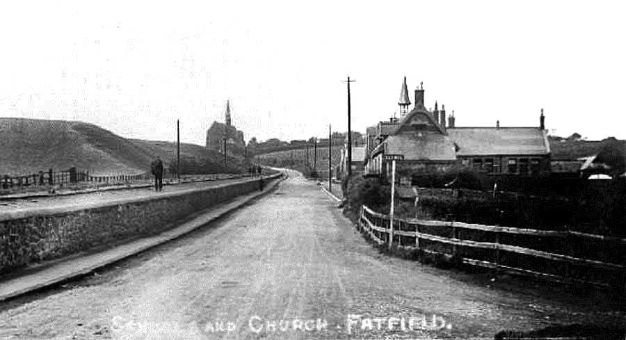
Worm Hill Terrace
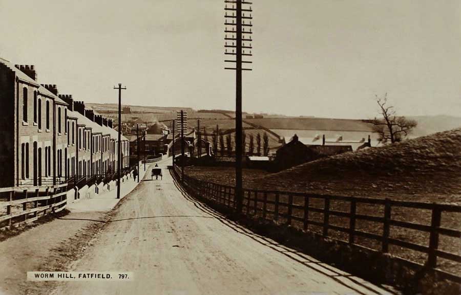
THEN
Worm Hill Terrace leading down to Fatfield Bridge. Worm Hill on the right-hand side.
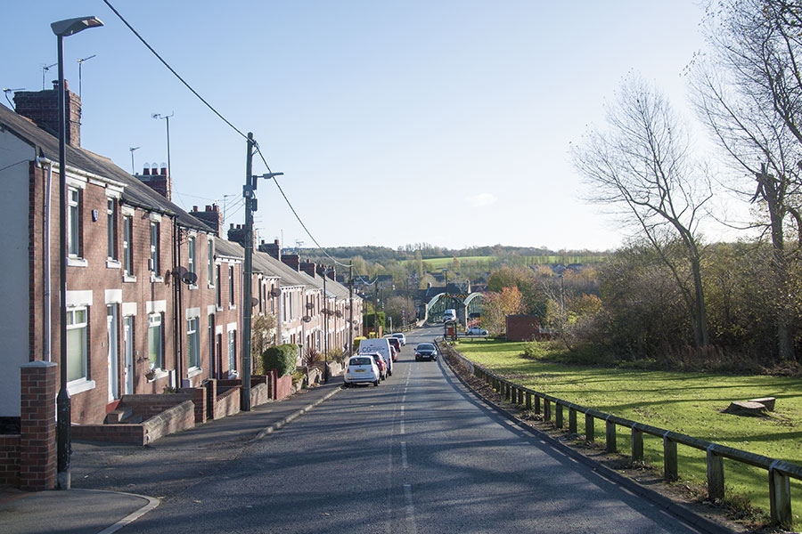
NOW
More horsepower, lots of satellite dishes and one significant change which occurred in the 1940s.
The metal railings were removed to assist the war effort - ostensibly to make weapons!
[ Photo: J.G. 10th Nov 2017 ]
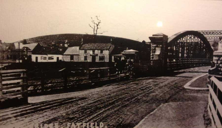
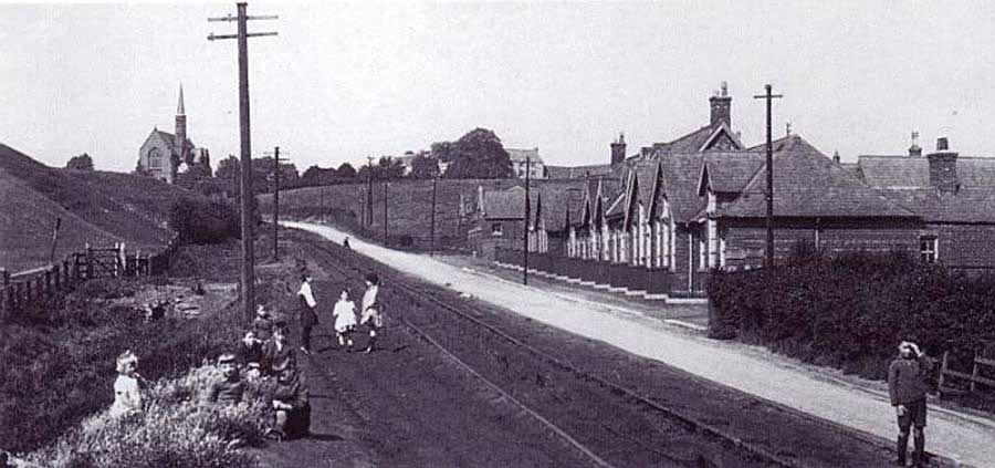
THEN
Worm Hill, Biddick Inn & Fatfield Bridge
[ Pre-1922. No Memorial on Worm Hill! ]
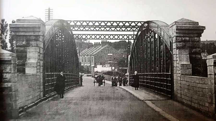
THEN
Fatfield Bridge & Worm Hill Terrace
[ 1915 ]
THEN
Bottom of Worm Hill Terrace as seen from Worm Hill
[ Note North Biddick Colliery Pit Heap. ]
Biddick Inn
... looking upstream from the north-side of Fatfield Bridge.
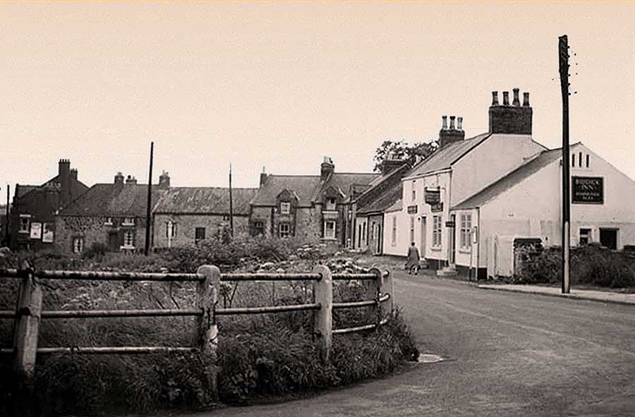
THEN
Biddick Inn at the entrance to Bonemill Lane
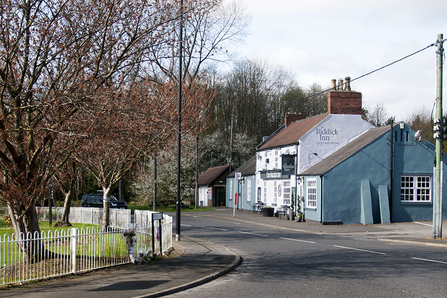
NOW
The Taxi Office and Harraton War Memorial are the only structures standing between Biddick Inn and the Old Co-op Building.
[ Photo: J.G. 5th April 2017 ]
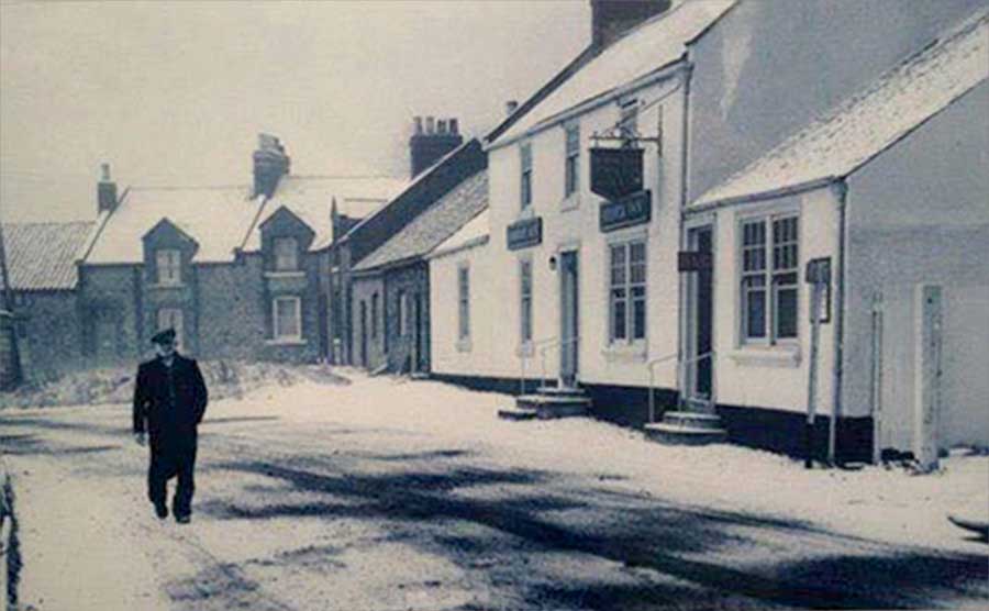
THEN
Harraton miner William Hughes passing a snowy Biddick Inn.
THEN
Biddick Inn, Worm Hill & Fatfield Bridge
( View from south of the river. )
THEN
Biddick Inn, Fatfield Bridge & Gem Cinema, seen from Worm Hill.
( The Gem is just above Fatfield Bridge. )
Lots of old pub pictures at: Pub Crawl
North Biddick Social Club
... on Bonemill Lane.
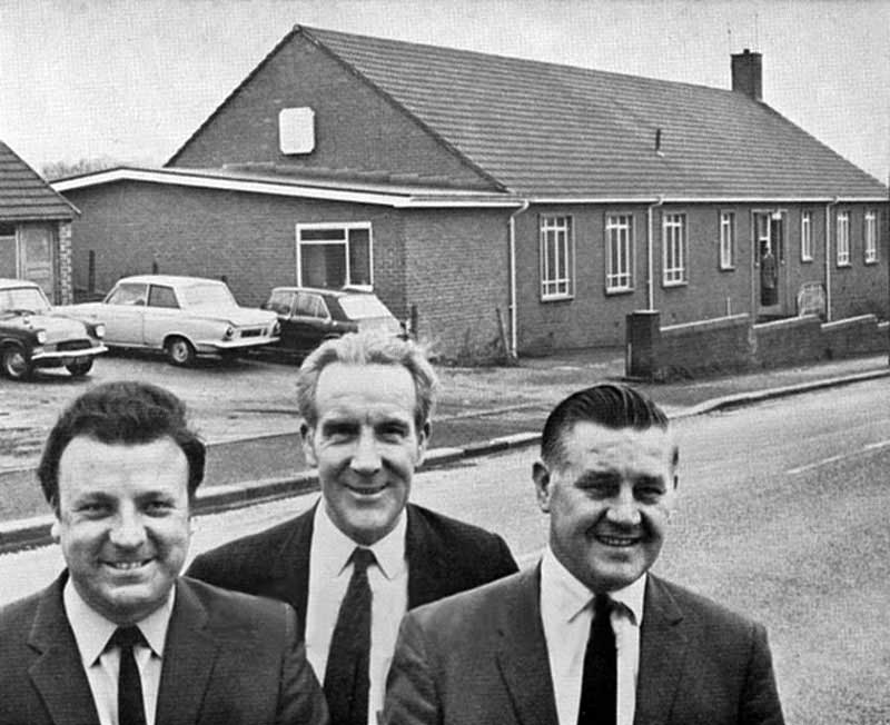
THEN
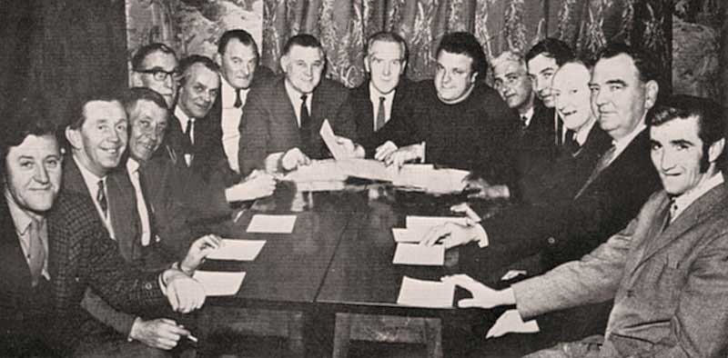
North Biddick Social Club - Senior Officials c.1970
Treasurer: George Mawson - Chairman: Frank Gillespie - Secretary: Jim Ramshaw
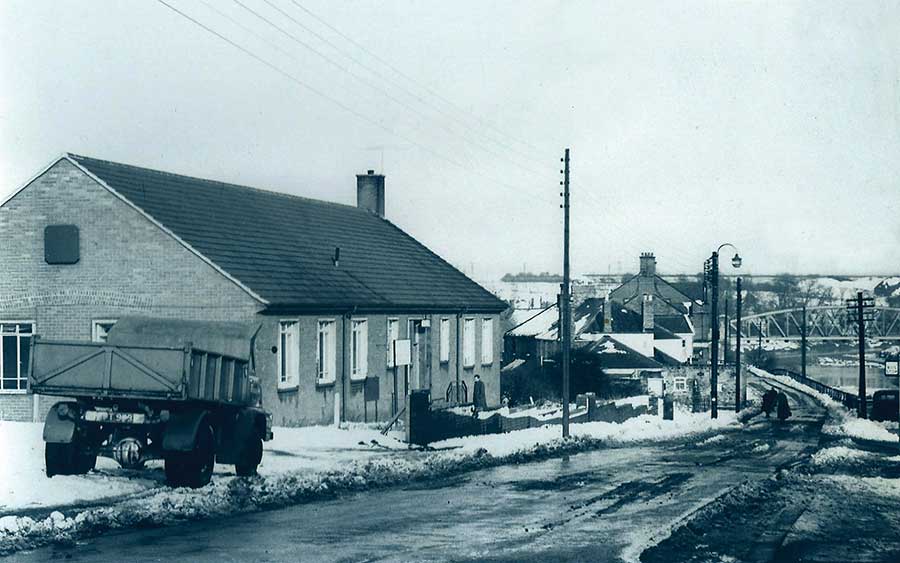
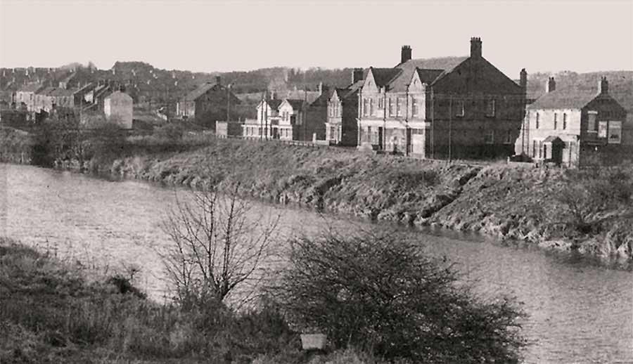
THEN
North Biddick Social Club - Havelock Arms - The Coop - Fatfield Bridge
NOW
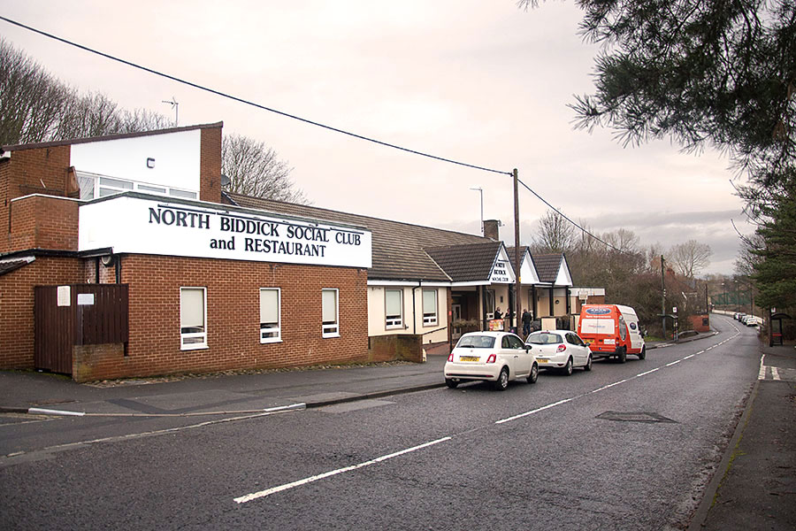
North Biddick Social Club & Restaurant
Note the old roof and chimney.
[ Photo: J.G. 20th December 2018 ]
NOW
North Biddick Social Club & Restaurant
[ Photo: J.G. 20th December 2018 ]
THEN
North Biddick Social Club - Havelock Arms - The Coop
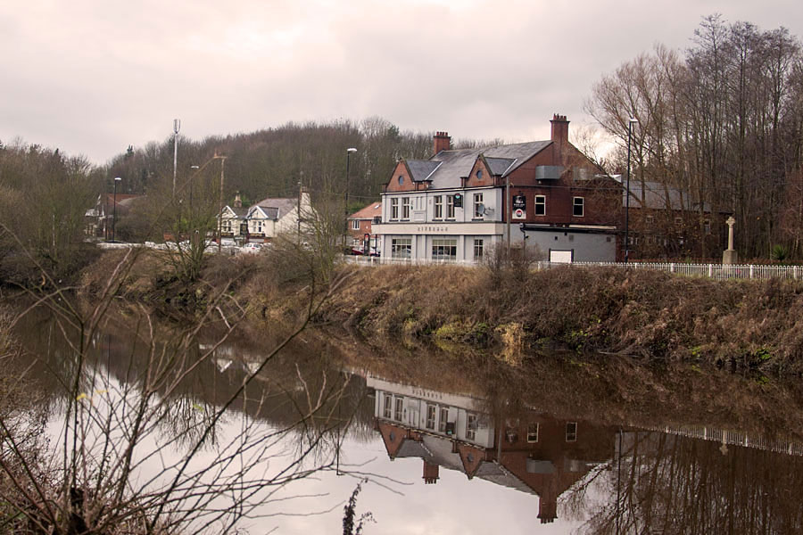
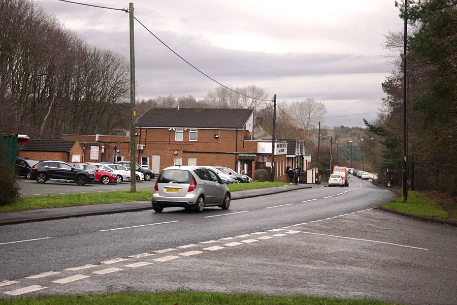
NOW
North Biddick Social Club - The Havelock - The Riverbar
Fatfield / Harraton War Memorial was resited in 2012 after being removed from the top of Worm Hill.
[ Photo: J.G. 20th December 2018 ]
THEN
North Biddick Social Club - The Committee c.1970
Junction: Bonemill Lane / Biddick Lane
... looking North-West.
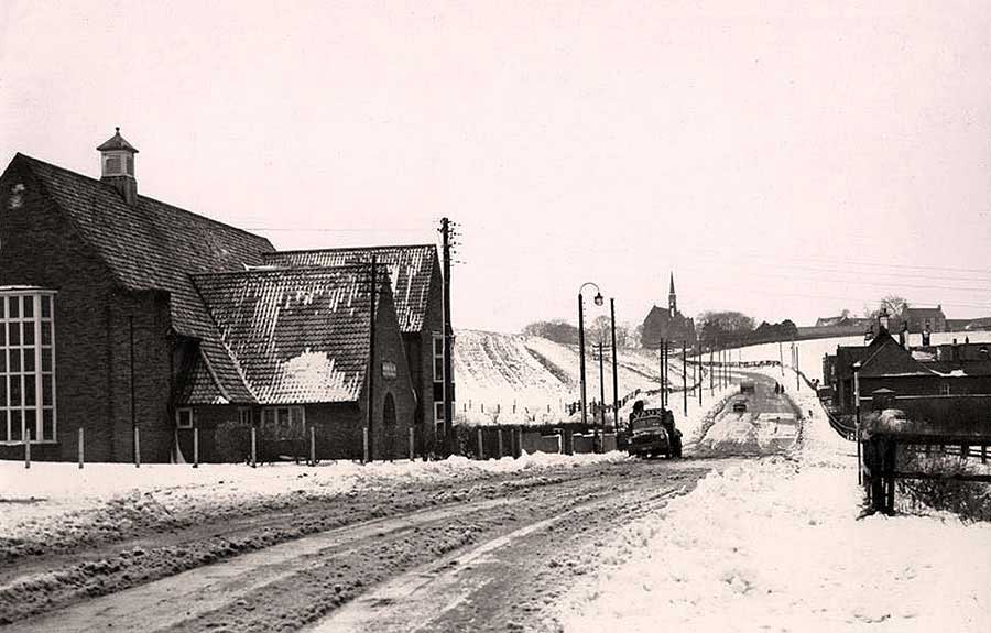
THEN
Harraton Community Centre - formerly Harraton Miners' Welfare Hall. Saint George's Church. Fatfield School.
Bonemill Lane passes the old school buildings before curving left towards Harraton Colliery.
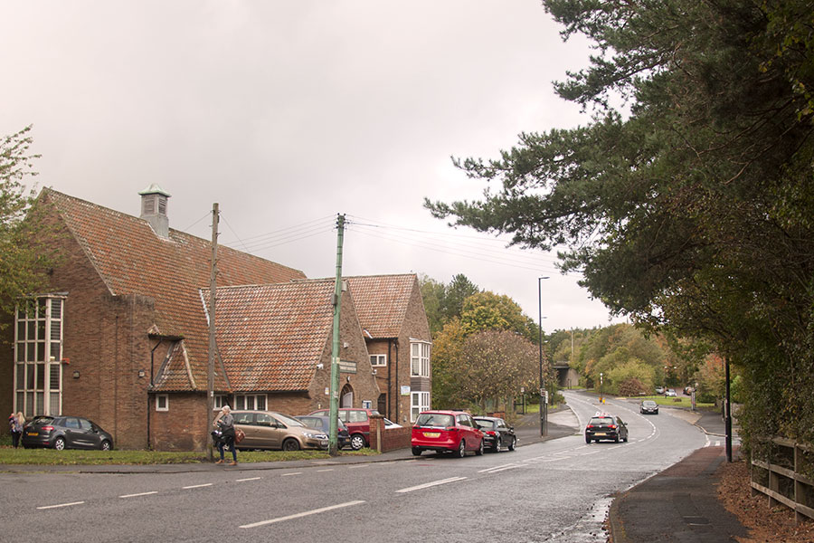
NOW
Bonemill Lane curves left immediately after Biddick Lane and goes under the Washington Highway.
Note the parked cars on the old route, where houses have replaced Fatfield School.
The spire of Saint George's Church is just visible above the trees.
[ Photo: J.G. 18th Oct 2017 ]
Then 2
Bonemill Lane & Biddick Lane
Then 3
St. George's Church - Harraton Wagonway - Fatfield School
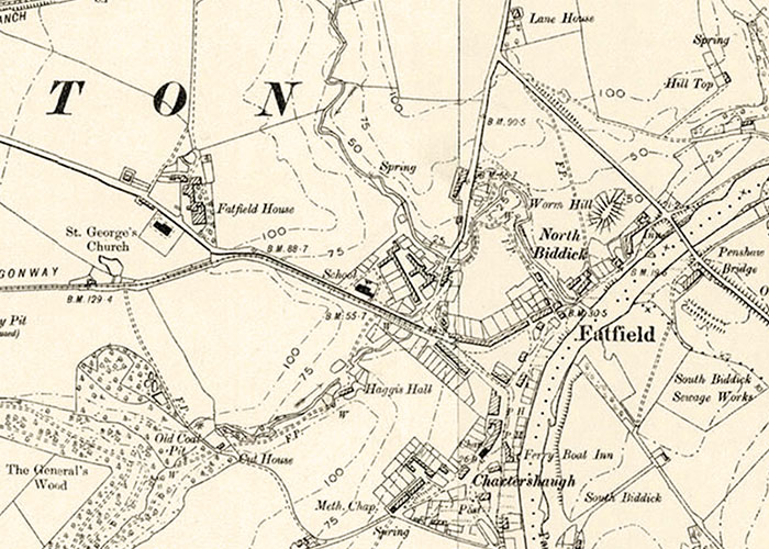
Bonemill Lane / Biddick Lane Junction
[ OS Map: 1888 - 1913 ]
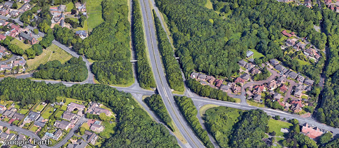
The new route of Bonemill Lane: south of Saint George's Church to Harraton Community Centre.
Part of the old route: the cul-de-sac, in the trees, below Saint George's churchyard.
[ Thanks to Google Earth ]