Washington County Durham
HOME WHAT'S WHERE THEN & NOW PAGE 3/8 PAGE 5/8
Memories of Washington
Then & Now Collection ( 4/8 )
- The Village
- Arch 1/2
- 2/2
- Above Holy Trinity
- Black Bush
- Glebe Crescent
- Glebe Colliery / The Avenue
- Wash. Station Rd
View from Holy Trinity to Our Blessèd Lady Immaculate
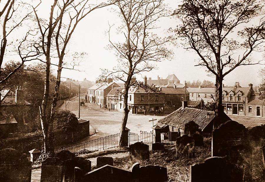
THEN
Also looking down on The Avenue, Village Lane, a bit of Spout Lane, The Smithy and the Cross Keys Inn.
Our Lady's Church is on the horizon.
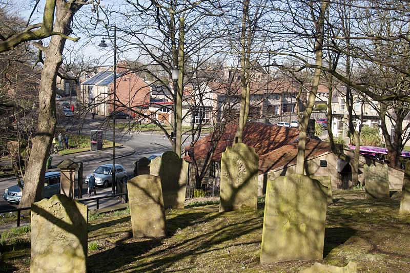
NOW
[ Photo: J.G. 29th March 2018. ]
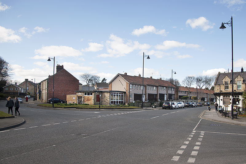
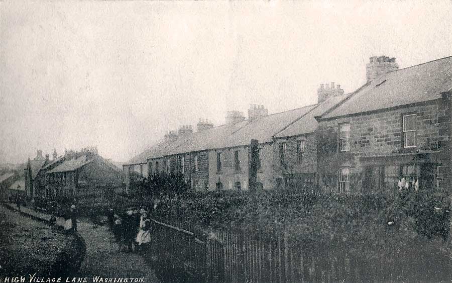
Spout Lane, Village Lane & The Avenue
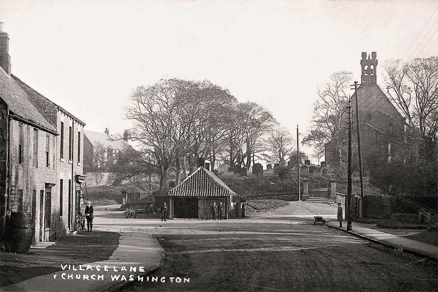
THEN
Looking down Village Lane towards The Smithy, Spout Lane, The Avenue and Holy Trinity Church.
[ N.B. The Buildings & Shop, on the left of this picture, no longer exist in the 'Now' picture below. ]
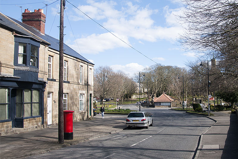
NOW
[ Photo: J.G. 26th March 2018. Deliberately taken from further up Village Lane - to include the former Post Office. ]
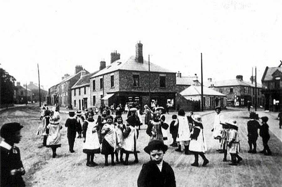
THEN
Village Lane on the left. Spout Lane on the right.
[ Lunch break at Bobby Lee's School, perhaps? ]
NOW
[ Photo: J.G. 26th March 2018. Note the low building where the demolished Buildings & Shop once stood. ]
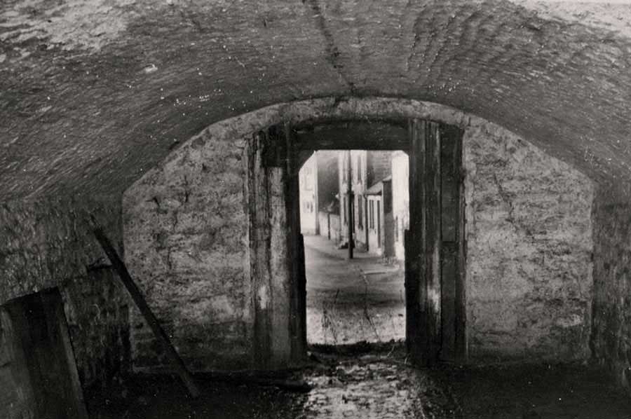
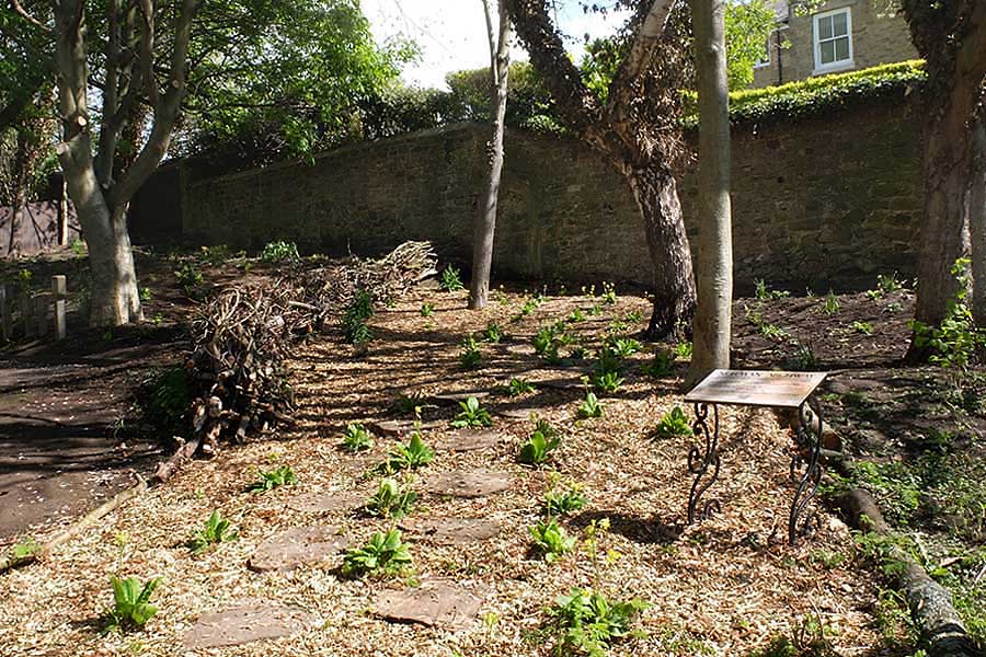
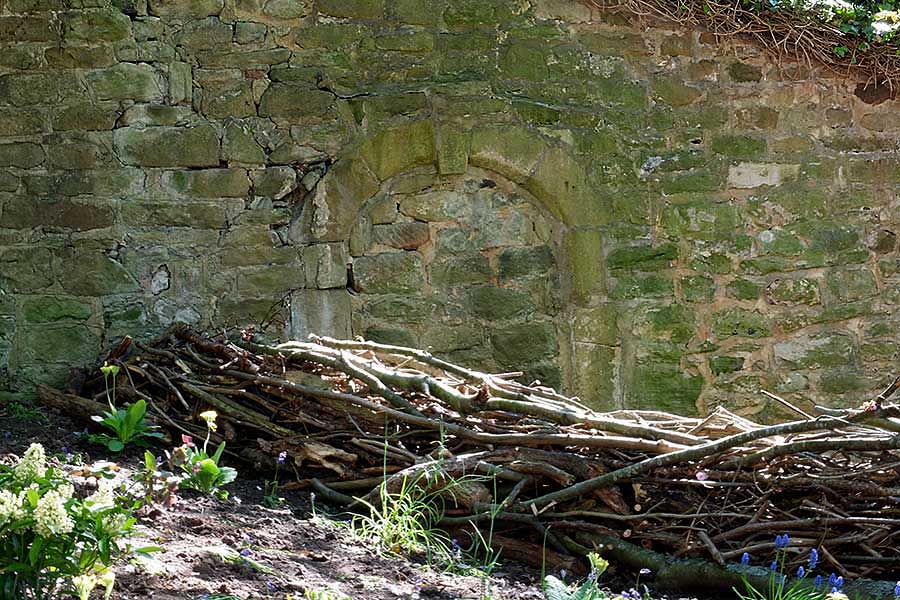
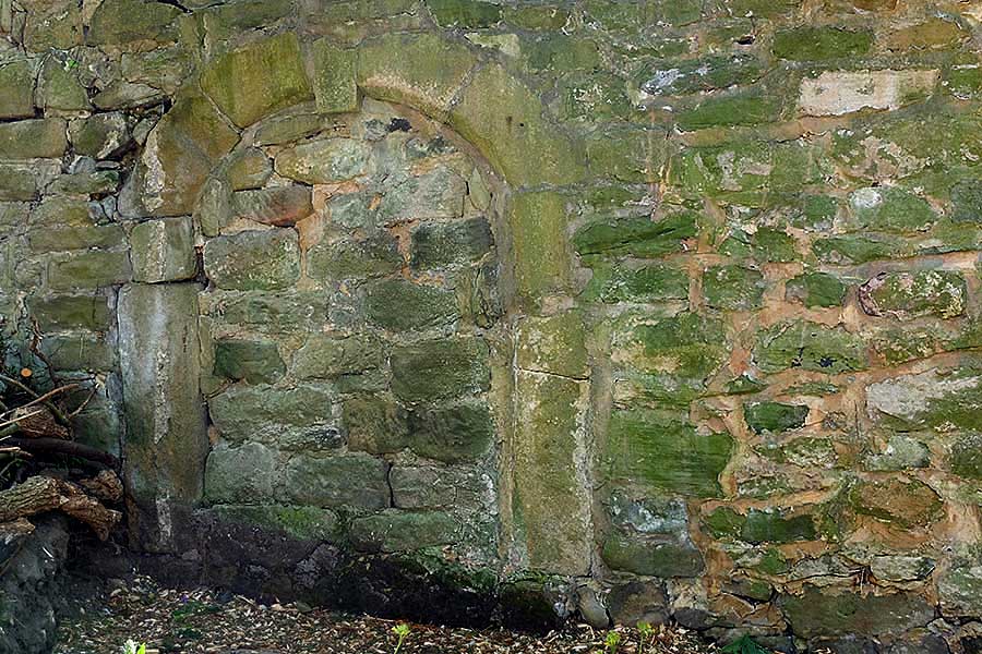
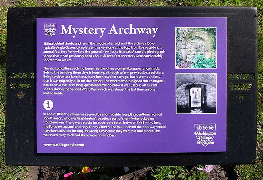
Mystery Archway in Washington Village
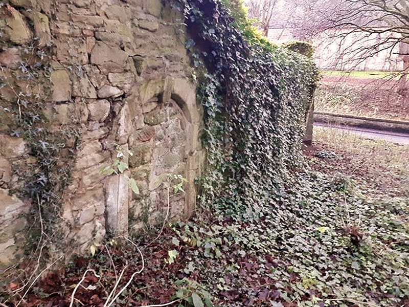
NOW
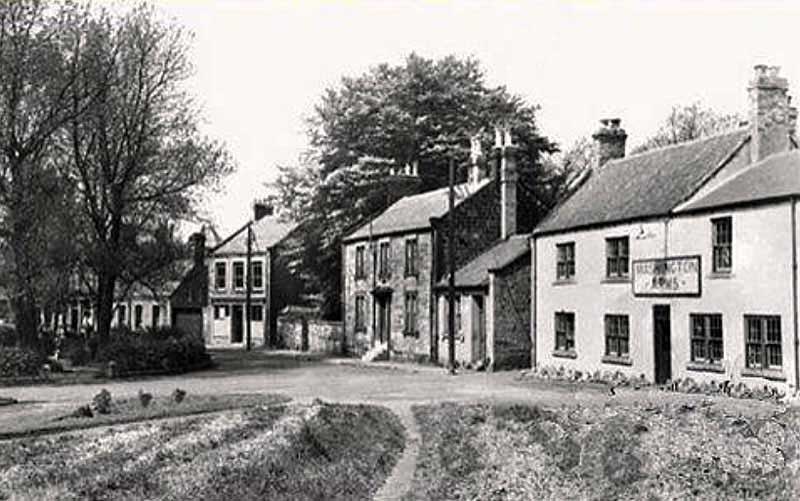
View from the Washington Arms Car Park
Background: Holy Trinity Church.
[ Picture: Sunderland Echo. ]
THEN
The Mystery Arch is located on the Wall between the Washington Arms and the House on the hill.
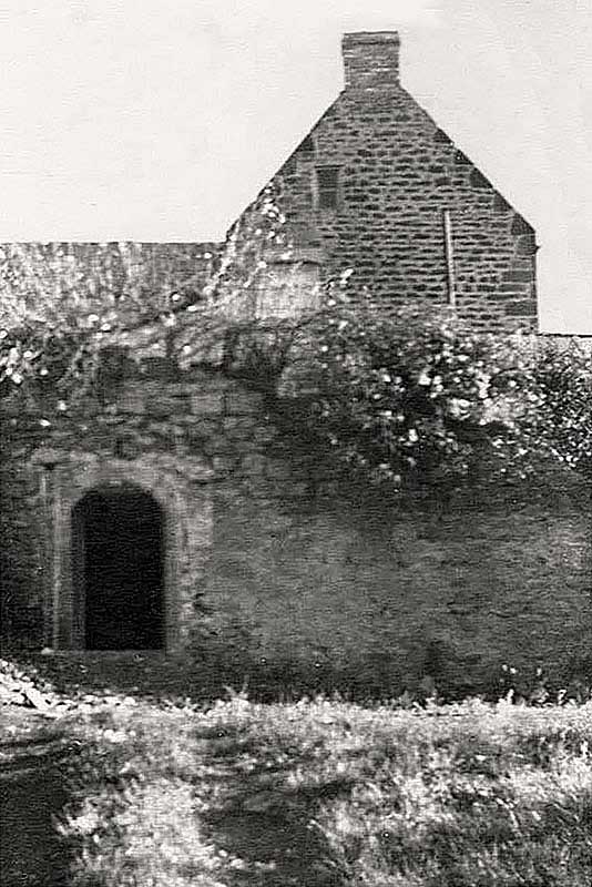
THEN
When was it built and for what purpose?
Passageway? Store House / Cellar? Cop Shop Cell / Temporary Lock-up?
THEN
Compare This View with the Picture Below.
THEN
Cross Keys - Library - Old Cop Shop - Walkway through fields to Stile Inn - Washington Arms
Washington Village In Bloom Notice Boards
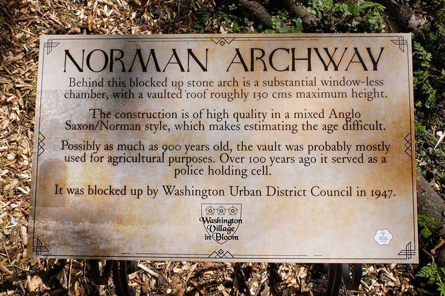
WASHINGTON VILLAGE IN BLOOM
Information Notice
[ Photographer: Keith Cockerill, 30 April 2022 ]
NOW
The Mystery Arch is just visible to the right of the thin tree, centre picture.
[ Photographer: Keith Cockerill, 30 April 2022 ]
NOW
[ Photographer: Keith Cockerill, 30 April 2022 ]
NOW
[ Photographer: Keith Cockerill, 30 April 2022 ]
NOW 2022 - Plus 1 Year
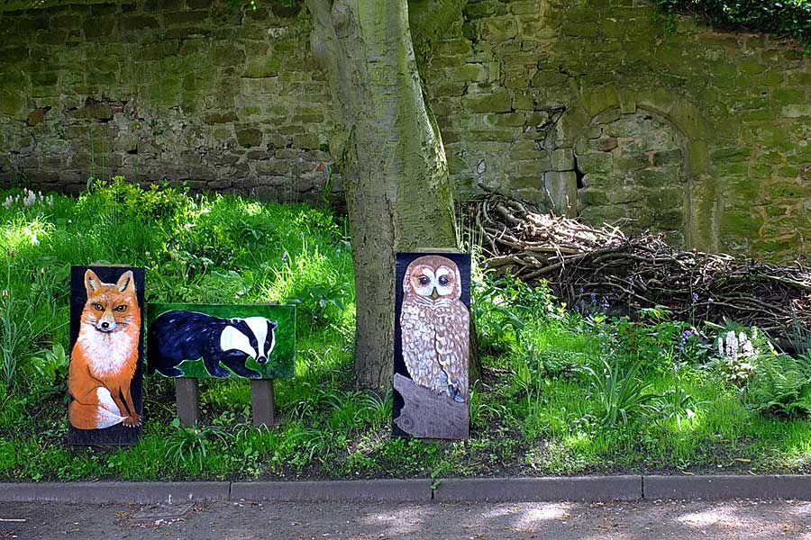
Another Superb WASHINGTON VILLAGE IN BLOOM Project
Animal Images created by Jim & Barbara Lindsay
[ Photographer: Harry the 'Sparky', 16 May 2023 ]
Did you notice that more mortar has been removed from the Wall in the Saxon Arch?
If this continues, the Wall could become dangerous, especially to Children!
WASHINGTON VILLAGE IN BLOOM
Information Notice
[ Photographer: Keith Cockerill, 30 April 2022 ]
The Above Mystery has been Researched by ( washingtonlass.com ) Audrey Fletcher.
For much more information, Click Picture below and Visit Audrey's YouTube Video.
[ You will leave this Website. ]
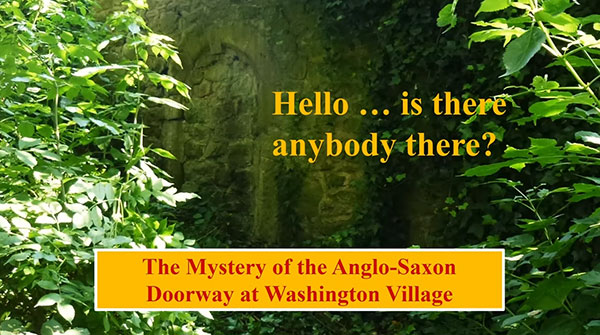
Researched, Produced and Narrated by Audrey Fletcher
[ Disclaimer: This Website cannot take responsibility for pages maintained by other parties. ]
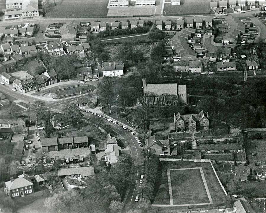
Washington Village
Aerial / Drone Views
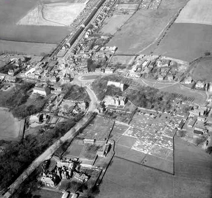
THEN
Spout Lane & The Avenue - Cross Keys - Library - 'Old Cop Shop' - Washington Arms - Holy Trinity - Old Hall
( Not too long ago. )
NOW
Taken from above The Avenue, near Dame Margaret's Hall, 10th February 2018.
This Photo appears here by kind permission of Photographer / Drone Operator, Paul Brumby.
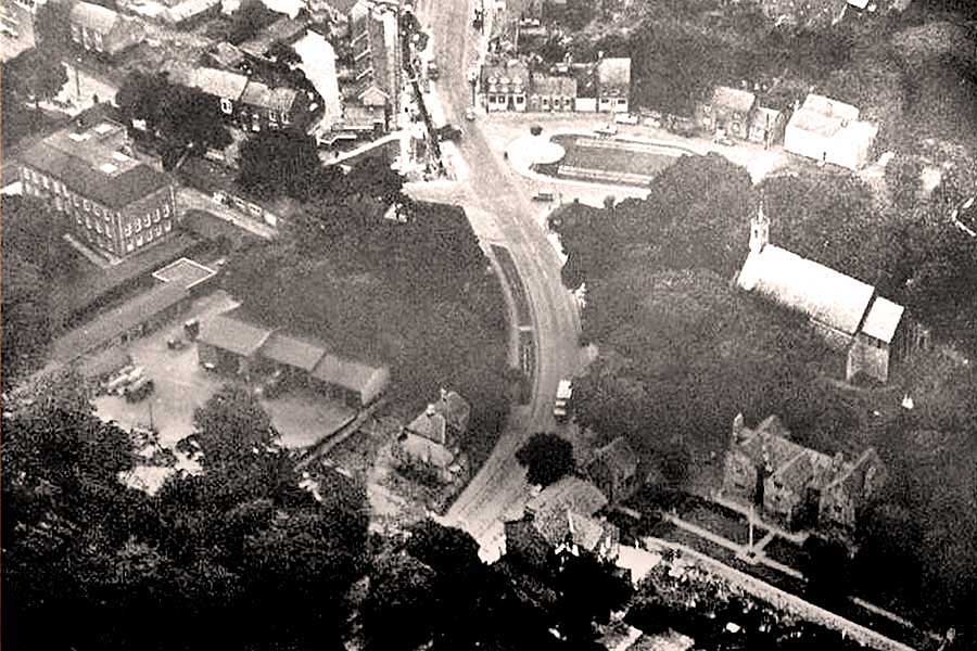
THEN
Village Green - Holy Trinity - Old Hall
THEN
Holy Trinity - Old Hall
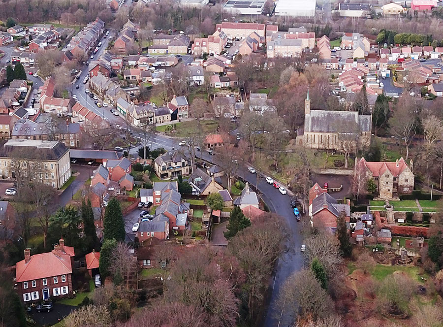
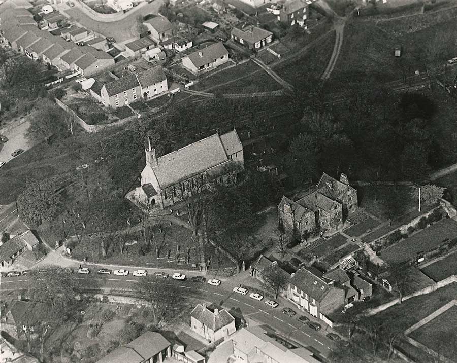
NOW
Taken from directly above Holy Trinity Church, 7th February 2018.
This Photo appears here by kind permission of Photographer / Drone Operator, Paul Brumby.
THEN
The Avenue - Dame Margaret's Hall - Washington Old Hall - Holy Trinity Church - Village Green - Spout Lane
Path from Spout Lane to Washington 'F' Colliery (top-left). Path from Washington Arms to Stile Inn (top-right).
From St. Mary's to Holy Trinity
Researched by ( washingtonlass.com ) Audrey Fletcher.
Click Picture below and Visit Audrey's YouTube Video.
[ You will leave this Website. ]
Researched, Produced and Narrated by Audrey Fletcher
[ Disclaimer: This Website cannot take responsibility for pages maintained by other parties. ]
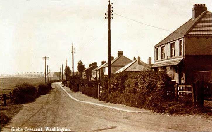
Black Bush Inn - Village Lane
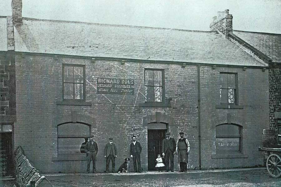
THEN
RICHARD COLE - LICENSED RETAILER OF - Wines, Ales & Porter
[ Shorter OED: Porter - a dark-brown bitter beer brewed from malt partly charred or browned by drying at a high temperature. ]

THEN
Many years later, the Black Bush Inn is still part of a terrace.
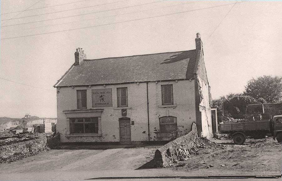
THEN
The now 'detached' Black Bush Inn on Village Lane. Note Washington Glebe Colliery in the background.
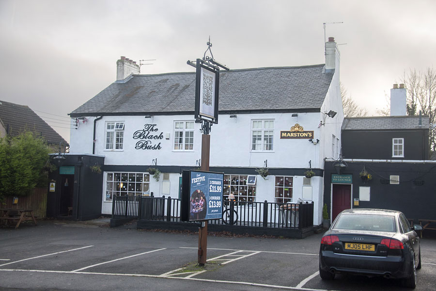
NOW
[ Photo: J.G. 14th Dec 2016 ]
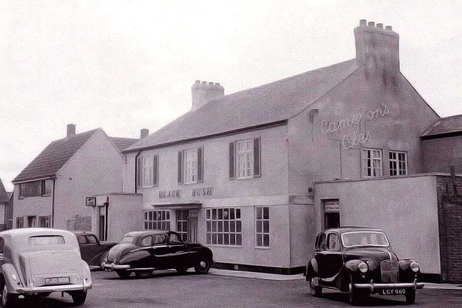
THEN
Super old cars parked at The Black Bush Inn. Not too long ago.
Holy Trinity bell tower: left horizon.
Black Bush Inn: off-picture, right.
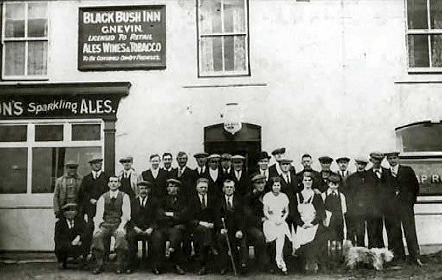
Regulars at the Black Bush Inn
Lots of old pub pictures at: Pub Crawl
Glebe Crescent - The Old Gravel Pit
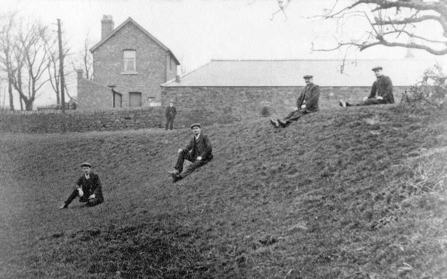
THEN
Left to Washington Station Road - Glebe Crescent Road is between the men and the farm buildings - Right to Village Green
[ By kind permission of Beamish Museum Resource Centre ]
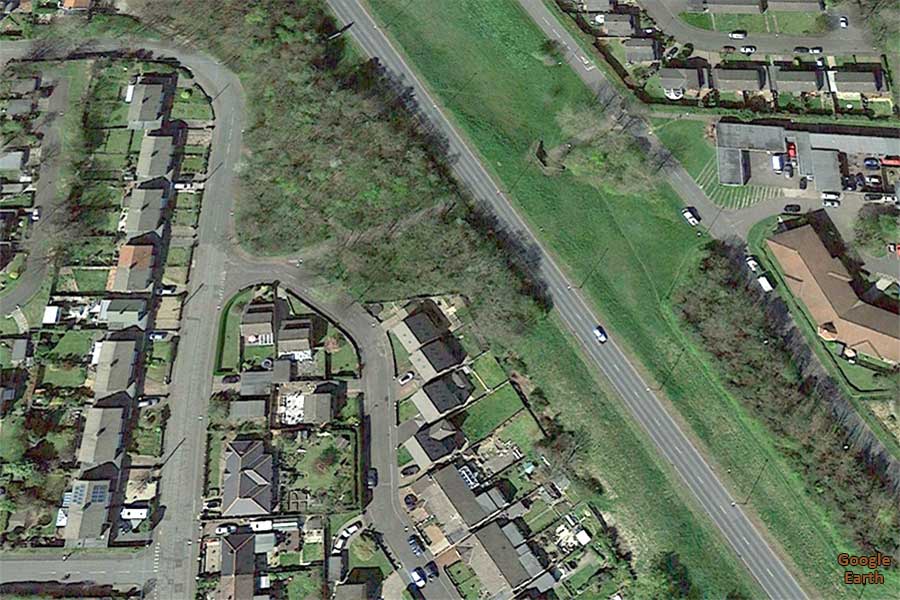
NOW
Note the incongruously positioned detached house in Glebe Crescent semis - that's where the above farmhouse once stood.
[ Satellite view from Google Earth ]
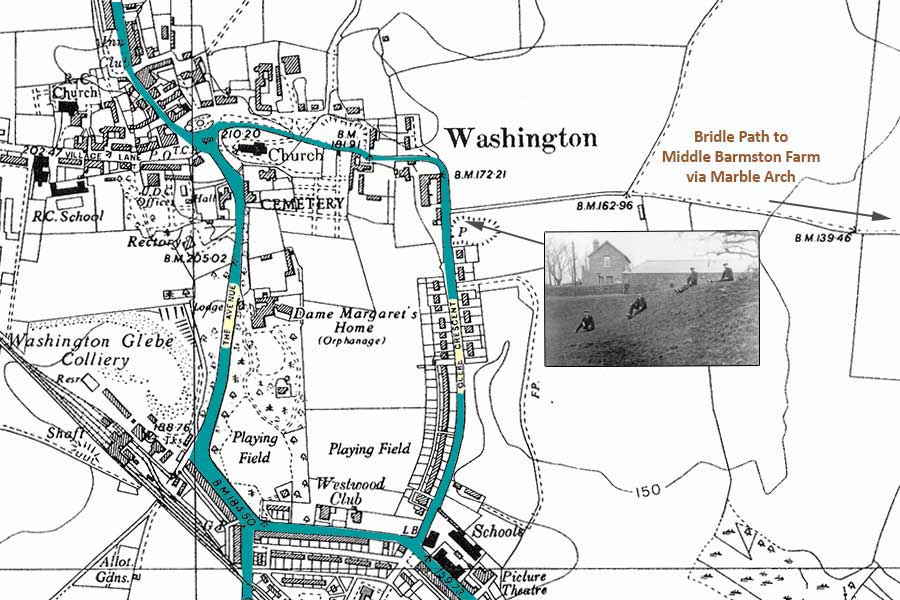
Washington Village & Glebe Crescent
[ Taken from the Key Locations Map: 1951 - see Home Page Sidebar ]
Looking south towards Washington Station Road.
On the north corner: Snowdon's Farm & Glebe Mount.
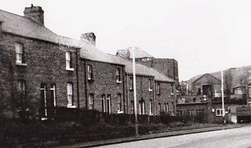
Washington Glebe Colliery - The Avenue
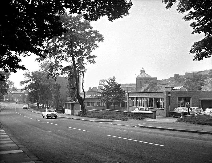
THEN
Washington Glebe Colliery Canteen - sited on The Avenue, opposite the grounds of Dame Margaret's Hall.
Home View (bottom of bank) faced The Hall when it was a Doctor Barnardo's Home.
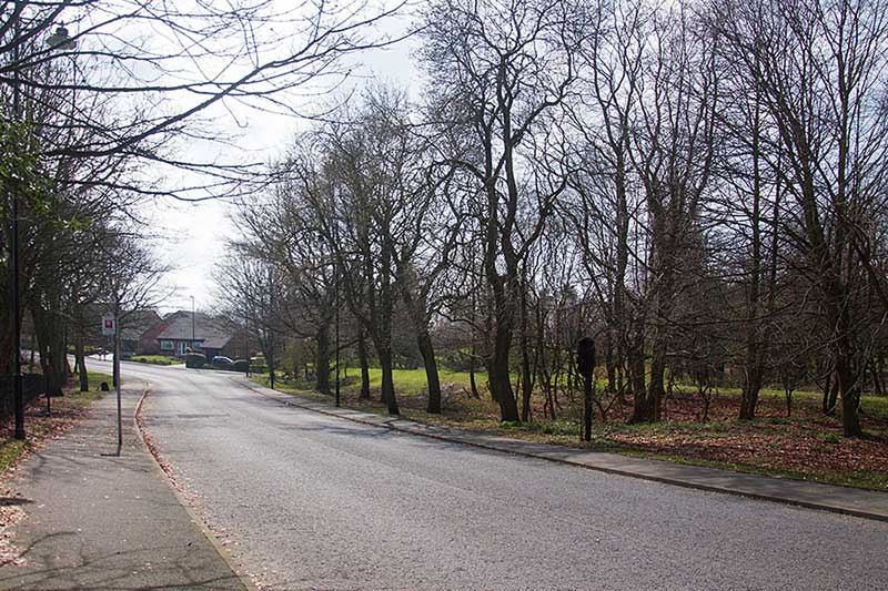
NOW
The Avenue, looking south from Dame Margaret's Hall. Home View replaced by bungalows. No Colliery!
[ Photo: J.G. 9th April 2018 ]
Washington Glebe Colliery - Main Entrance
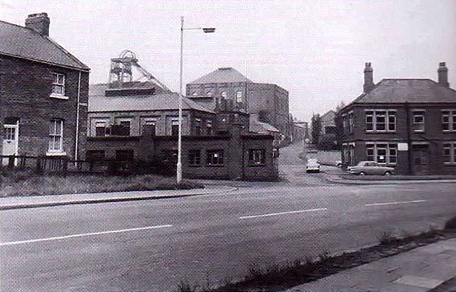
THEN
Washington Glebe Colliery Entrance. The Canteen is sited on The Avenue, off-picture, right.
Home View faced Dame Margaret's Hall when it was a Doctor Barnardo's Home.
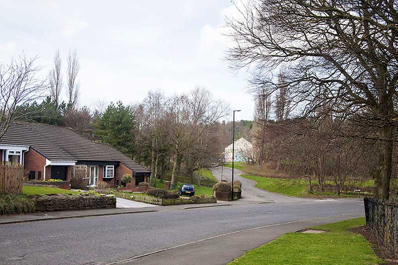
NOW
The Avenue. Home View replaced. The only remaining colliery building became Washington Boxing Club.
[ Photo: J.G. 9th April 2018 ]
THEN
Home View
[ Note the future Boxing Club building. ]
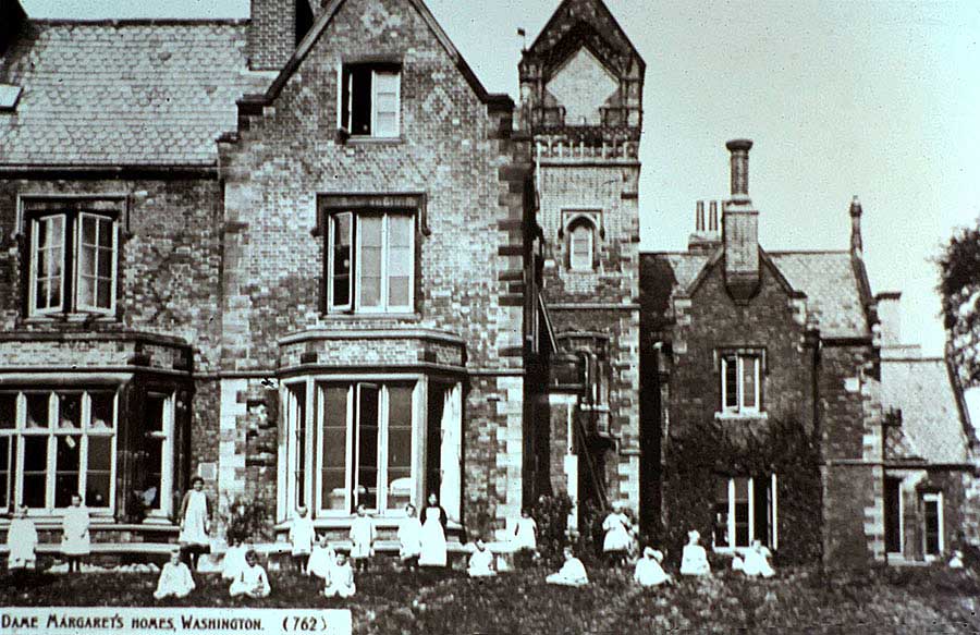
THEN
Children at Dame Margaret's Hall.
[ Doctor Barnardo's Home ]
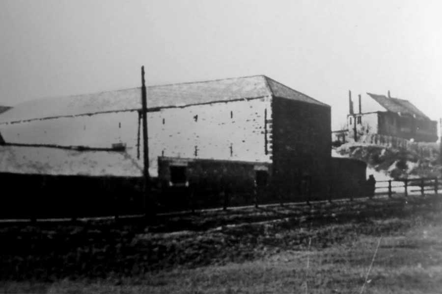
Washington Glebe Colliery - Empty Fields
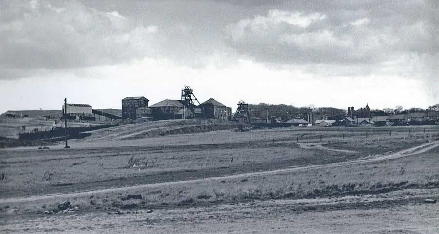
THEN
Pit Heap, Washington Glebe Colliery, Home View and the spire at Dame Margaret's Hall (not Holy Trinity Church).
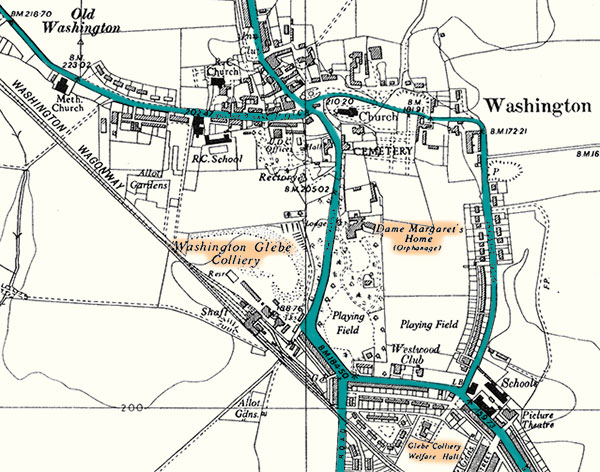
THEN
Map showing Washington Glebe Colliery, The Avenue, Home View, Dame Margaret's Hall & Glebe Colliery Welfare Hall
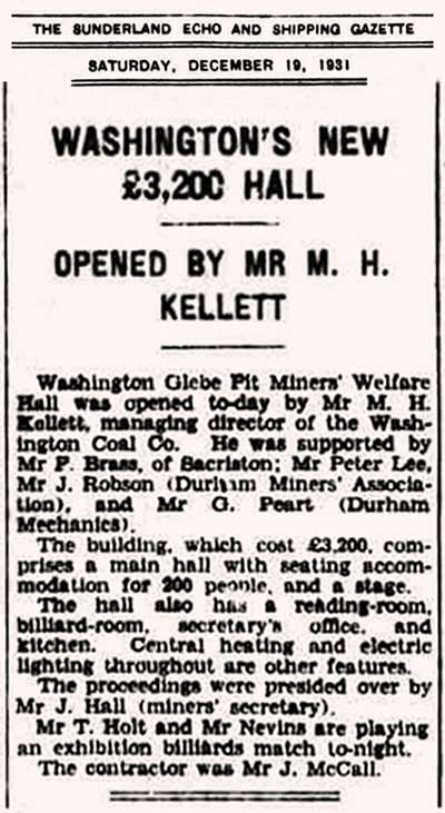
Washington Glebe Miners' Welfare Hall
[ Supplied by Washington History Society ]
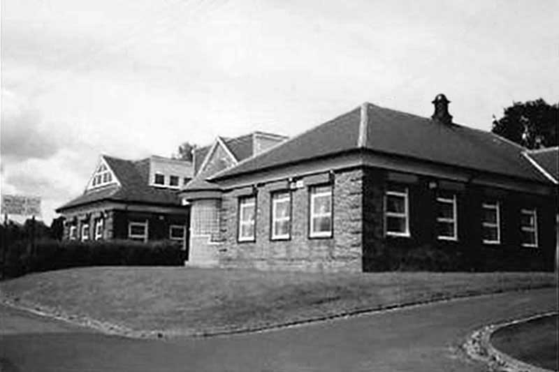
Washington Glebe Miners' Welfare Hall
[ Thanks to Audrey Fletcher ]
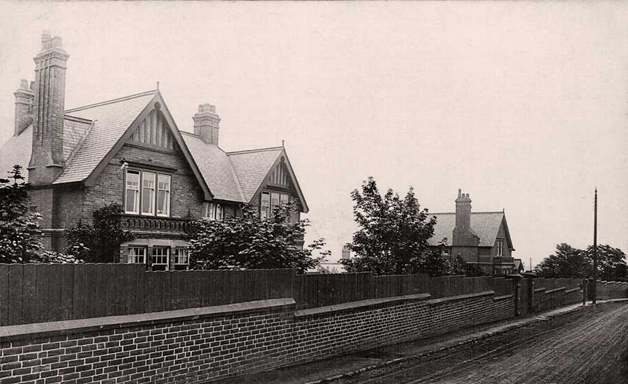
Washington Station Road
( Between Glebe School and Fatfield Road )
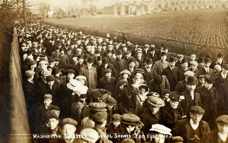
GLEBE COLLIERY DISASTER, 1908
Mourners walking alongside the field where the future Emmerson Terrace was built.
The rear of the Procession is passing Glebe (JFK) School.
Glebe School.
[ Compare the Apexes & Chimneys in this picture with those in the Procession picture above. They match! ]
• • ◊ • •
Washington Station Road
( Site of future Glebe School )
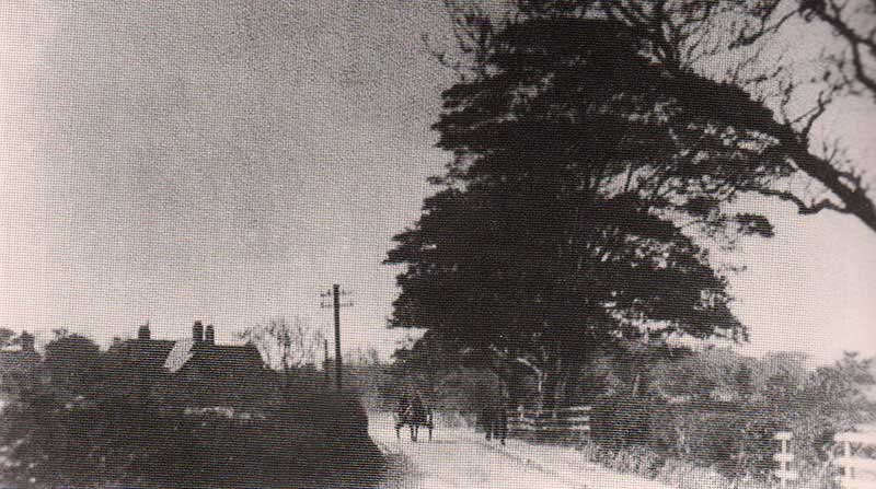
THEN - Before 1900.
The Horse and Cart is heading down Washington Station Road towards Washington Railway Station.
That's Red House on the left. Glebe School was later built on the land to the right.
[ Thanks to Keith Cockerill. ]
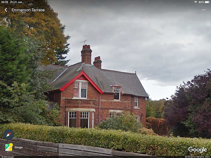
NOW
Red House, opposite Emmerson Terrace. The Westwood Club is just beyond Red House.
The Westwood Club & Red House
[ Looking towards Glebe School ]
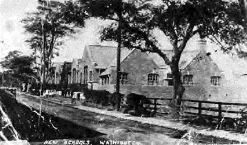
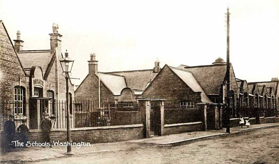
The Original Washington Glebe School
[ Looking towards Red House ]
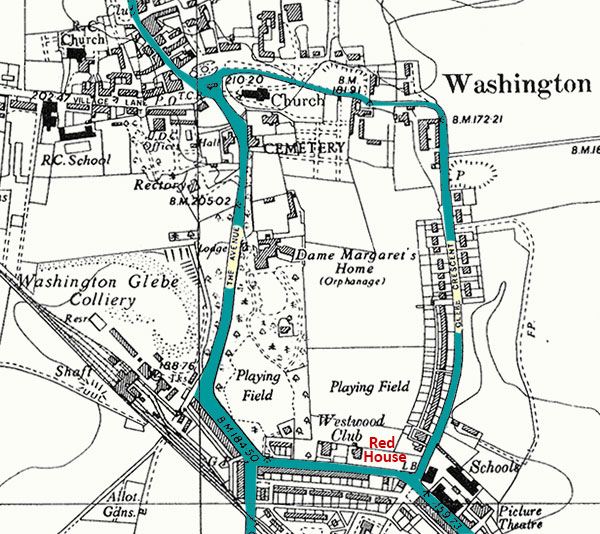
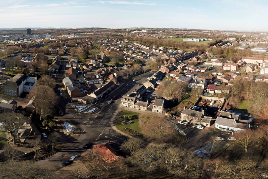
Map showing Westwood Club, Red House and Washington Glebe (JFK) School
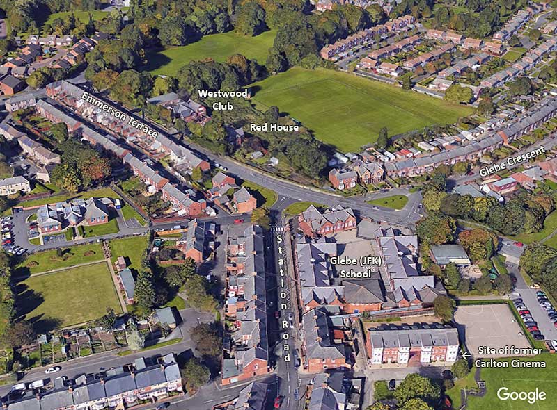
NOW
Aerial View, 2019
[ Thanks to Google Earth ]
• • ◊ • •
AN EXTRA ITEM OF INTEREST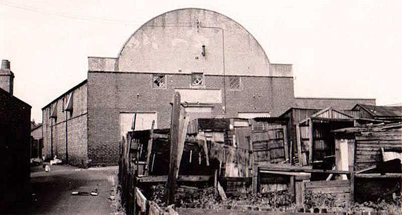
The Carlton Cinema
Known to locals as 'The Glebe'.
[ The left side of the Carlton lined-up with that of the Residential Block in Google picture. }