Washington County Durham
HOME WHAT'S WHERE PAGE 2/8 PAGE 4/8
Memories of Washington
Then & Now Collection ( 3/8 )
- Susan Peareth's School
- Blue Bell Inn
- Board School House
- Return to New Inn Corner / Spout Lane
- Spout Lane 2
- Spout Lane 3
Susan Peareth's School (Founded 1814) - Top of Well Bank
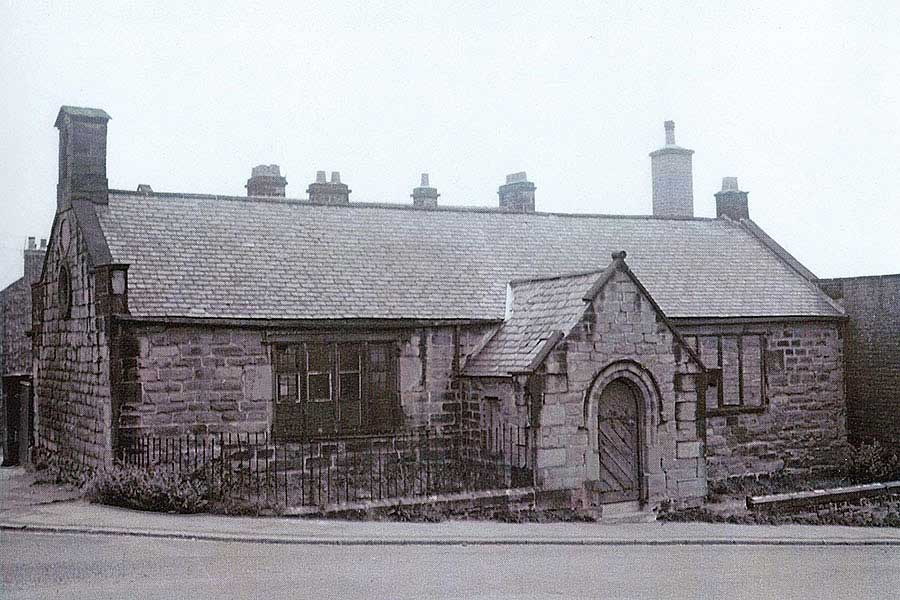
THEN
Founded & funded by widow Mrs Susan Peareth, Lady of Peareth Hall, to teach
reading, writing & numeracy to local children of poor families.
[ Photo by John Routledge of the Blue Bell Inn ]
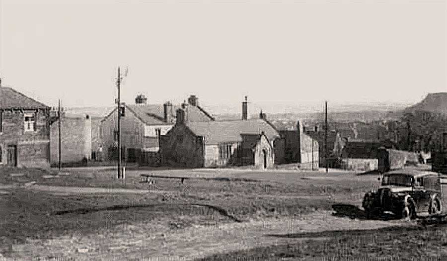
THEN
Blue Bell Inn - Susan Peareth's School - Top of Well Bank Road - Penshaw Monument (lost in a bright sky) - 'F' Pit Heap
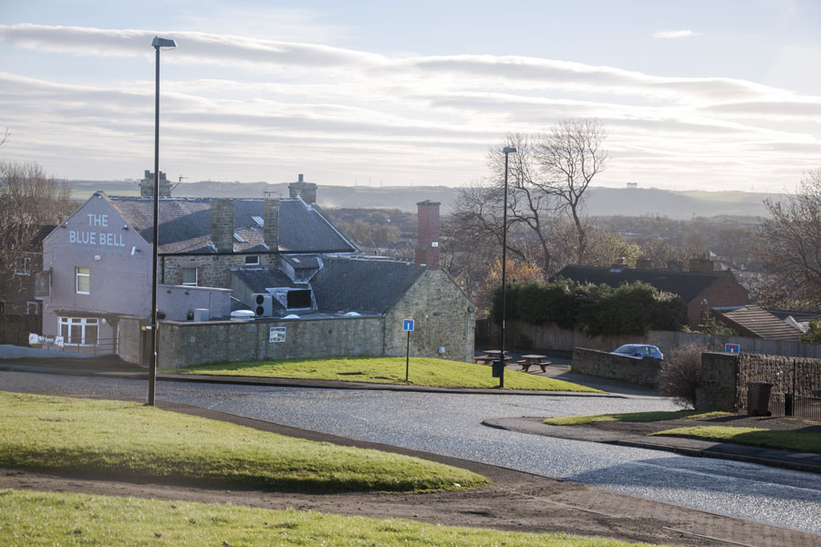
NOW
Blue Bell Inn - Grass Plot where Susan Peareth's School once stood - Top of Well Bank Road - Penshaw Monument
[ Photo: J.G. 1st Dec 2016 ]
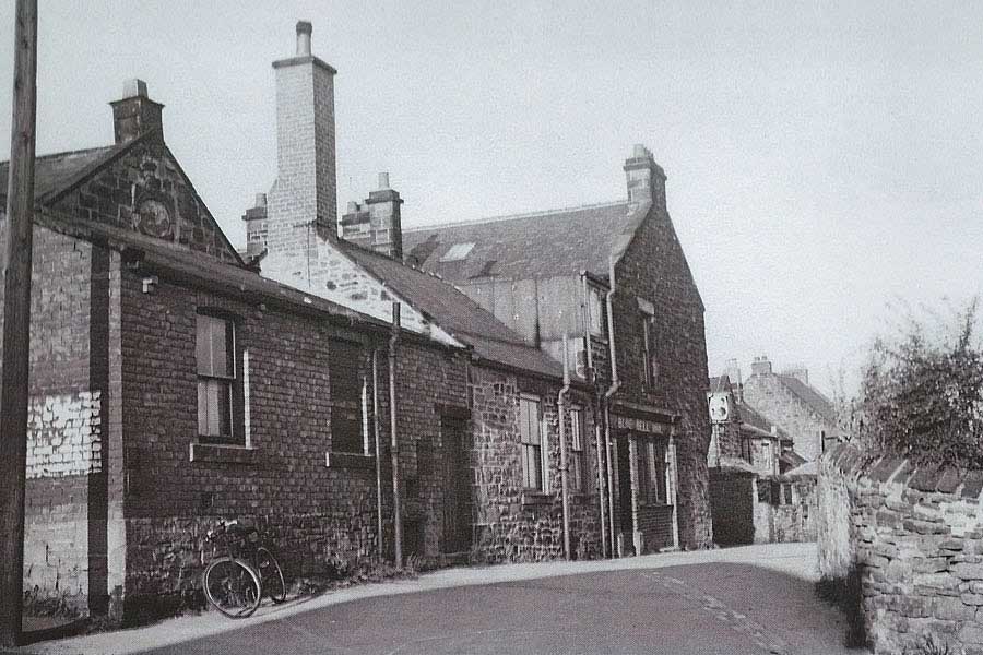
The south-facing apex of Susan Peareth's School
and the street behind the Blue Bell Inn
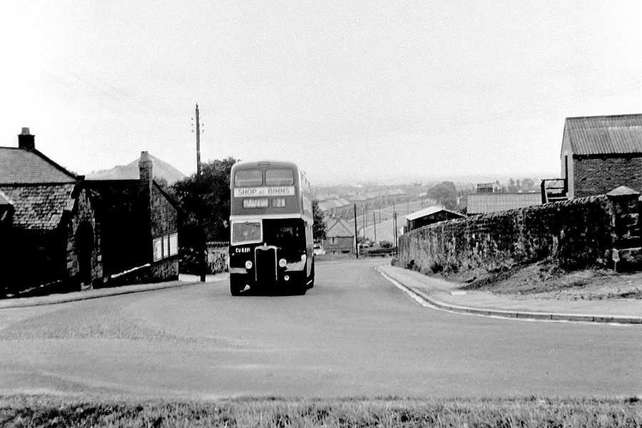
The 25 Bus making its way past the School Entrance.
Mrs Peareth lived a short walk away. Click Me to find out where.
The Blue Bell Inn
( Coach Road, High Usworth )
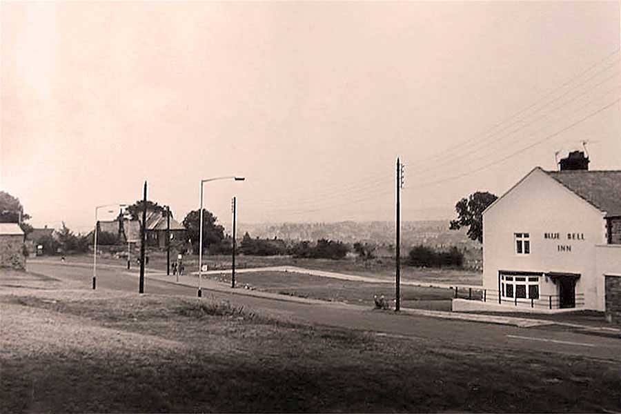
THEN
The School House standing close to the Coach Road, which once led from Great Usworth to Little Usworth.
Blue Bell Inn is on the right. Susan Peareth's School was immediately off-picture, right.
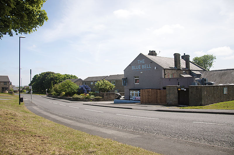
NOW
Blue Bell Inn, looking towards the Entrance of the School House - seen behind lamp post.
[ Photo: J.G. - 5th June 2018 ]

THEN
The Blue Bell, viewed from The Top of Well Bank
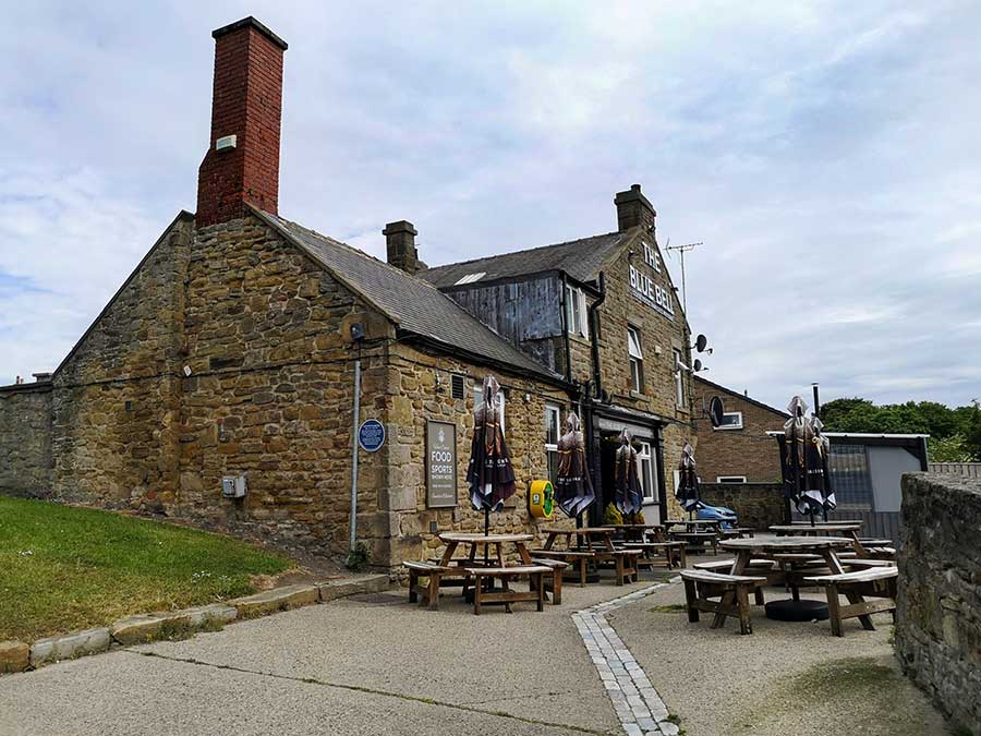
NOW
The Blue Bell, viewed from The Top of Well Bank
The Blue Plaque remembers Susan Peareth, Lady of Peareth Hall.
Read The Plaque at Whats Where; Schools; Susan Peareth's.
[ Photographer: Ernie Guy, Member of Washington History Society - May 2022 ]
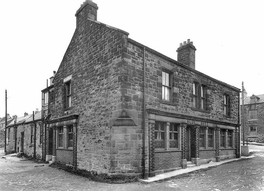
THEN
Main Entrance to Blue Bell Inn, viewed from the backstreet connecting Well Bank (left) to Coach Road (right).
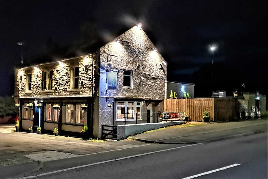
NOW
The Blue Bell, viewed from 'The Old Coach Road'
[ Photographer: Ernie Guy, Member of Washington History Society - 8th October 2021 ]
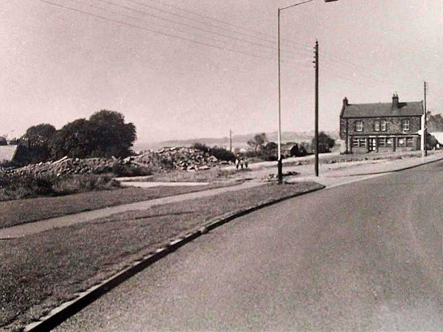
THEN
Blue Bell Inn from School House Entrance
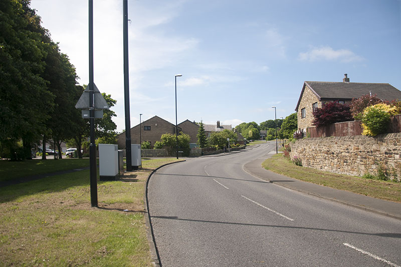
NOW
Blue Bell Inn - 5th June 2018
The School House
( The Former Great & Little Usworth Board School )
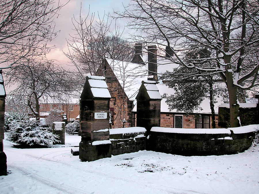
NOW
This was the Headmaster's House. The former Caretaker's House stands off-picture, left.
That's Coach Road Estate in the background.
[ Photo: Tom Copeman, 1st Jan 2005 ]
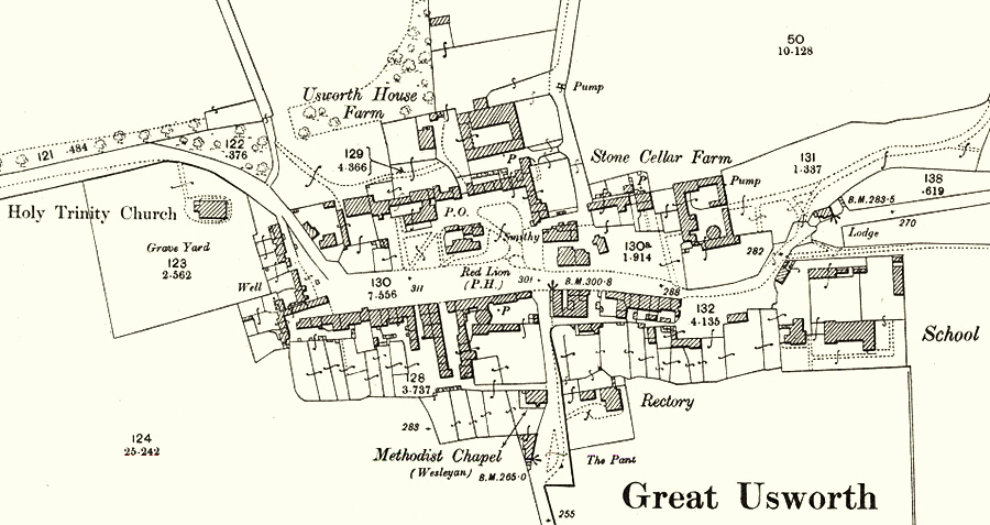
THEN
Extract from O.S. 25 Inch Map, 1892-1914.
Note the Headmaster's House, the Caretaker's House (alongside the road) and the large School Building.
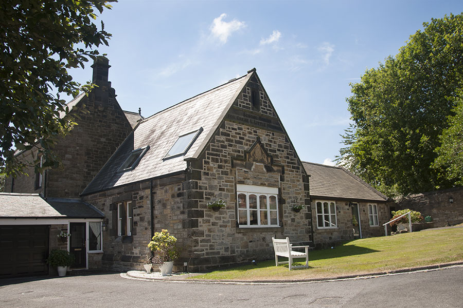
NOW
The Headmaster's House from inside the grounds.
[ Photo: J.G. 2nd July 2018. Many thanks to the Lady of the House for her kind permission to post these photographs. ]
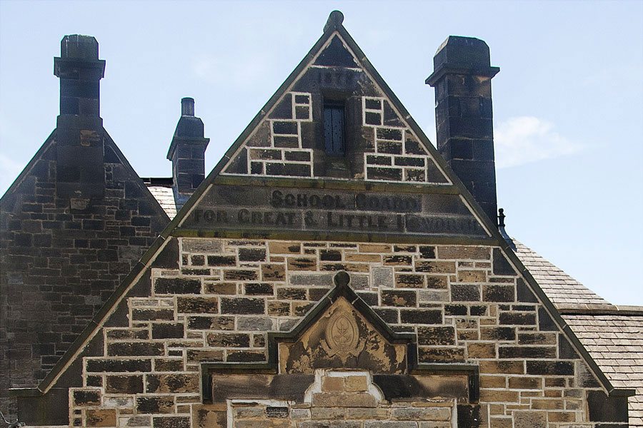
NOW
Note the date in the apex: 1878
[ Photo: J.G. 2nd July 2018 ]
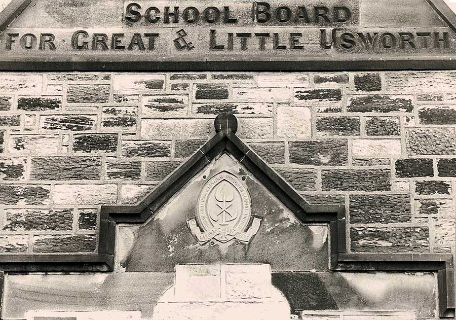
THEN
Upper and Lower Inscriptions on the Headmaster's House
( Some time ago - check the shovel blade below. )
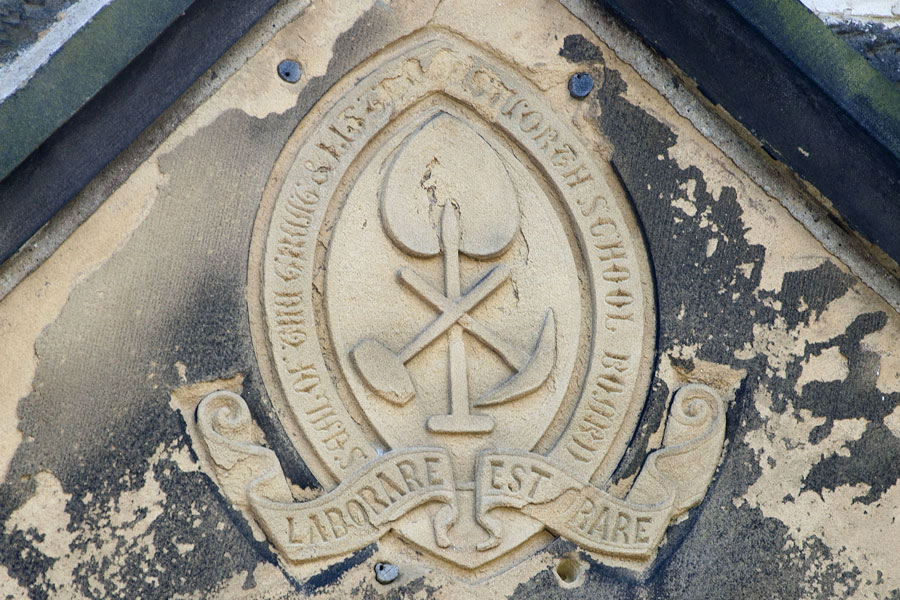
NOW
SEAL OF THE GREAT & LITTLE - USWORTH SCHOOL BOARD
LABORARE EST ORARE
'To Work Is To Pray'
[ Photo: J.G. 2nd July 2018 ]
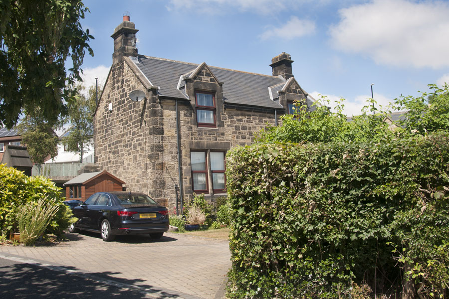
NOW
The Caretaker's House from inside the grounds.
[ Photo: J.G. 2nd July 2018. ]
• • ◊ • •
Unfortunately, I don't have any photographs of the School Buildings in their original state.
If you have any you'd like to share, I'll be delighted to post them here.
I'll also make sure that the residents get copies.
Spout Lane, The Coop & Victoria Road
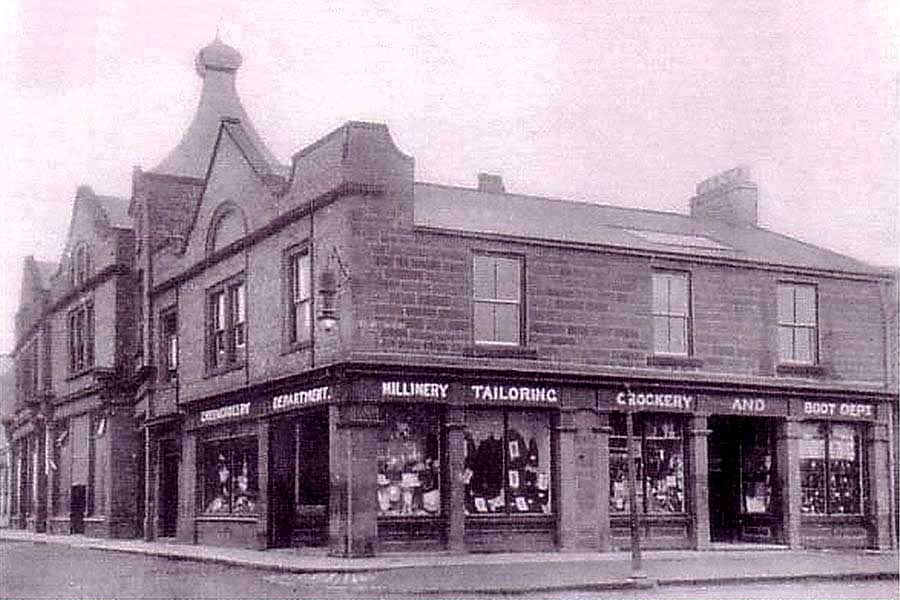
THEN (1 of 2)
The Cooperative Store on Spout Lane was New Washington's very own super-store.
[ The Butchery Department had its own abattoir. Once, in the Butcher's Shop with my Mam, I was allowed to hold the bolt gun. Wow! ]
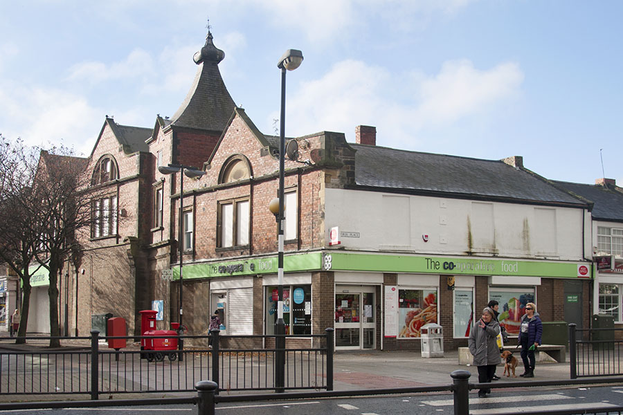
NOW (1 of 2)
Spout Lane is no longer a through road.
[ Photo: J.G. 18th Oct 2017 ]
• • ◊ • •
The Main Road to Houghton-Le-Spring
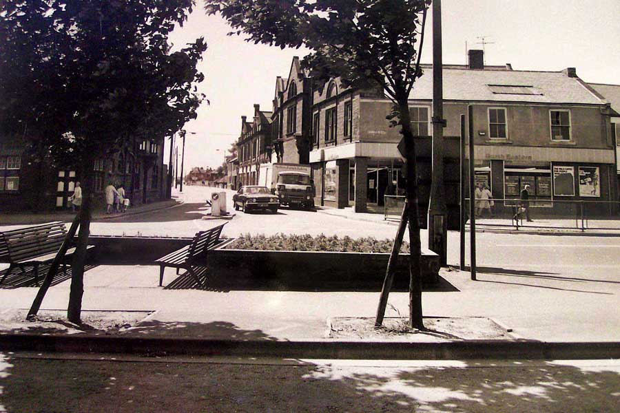
Between
THEN & NOW
Spout Lane: Leading to 'The Comrades' playing fields, Washington Miners' Welfare Hall,
The Police Station, Washington Grammar School and Washington Village.
• • ◊ • •
The Coop viewed from Spout Lane
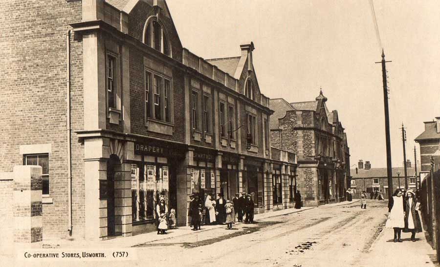
THEN (2 of 2)
Main Building: Drapery / Department / Dairy Dept / Greengrocery. New Inn Corner - Victoria Road - New Rows Terrace.
[ The alley between The Coop Buildings leads to the Alexandra Theatre, later the Regal Cinema. In 1904, New Rows was in the Parish of Usworth. ]
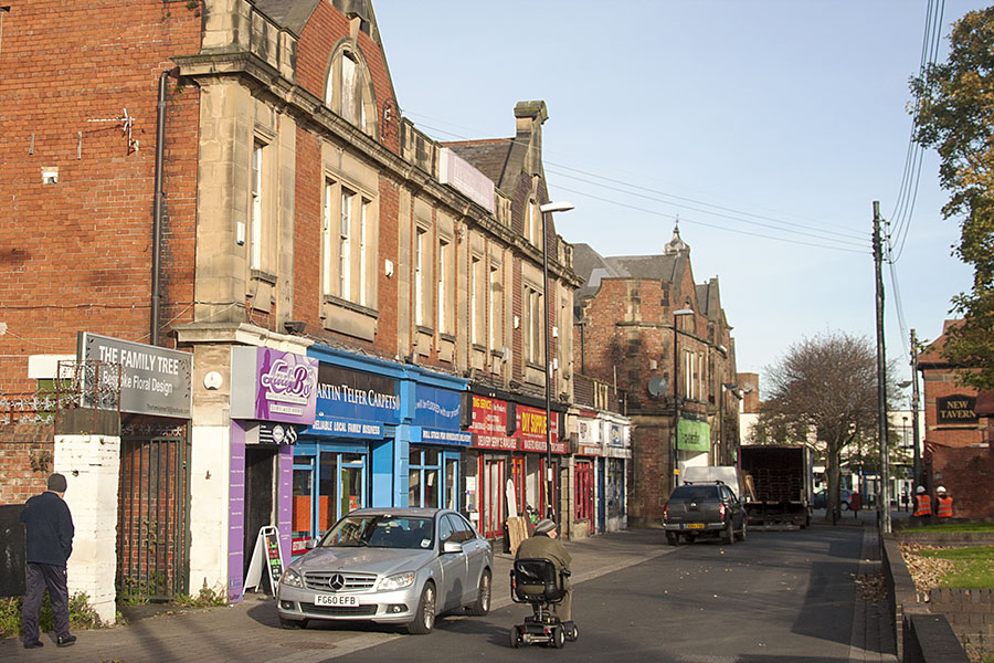
NOW (2 of 2)
Spout Lane is no longer a through road and the New Inn is now called the New Tavern.
[ Photo: J.G. 30th Oct 2017 ]
Spout Lane / Western Terrace
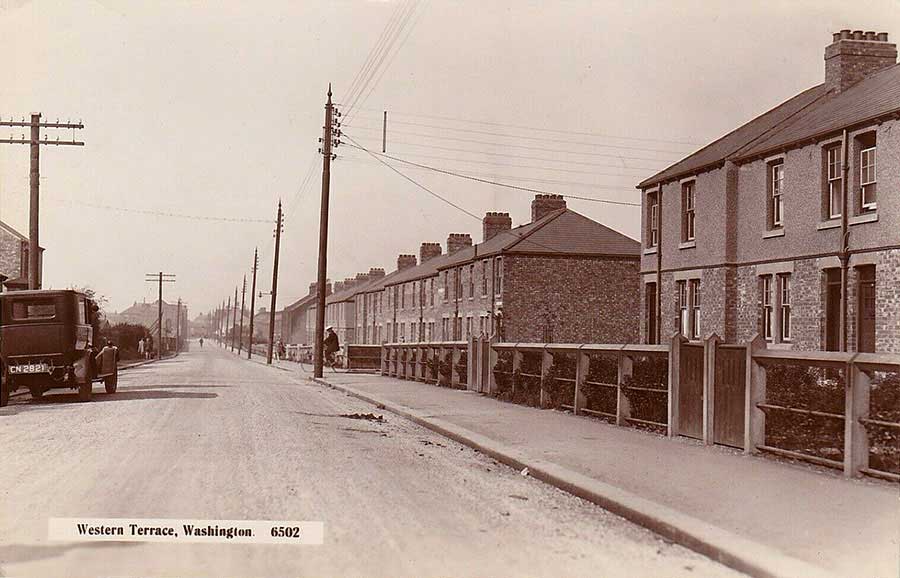
THEN
Straight ahead to the New Inn Corner. The Old Grammar School entrance was of off-picture, passenger side of the car.
[ Postcard Photo contributed by owner, Keith Cockerill. Attached Stamp: King George VI, who reigned from Dec 1936 to Feb 1952. ]
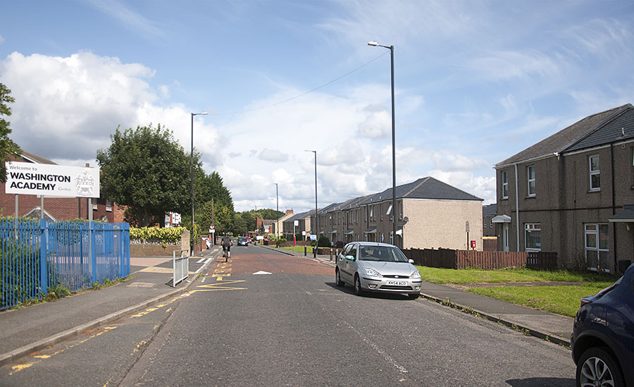
NOW
The original Spout Lane is blocked by a pedestrian underpass. This road now curves to the left, just before the distant trees.
[ Photo: J.G. 13th August 2019 ]
• • ◊ • •
THEN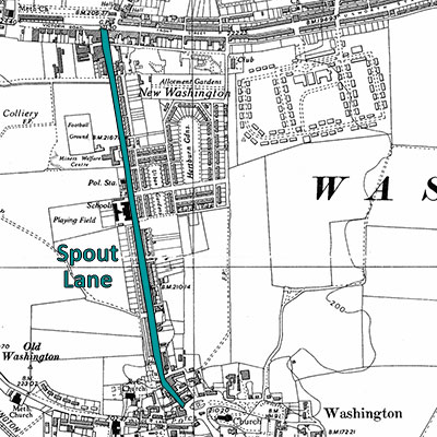
A Major Thoroughfare to Houghton-le-Spring
[ Map: 1950s ]
NOW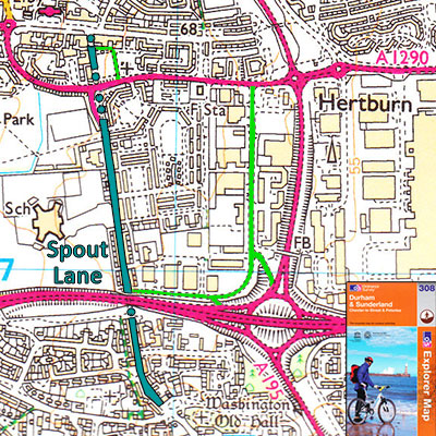
Blocked ... by two Pedestrian Tunnels!
[ Map: 2000 ]
Spout Lane / Municipal Terrace
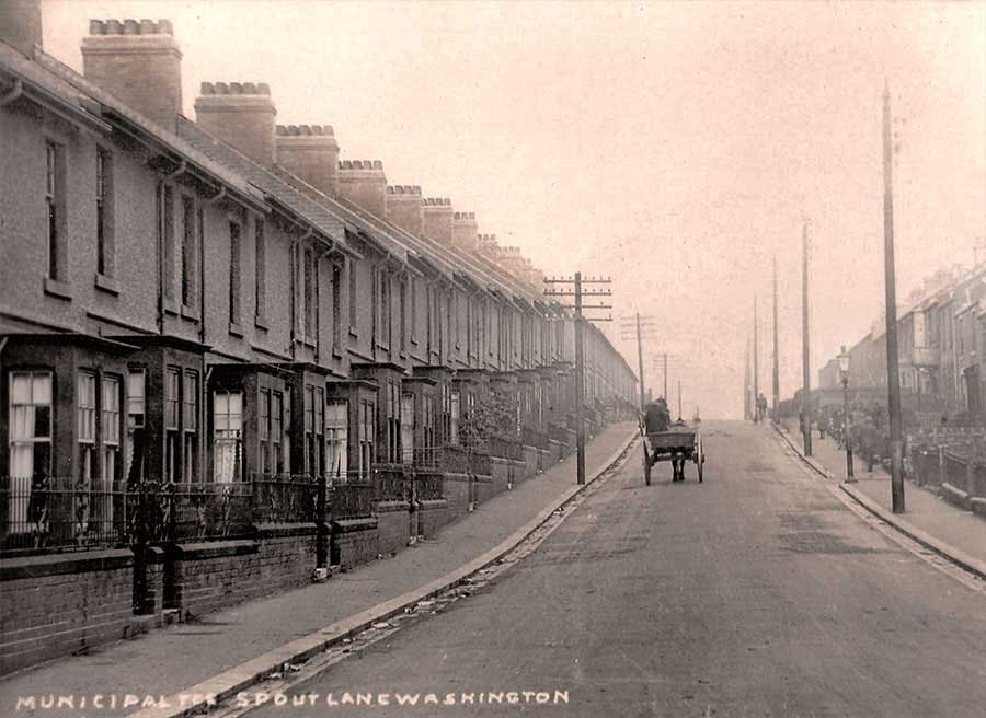
THEN
Municipal Terrace ( 5 chimney pots per house! ) Spout Lane Straight ahead to New Inn Corner.
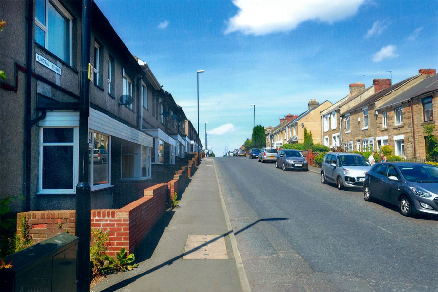
NOW
Spout Lane: just up the bank from the A1231 (Sunderland Highway) which now blocks this road. [ June 2014 ]
• • ◊ • •
BETWEEN THEN & NOW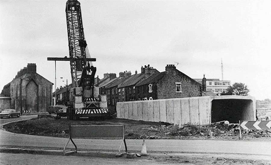
Construction of the A1231 Sunderland Highway Pedestrian Underpass.
[ Note the temporary by-pass road. ]
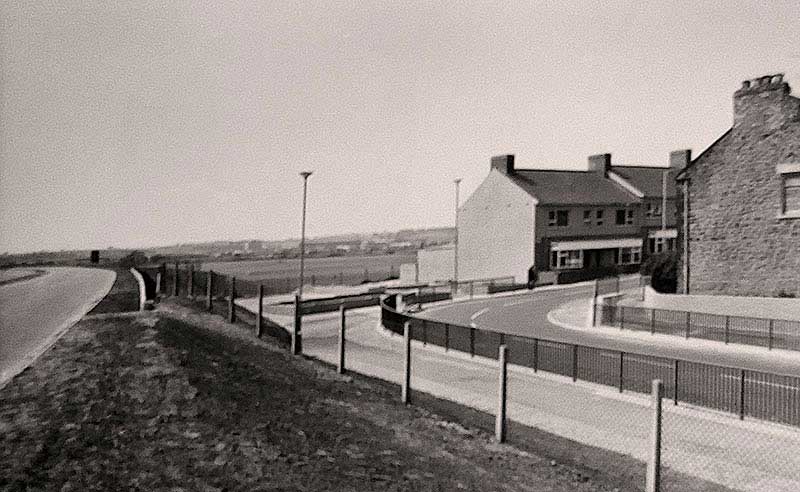
Above The Pedestrian Underpass
[ Note Washington Grammar School playing fields. Photo: Thanks to Adrian Lupton. ]
THEN
A Major Thoroughfare to Houghton-le-Spring
[ Map: 1950s ]
NOW
Blocked ... by two Pedestrian Tunnels!
[ Map: 2000 ]