Washington County Durham
HOME WHAT'S WHERE THEN & NOW PREVIOUS PAGE 2/8
Memories of Washington
Then & Now Collection ( 1/8 )
- Colliery
- St. Michael's / Pawson's
- Usworth Welfare Hall
- Usworth Welfare Park 1/5
- 2/5
- 3/5
- 4/5
- 5/5
- Stile Inn & Top Club
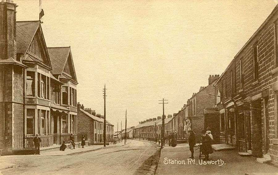
Usworth Colliery / Waterloo Road
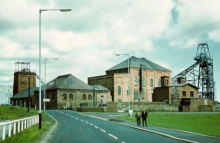
THEN
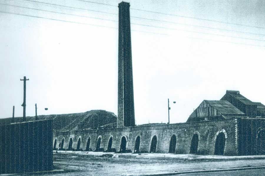
Usworth Colliery closed in August 1974. Sulgrave Road (right) connects Waterloo Road to Usworth Station.
[ Photographed in 1974 and contributed by photographer Stafford Linsley. ]
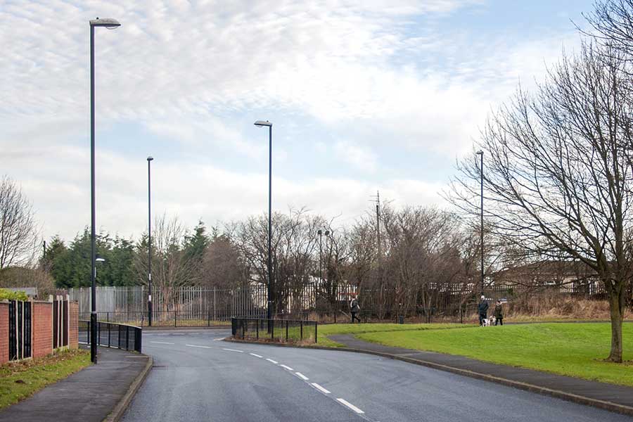
NOW
Sulgrave Road has been extended to the left and Waterloo Road is blocked at this 'T' junction
[ Photos: J.G. 10th Jan 2017 ]
NOW
Cornwallis: once the road to Mrs Ward's Post Office.
[ Former site of Brickyard, 23rd Jan 2017 ]
NOW
Trafalgar Road: opposite Cornwallis.
[ Former site of Old Row, 10th Jan 2017 ]
THEN
Usworth Brickyard: site of the future Cornwallis.
[ The road to the Post Office was off-picture, left. ]
THEN
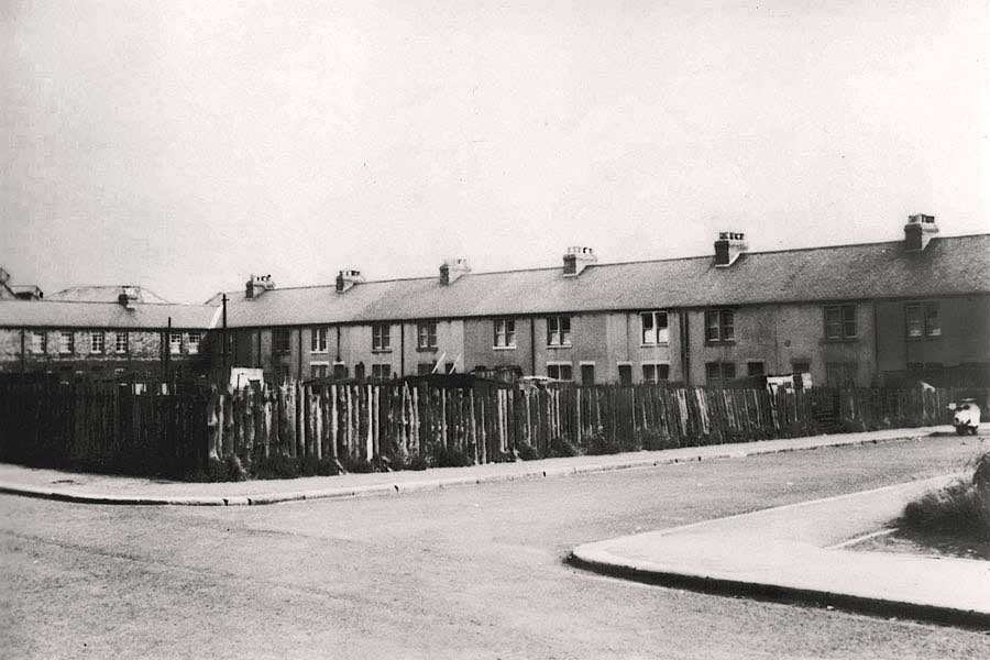
Old Row: site of the future Trafalgar Road.
[ At the crossroads with the P.O. road: the way into Usworth Green. ]
THEN
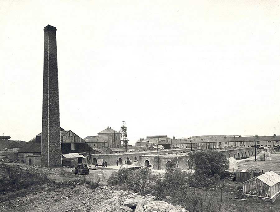
Usworth Brickyard, Usworth Colliery & Old Row, May 1965
Waterloo Road runs between the kilns and Old Row.
[ Courtesy of Tyne & Wear Archives & Museums ]
THEN
The original route of Waterloo Road, circa 1965
[ Sulgrave Road did not exist. ]
• • ◊ • •
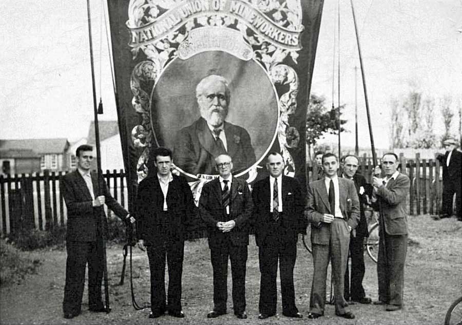
Usworth Colliery Lodge Banner ( 2015 )
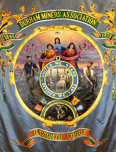
The New Usworth Colliery Lodge Banner
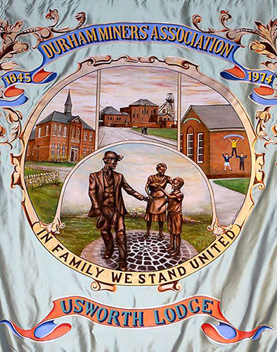
... as seen at Durham Big Meeting, 11th July 2015
[ The above 'Usworth 2015 Banner' photographs appear here by kind permission of photographer David Jones (W.G.S. 1959). Cheers Dave. ]
N.B. Former W.G.S. ( 1951 Intake) pupil, Stafford Linsley's superb 1974 picture of Usworth Colliery is replicated on the 'new' Usworth Lodge Banner.
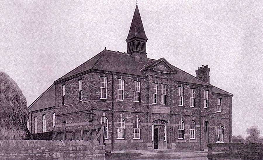
Saint Michael And All Angels Church, Usworth
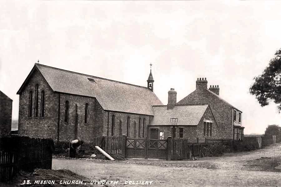
THEN
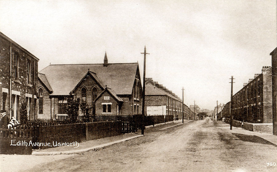
The Mission Church, later Saint Michael's. The junction of Edith Avenue, Manor Road and Waterloo Road.
A wooden 'Church Hut' stood within those gates in the 1950s. This is where the local Cub Scouts met, me included.
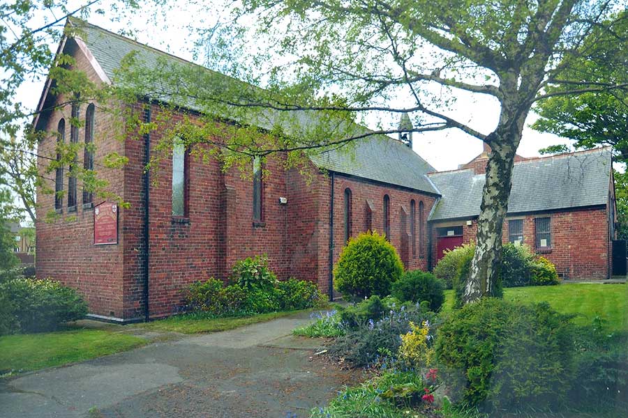
NOW
Saint Michael And All Angels Church, Sulgrave. [ May 2014 ]
Pawson's Dress Factory (which once stood diagnally opposite St. Michael's Church)
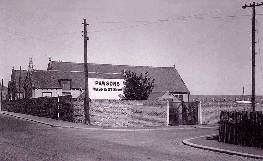
THEN
Pawson's Factory employed lots of women & girls in buildings that once housed the original Usworth School and a Methodist Church.
Note one of Usworth Colliery Pit Heaps on the right horizon and glimpses of Railway Terrace and Usworth Green 'Prefabs'.
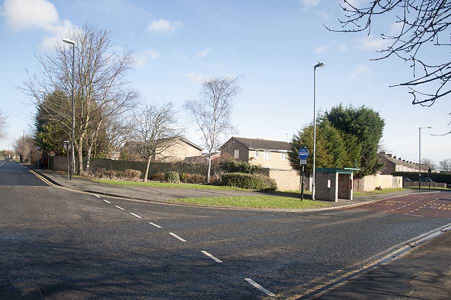
NOW
Waterloo Road and 'the new' Marlborough Road. Manor Road is off-picture, left. The road up Edith Avenue no longer exists!
[ Photo: J.G. 28th Feb 2017 ]
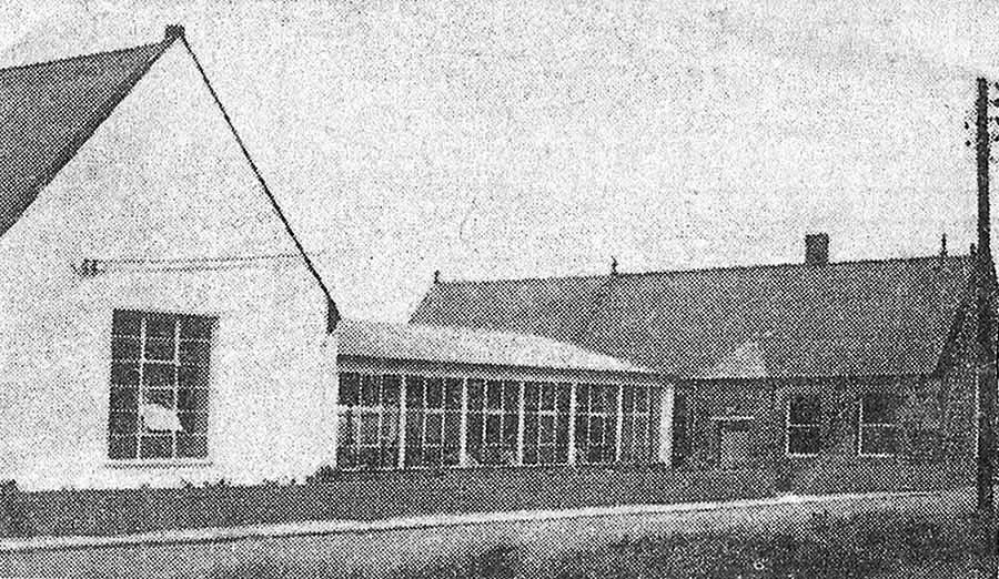
THEN
Pawson's Factory on Waterloo Road. Sewing machines behind glass.
Allegedly, the girls had to work long & hard for their wages!
NOW
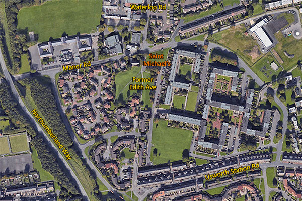
Route of the former road from St. Michael's, up Edith Avenue, to Usworth Station Rd.
[ Thanks to Google Earth. ]
THEN
Edith Avenue: St. Michael's Church and Pawson's Factory are at the bottom of the bank.
[ That's Usworth Colliery in the distance. ]
This brings back memories of Brag games in my mate Fernie's front room at 44, Edith Avenue. "Am gannin a tanner, blind!"
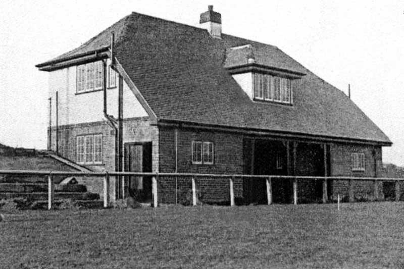
Usworth Colliery Miners' Welfare Hall - Manor Road
... just east of Northumberland Way bridge.
THEN
Usworth Colliery Miners' Welfare Hall
There was a billiards/snooker room upstairs. It overlooked Manor Road and The Parkie's house. I think it was in the top-left corner.
I went home for lunch, travelling from Usworth Juniors to Don Gardens via the path between that fence and the Welfare Hall.
Remember the out-door, one-man, Gents' urinal behind the Hall? It was close to the path ... with virtually no privacy!
Sometime later, a Scout Hut was built close to the haystack's position.
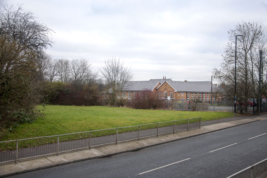
NOW
The former site of Usworth Miners' Welfare Hall showing its proximity to Usworth Colliery Mixed School
[ Photo: J.G. 19th Jan 2017 ]
Welfare Hall & Usworth Colliery Mixed School
Usworth Lodge Banner outside the Welfare Hall
THEN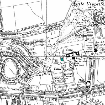
Welfare Hall - adjacent to the Senior School playground
[ 1951 ]
NOW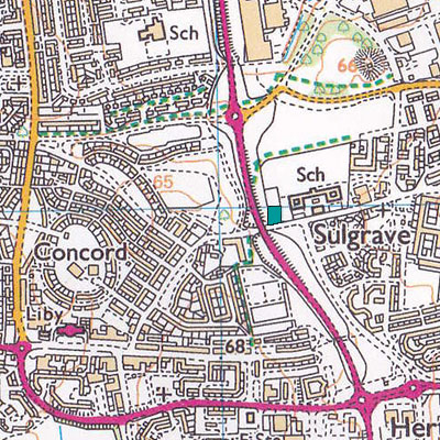
Northumberland Way - passing the empty site
[ 2000 ]
Usworth Colliery Welfare Park
( How it came to be constructed. )
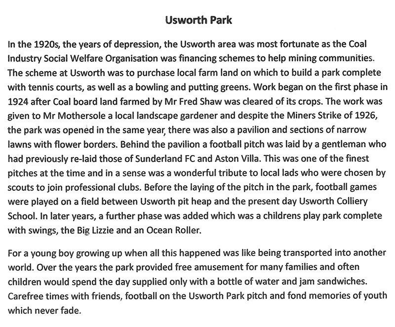
From information published in the Durham Chronicle, 4th September 1926.
Many thanks to Joe Chipchase. This contribution highlights a very important event in Usworth's History.
• • ◊ • •
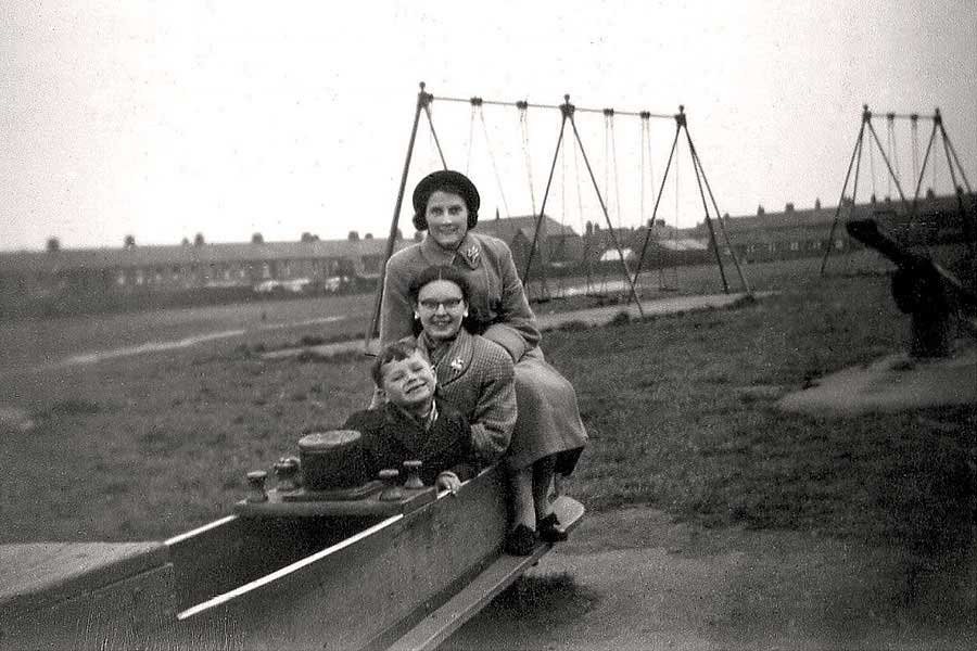
The Children's Play Park
( Manor Road )
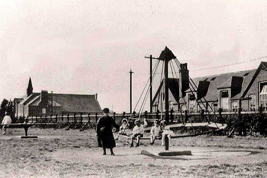
USWORTH COLLIERY MINERS' WELFARE PLAYGROUND
Usworth Colliery Miners' Welfare Hall - Usworth Colliery Mixed School
The Roundabout and The Ocean Wave. The Lizzie, Slide, See-Saw and Swings are off-picture.
USWORTH COLLIERY MINERS' WELFARE PLAYGROUND
Sadie Guy, née Archer, with Visiting Relatives.
Edith Avenue (left) - Edith Avenue Methodist Church (centre) - Chapel Street (right)
A wall was built beyond the Swings to form the No.2 Football Field.
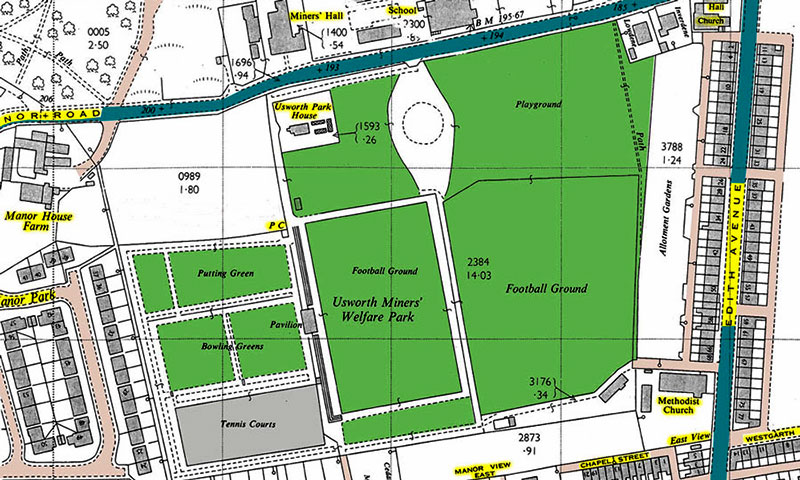
See Map below.
• • ◊ • •
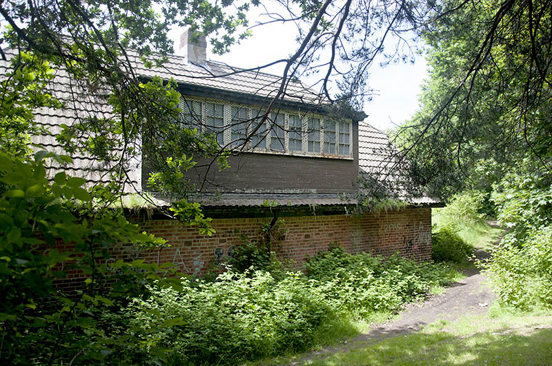
The Pavilion
( Upper Section: Bowls, Putt & Tennis. )
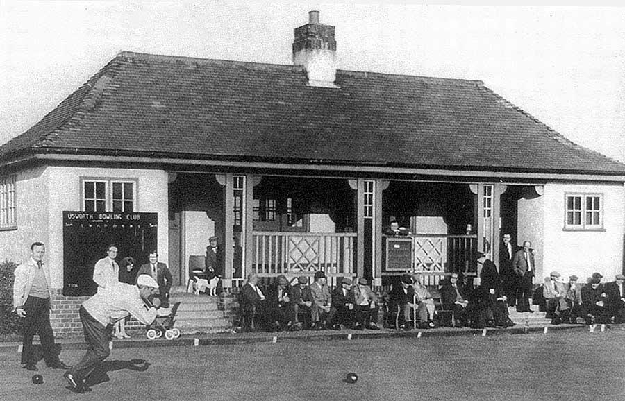
THEN
Usworth Bowling Club in Competition
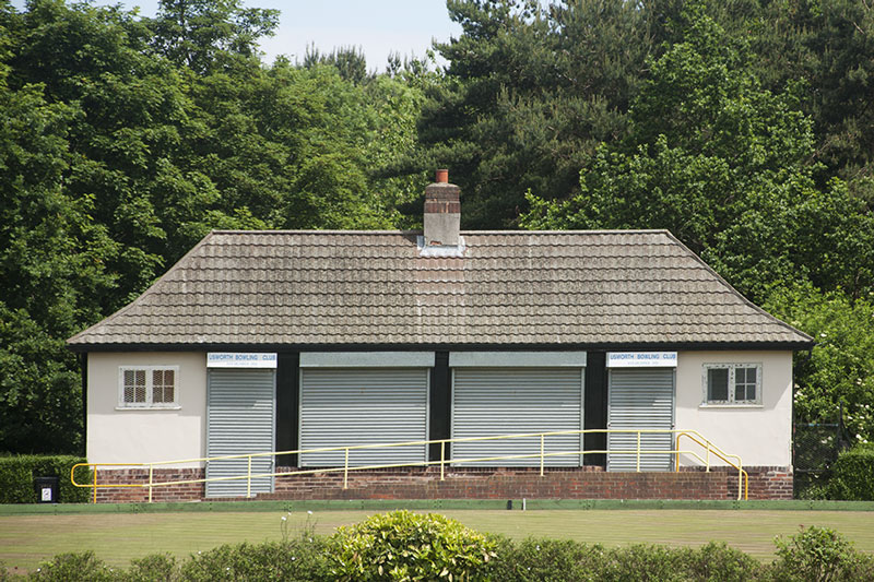
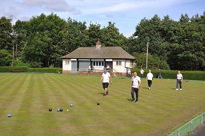
NOW
Usworth Bowling Club is still active and this is their Tournament Green.
[ Photo: J.G. 5th June 2018 ]
NOW
Usworth Bowling Club
[ Photo: Ernie Guy, August 2022 ]
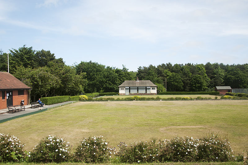
NOW
I'm told that this green, where young and less skilful players could enjoy a game of Bowls, is no longer being maintained.
Blimey, look at those trees growing behind the Pavilion. What's happened to the football pitch?
[ Photo: J.G. 5th June 2018 ]
• • ◊ • •
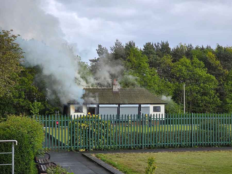
* UPDATE *
An Arson Attack on The Bowling Club Premises!
The Flames appeared about 16:30 BST
on Tuesday, 12th May 2026.
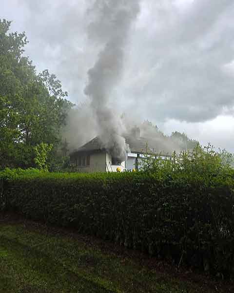
The Fire Brigade tackling the blaze at the Bowling Club Premises
in the former Bowls Pavilion / Football Changing Rooms.
Has this ruined over 100 years of Local History?
[ Photos: Friends of Usworth Park, Facebook. ]
• • ◊ • •
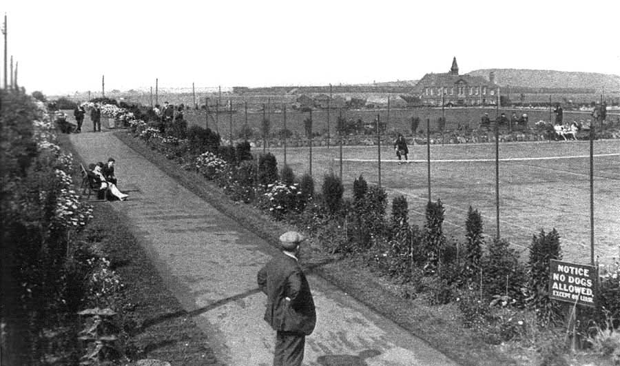
THEN
The Tennis Courts with the two Bowling Greens just beyond. The pavilion is off picture, upper-right.
Usworth Miners' Welfare Hall and Colliery Pit Heap are in the background.
THEN
Once a huge Public Park - note all the grass - with a resident Park Keeper to look after it.
Who remembers the open-air Gent's at the corner of the football field?
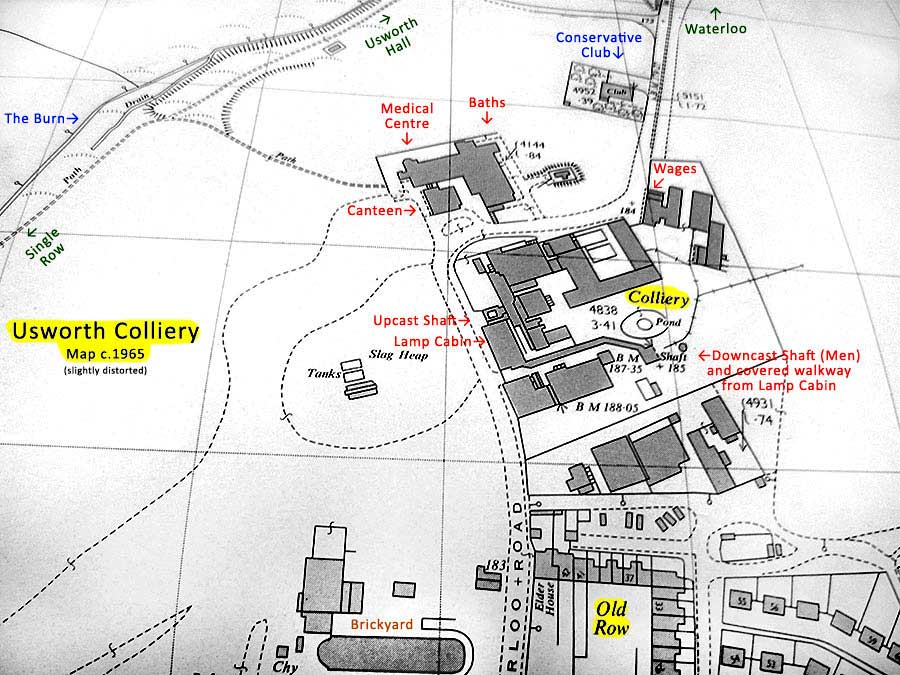
[ Map: 1965 ]
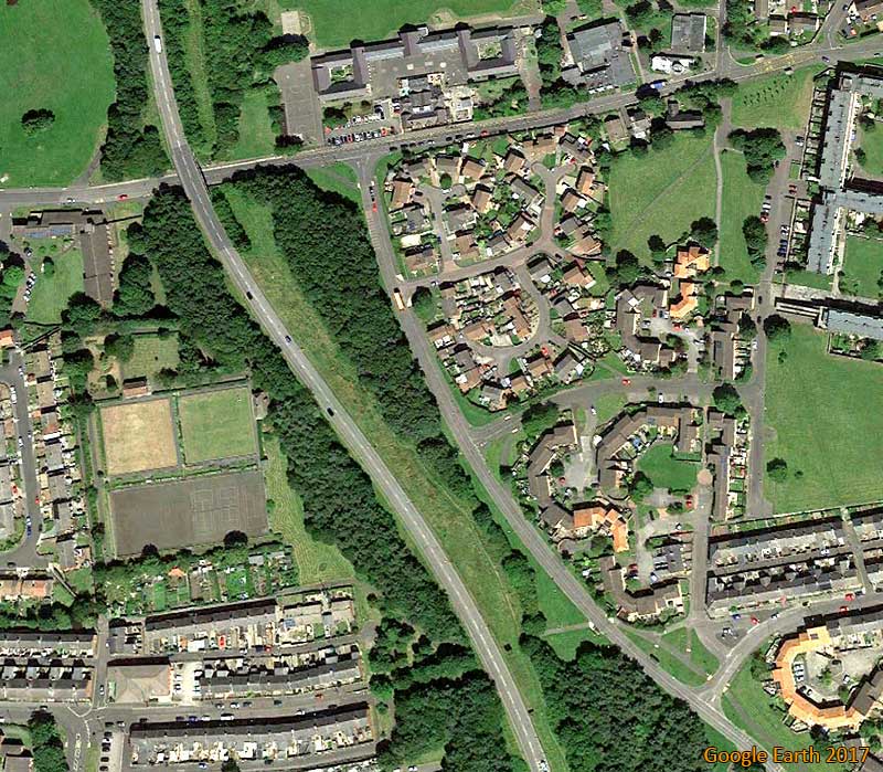
NOW
Note how much of Usworth Park has been lost to the local community,
and how the A195 cuts straight through the football field!
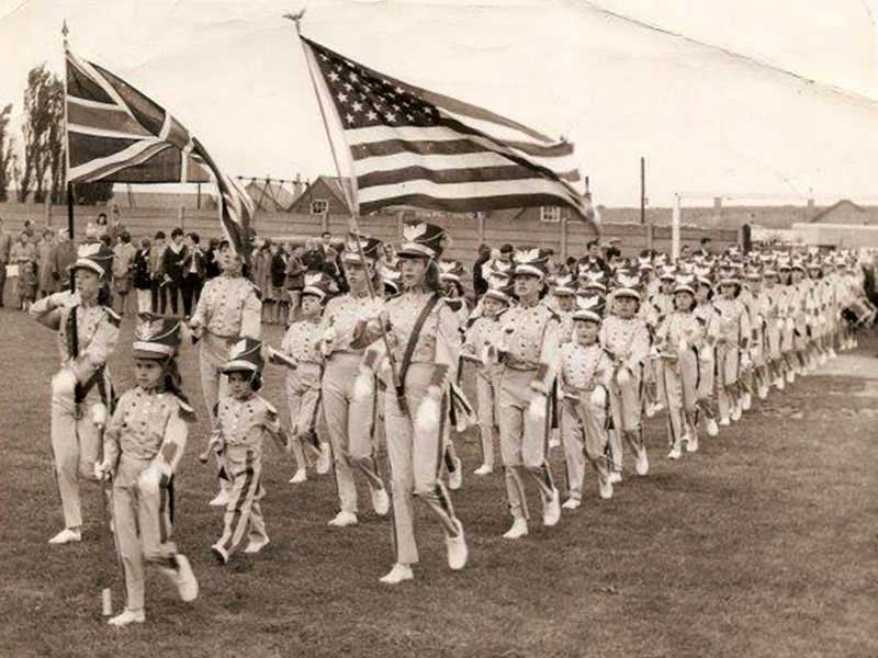
THEN
Usworth C.W. Sports Day, 1965: The Washington Greys march from the Playground onto the No.2 Football Field.
Frame for The Swings, Usworth Colliery Mixed School, Pit Heap and Showmen's Vans in the background.
[ Picture: Sunderland Echo. ]
To take a look behind the Pavilion, go to the next Tab.
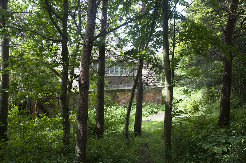
Behind Usworth Pavilion
( Lower Section: Changing Rooms & Superb Football Field. )
THEN
Usworth Pavillion - Football Changing Rooms
Up the Steps to the Bowling Greens.
NOW
Bricked up changing room entrances and windows.
Mesh on the upper, extended windows.
[ Photo: J.G. 5th June 2018 ]
NOW
Trees on our once greatly admired football field. In the 1970/71 season, it hosted the F.A. Cup, 4th Qualifying Round,
game between Washington Football Club and Bradford Park Avenue. The professional team won 3 - 0.
Usworth Colliery Welfare Park was packed with 3,000 spectators, including Yours Truly.
Our team gave a good account of themselves. What a sad sight it is now!
[ Photo: J.G. 5th June 2018 ]
NOW
Bowling Greens on the left of the Pavilion.
Trees and the A195 on the Field.
[ Photo: J.G. 5th June 2018 ]
THEN
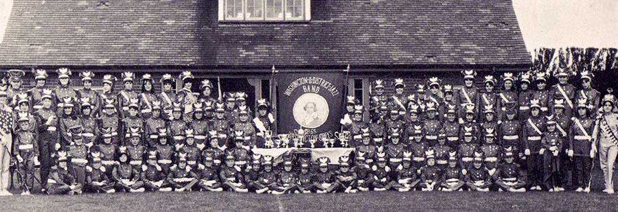
Washington Greys Jazz Band - on the Football Pitch at Usworth Colliery Welfare Park - 1965.
THEN
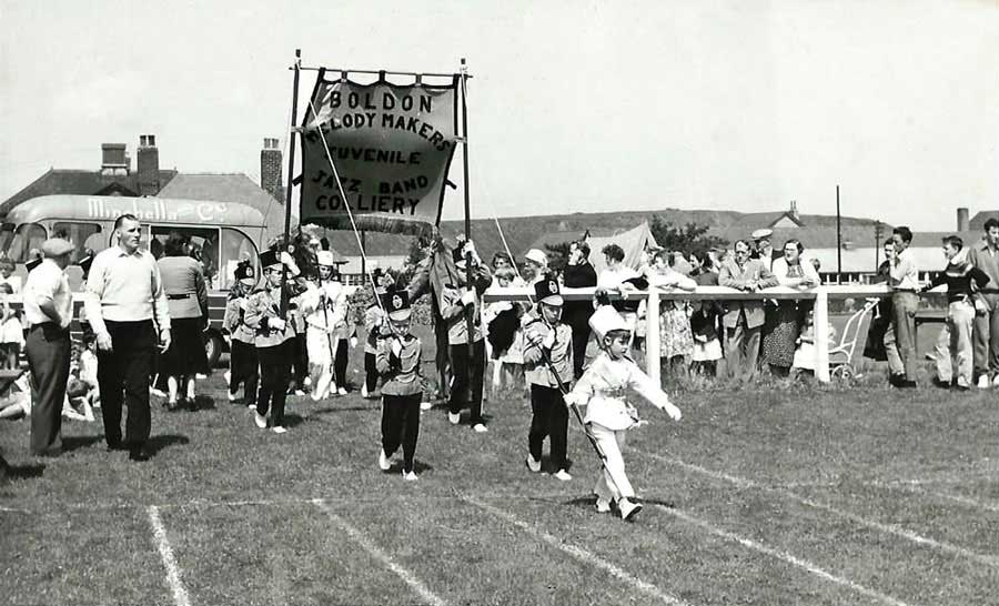
Usworth Sports Day. Jonty Simpson overseeing Boldon Colliery Melody Makers Jazz Band onto the main Football Field.
The Parkie's house, Usworth Miners' Welfare Hall, Usworth Colliery Senior School & Usworth Pit Heap.
[ Picture, early 1970s: Thanks to Ray Middleton. ]
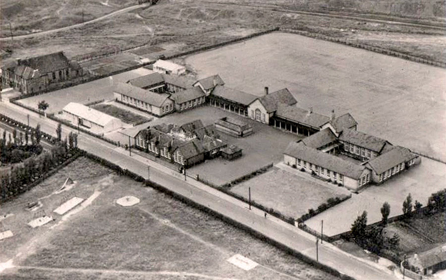
Usworth Colliery Welfare Park
The Main Football Field
( Viewed from the raised area on the Usworth Station Road side of the Pavilion )
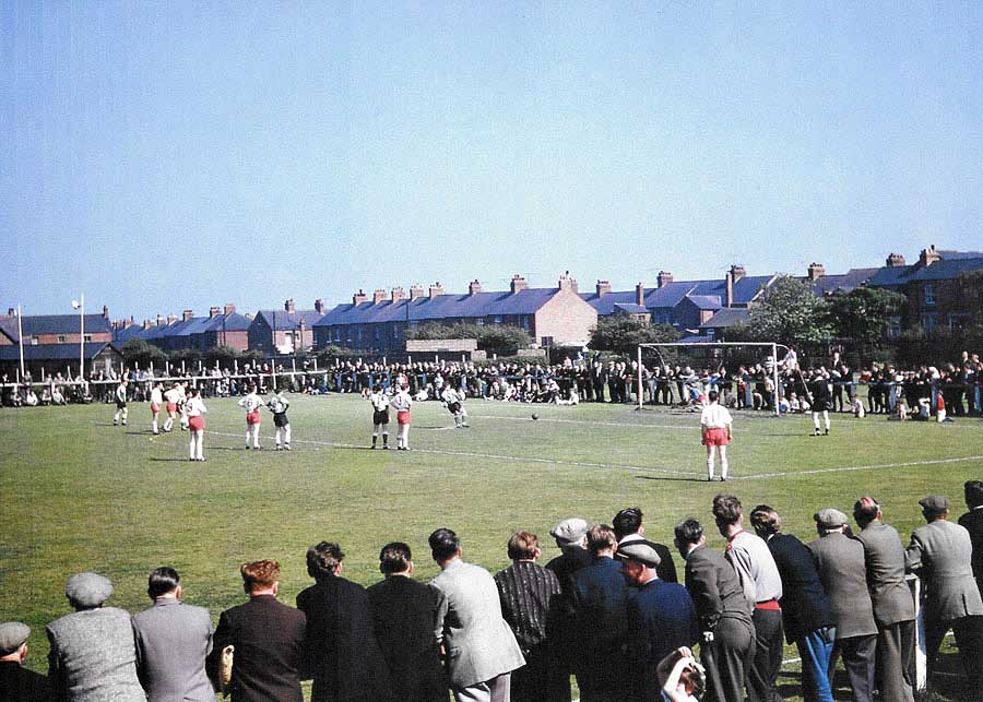
THEN
Typical Turnout for a 'Big Match' in the 1960s
Note the 'tiny triangle' of Edith Avenue Methodist Church (far left) and Chapel Street (centre-picture).
Next to the Church: the east terrace of Edith Avenue. Station Road runs (from far-right), down to Usworth Station.
( See Map on TAB: Park 1/4 )
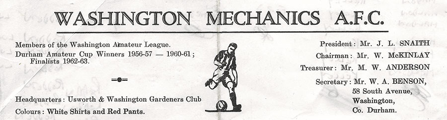
THE HOME TEAM
The Mechanics played in Red Shirts and Black Shorts in the 1950s but changed their strip in the 1960s.
[ Thanks to Photographer Ernie Guy, Member of Washington History Society ]
Usworth Colliery Welfare Park
Usworth & Washington Miners' Picnic
( 6th August 2022 )
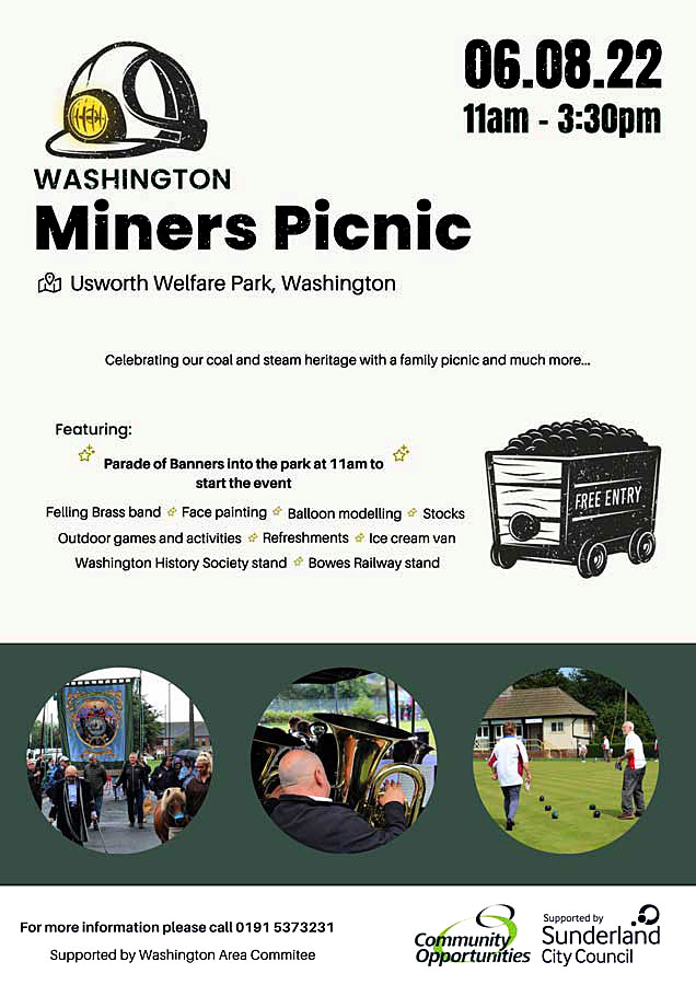
EVENT POSTER
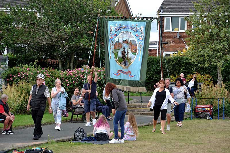
Usworth Colliery Lodge Banner
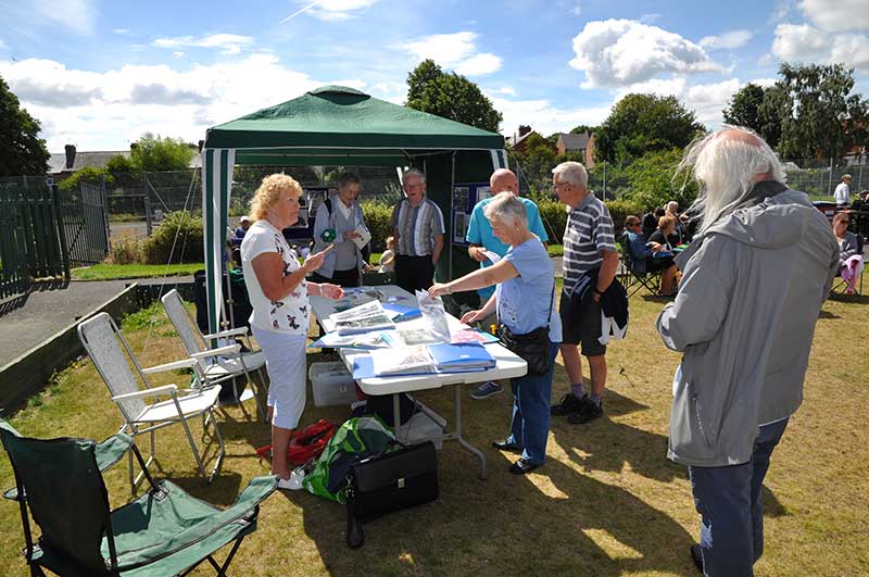
Exhibition of Bygone Photographs from Washington History Society Archives
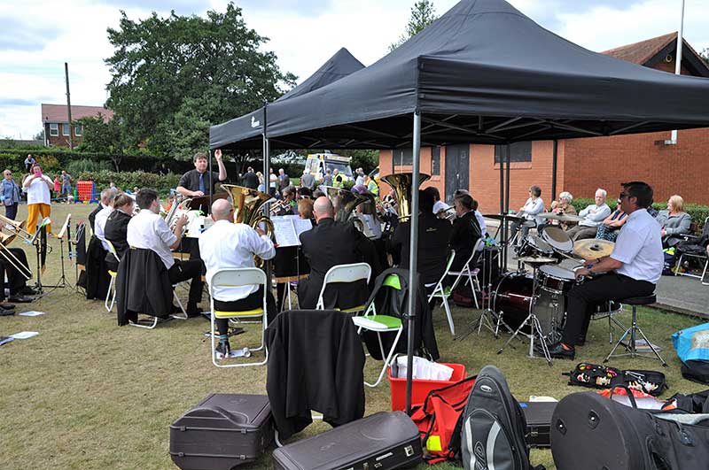
Felling Brass Band
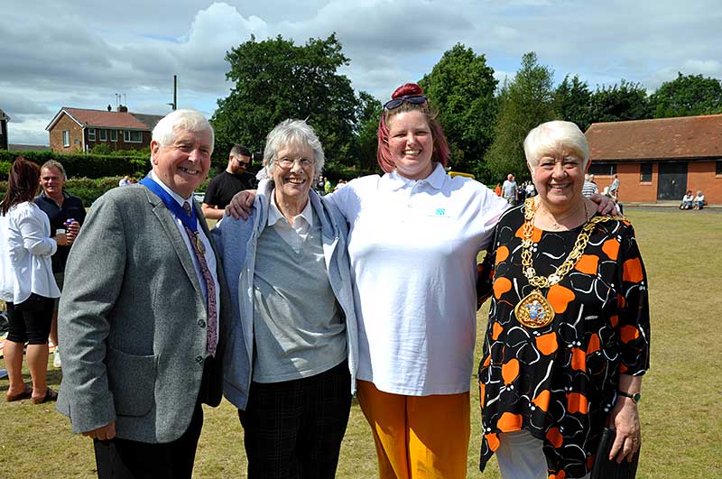
Councillor Alison Smith, Mayor of Sunderland, with her Husband & Consort, Councillor David Smith
Doris Jones ( former pupil of W.G.S. and Member of W.H.S.)
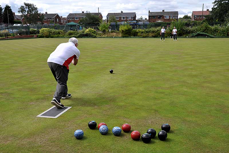
View from The Pavilion
Bowls Game in progress while the Miners' Picnic is set up on the Top Green
Remember what we kids called this wonderful game back in the 1950s?
( Auld Men's Marbles! )
[ Photographs courtesy of Ernie Guy, Member of Washington History Society - 6th August 2022 ]
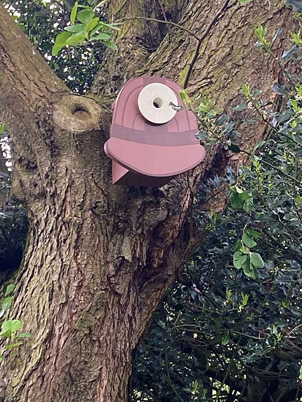
Usworth Colliery Welfare Park
Bird Boxes
( May 2024 )

Bird Box - Usworth Park
The Bowls Clubhouse

Bird Box - Usworth Park
Miner's Flame Safety Lamp
Bird Box - Usworth Park
Miner's Safety Helmet

Bird Box - Usworth Park
Colliery Headgear
[ Bird Box Photographs courtesy of Tom Copeman, Member of Washington History Society - May 2024 ]
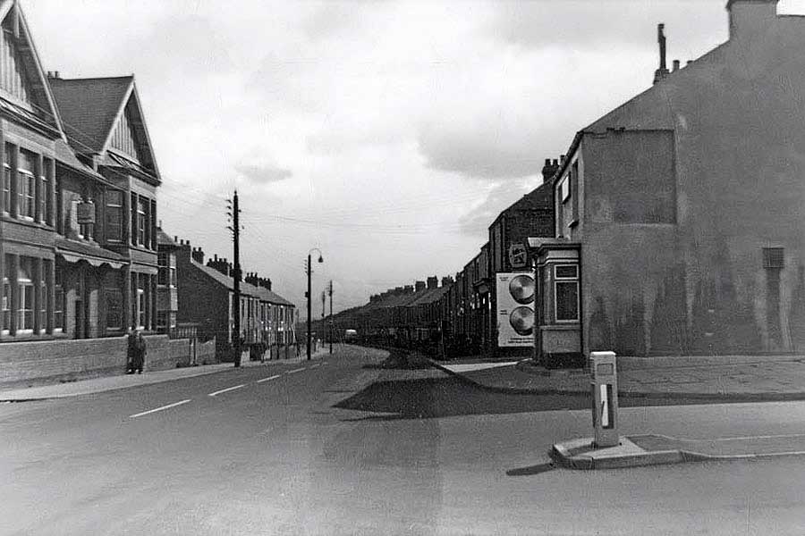
Stile Inn & Top Club - Usworth Station Road
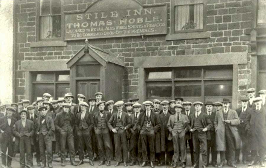
THEN
Stile Inn Regulars. Compare the pub sign shape, entrance roof and the window sills & lintels with those in the following image.
THEN
The Original Usworth Working Men's Club with Elliot Terrace beyond. The Stile Inn with Woodland Terrace, beyond.
THEN
Many Years Later: Usworth Working Men's Club and Stile Inn. New by-pass road to Usworth Station.
[ Note the C.I.U. sign - Club & Institute Union ]
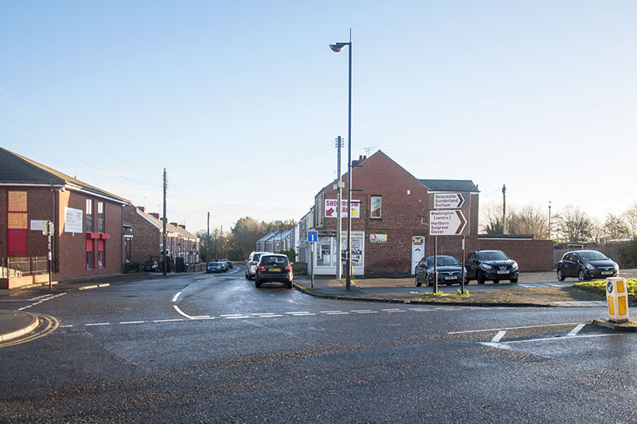
NOW
The Old Top Club is gone and the Stile Inn site is a car park. Woodland Terrace gable-end replaces that of the Stile Inn.
Usworth Station Road is blocked, just beyond the trees, by Northumberland Way.
[ Photo: J.G. 22nd Dec 2016 ]
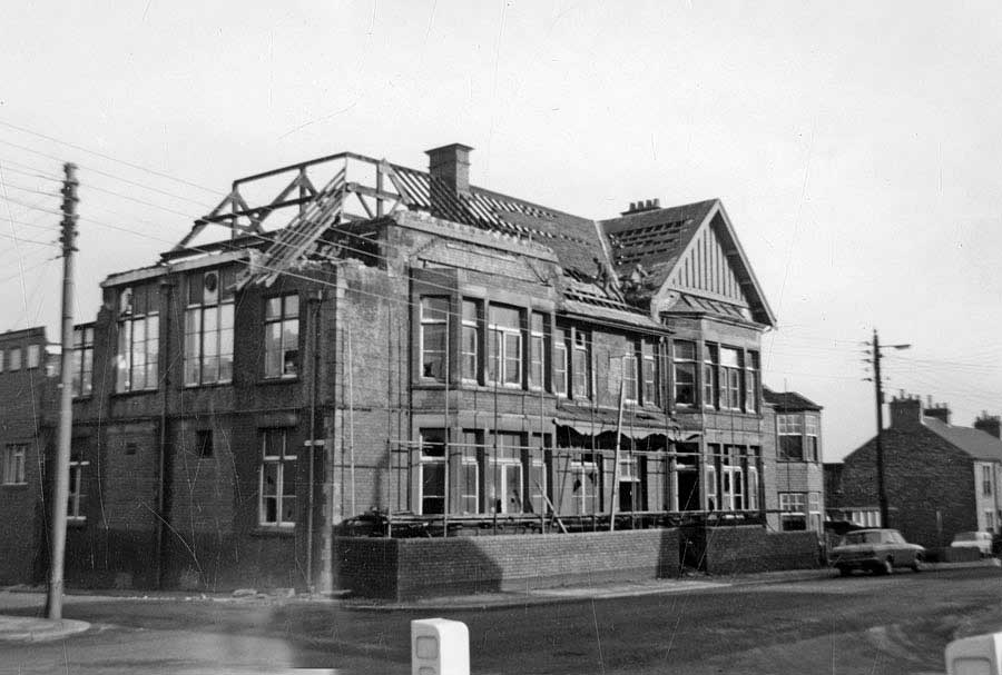
Top Club Demolition - 1970
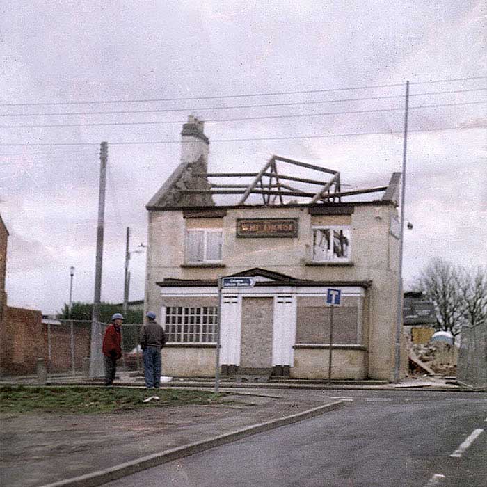
Stile Inn Demolition - 2001
Lots of old pub pictures at: Pub Crawl