Washington County Durham
HOME WHAT'S WHERE PREVIOUS PAGE (1/2)
Memories of Mining
Major Local Collieries (2/2)
- Washington 'F'
- Washington Glebe
- Usworth
- Follingsby
- Harraton
- Chartershaugh
- North Biddick
- Springwell
- Mount Moor
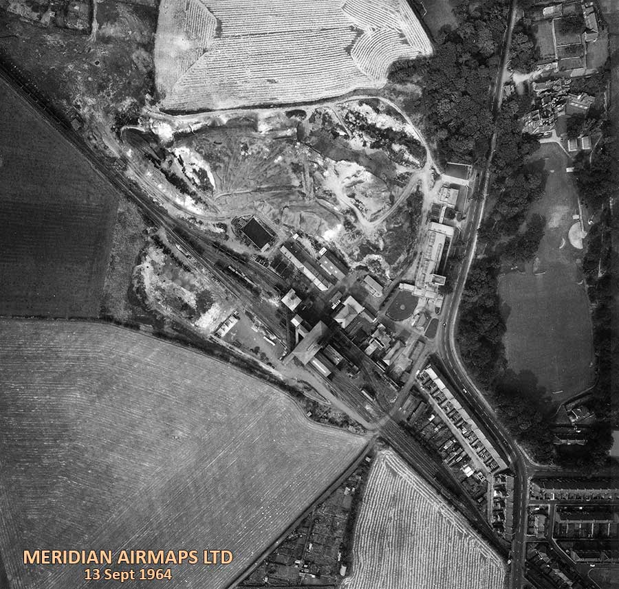
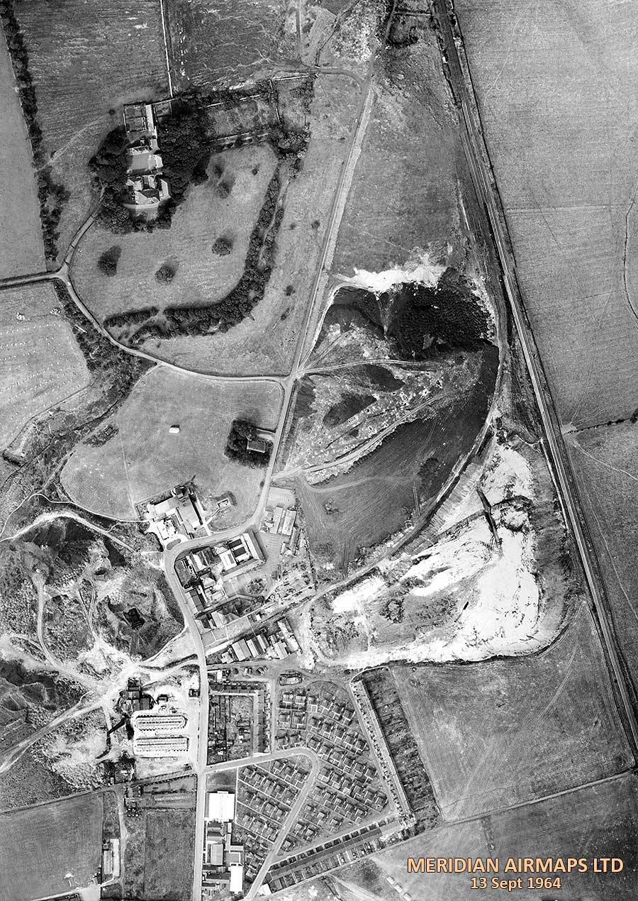
Washington 'F' Colliery
Aerial View - 1964
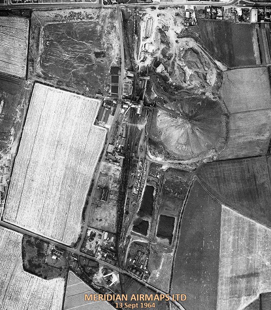
AERIAL VIEW of WASHINGTON 'F' COLLIERY
1. Blue House Lane from the Junction with Wellbank Rd to the junction with Victoria Rd, near the Ritz Cinema.
2. The Pit Road ( centre / vertical ) to Brandy Row School at the junction with Village Lane.
[ Compilation of 6 Photographs. Courtesy of Washinghton History Society. ]
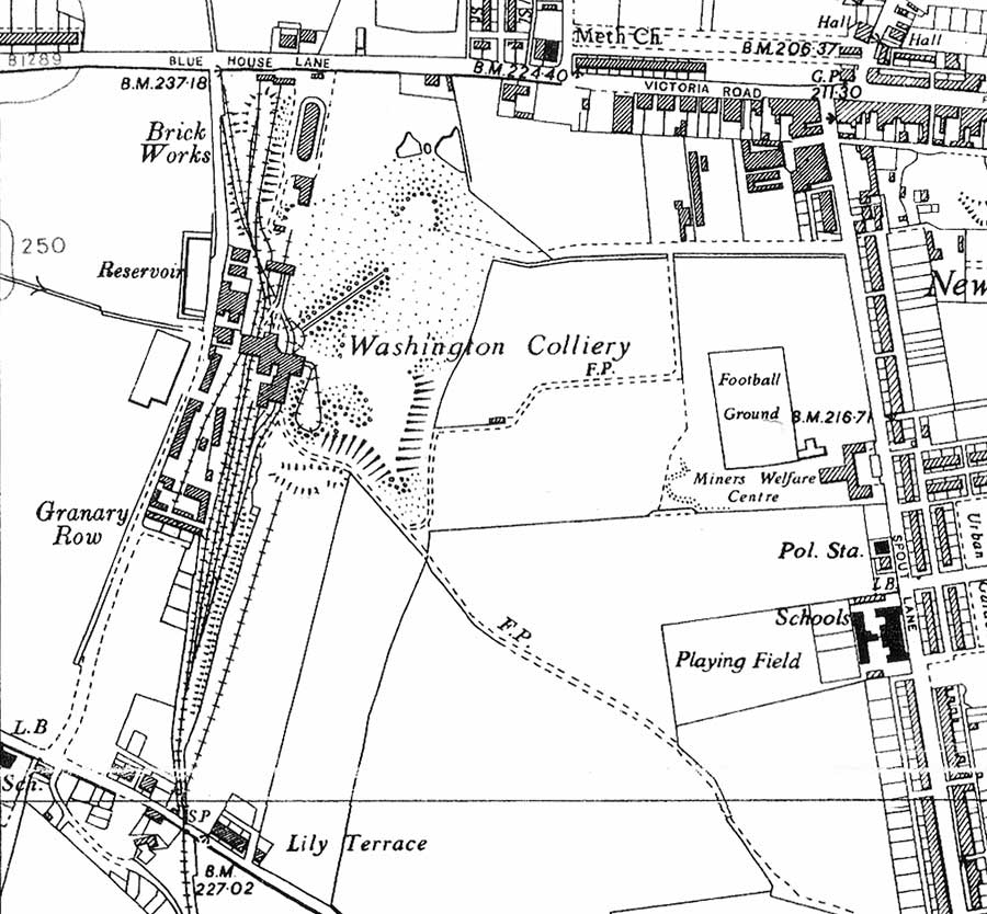
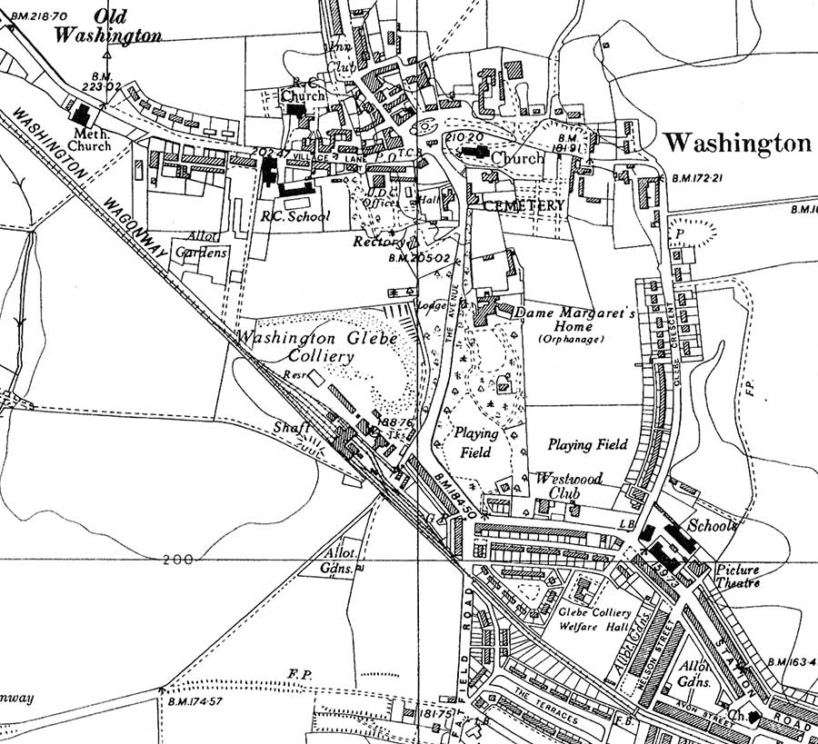
MAP of WASHINGTON 'F' COLLIERY - 1951
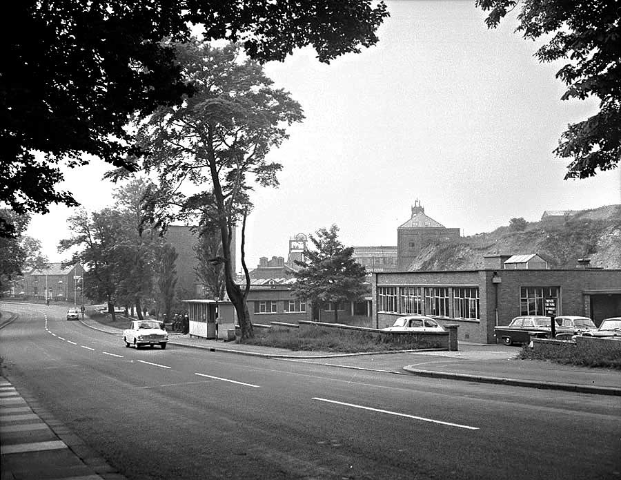
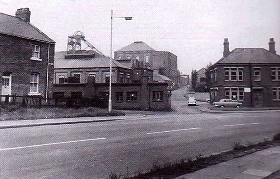
The Road Junction where The Pit Road meets Blue House Lane.
Known locally as 'The Pit Road Ends'.
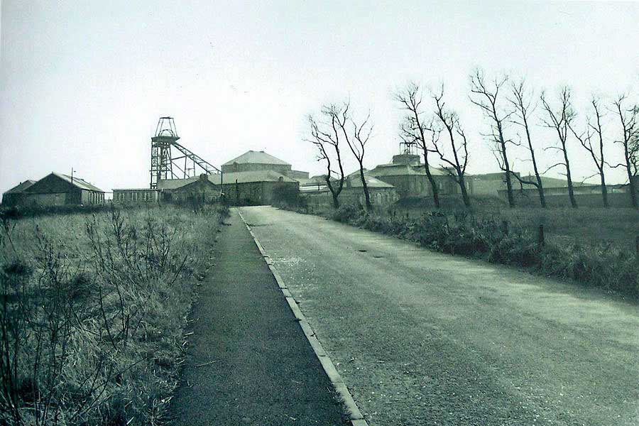
Heading Home down The Pit Road towards Blue House Lane
[ Picture from a Washington Development Corporation Booklet ]
View from further up Blue House Lane
[ Courtesy of photographer, Dr Stafford Linsley, July 1968 ]
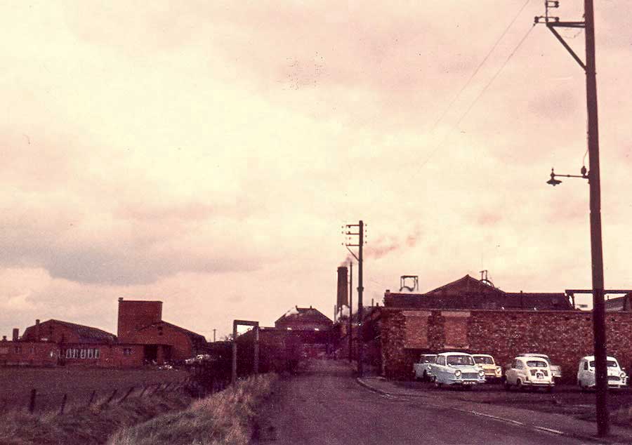
Heading up The Pit Road from Village Lane
Note the Canteen windows in the bottom-left corner.
[ Courtesy of Washington History Society. ]
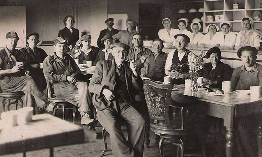
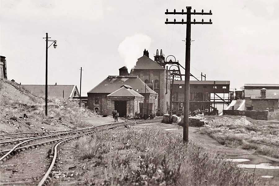
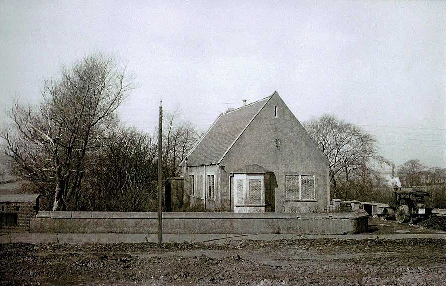
'F' Pit Canteen
Staff and Customers
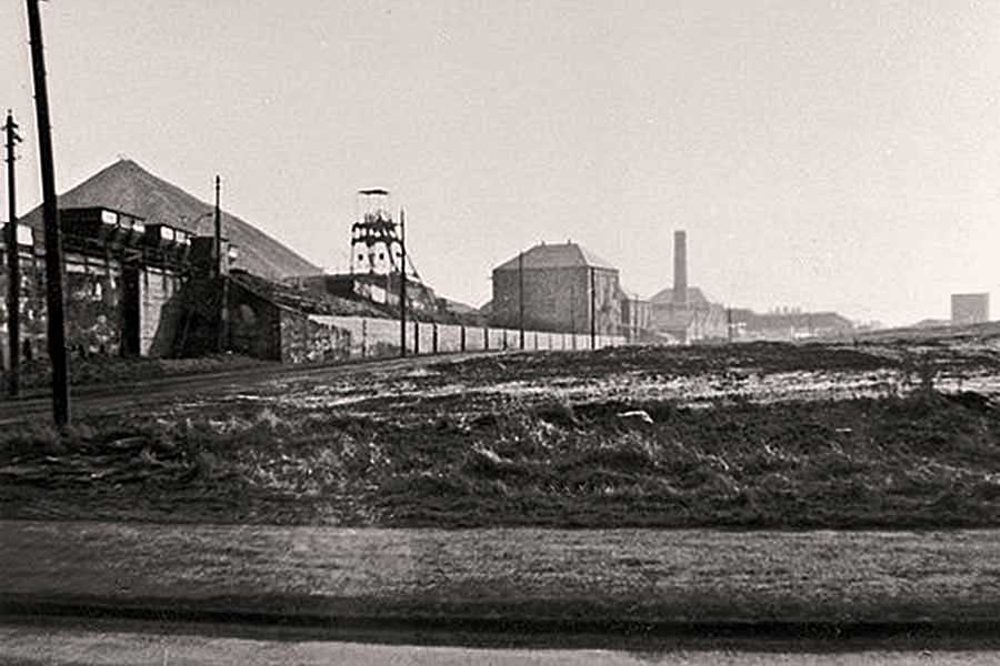
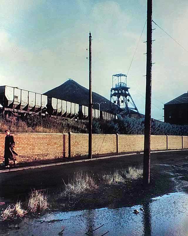
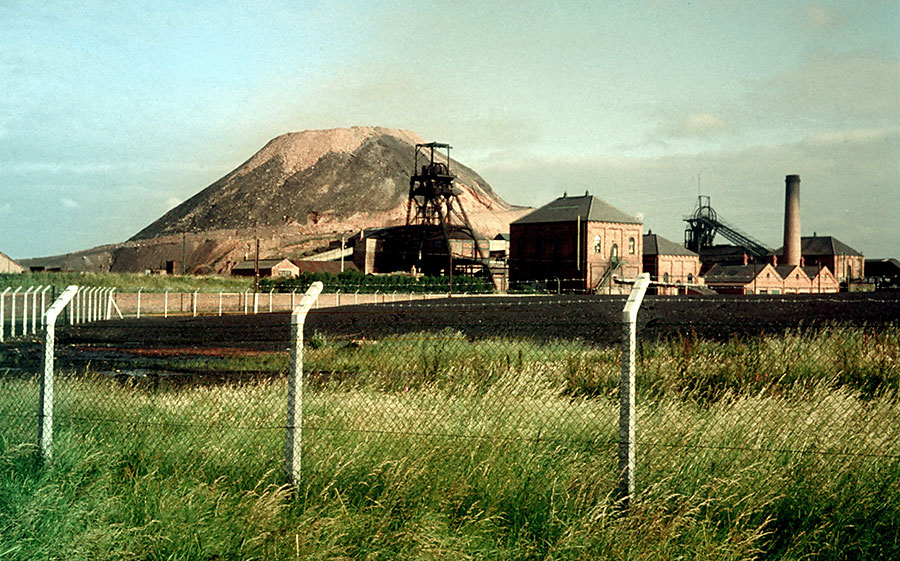
The Pit Road and Granary Row.
Note Two Pit Heaps.
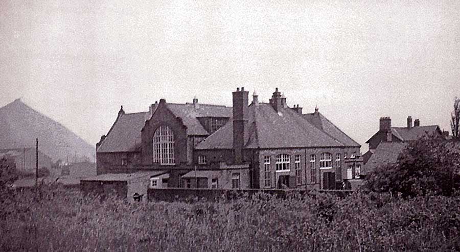
Brandy Row School - Colliery Manager's House (far right).
Note the large Colliery Garage on The Pit Road.
Washington Glebe Colliery
Aerial View - 1964
AERIAL VIEW of WASHINGTON GLEBE COLLIERY
1. Washington Village is just off-picture, top-right and the Victoria Hotel is just off-picture, bottom-right.
2. The Avenue passes Dame Margaret's Hall & Grounds, Glebe Colliery Canteen, the Entrance to the Colliery,
and Home View, before terminating at the junction with Washington Station Road and Fatfield Road.
3. Note Washington Wagonway running through the Colliery from the 'F' Pit to the Leamside Line which passes through
Washington Railway Station. The Wagonway crosses Fatfield Road in the bottom, right-hand corner of this photograph.
[ Single Photograph. Courtesy of Washinghton History Society. ]
MAP of WASHINGTON GLEBE COLLIERY - 1951
The Avenue - Glebe Colliery Canteen - Grounds of Dame Margaret's Hall, opposite.
Colliery Entrance: bottom of bank.
[ Courtesy of Tyne & Wear Archives & Museums ]
Entrance to Washington Glebe Colliery - The Avenue was the main road from Washington to Penshaw and Houghton-le-Spring.
Home View terraced houses, overlooking the Grounds of Dame Margaret's Hall.
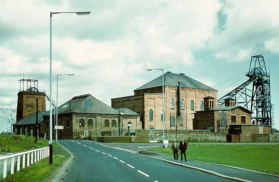
Washington Glebe Colliery: Downcast Shaft (air in - tallest headgear) & Upcast Shaft (air drawn out by fan).
Washington Wagonway: Straight ahead to Washington 'F' Colliery - Back-up to Washington Station and The Leamside Line.
Washington Glebe Colliery with the 'F' Pit Heap in the background. Dame Margaret's Hall is just visible.
Photo taken from Footpath to Oxclose leading from the Shop in the picture below.
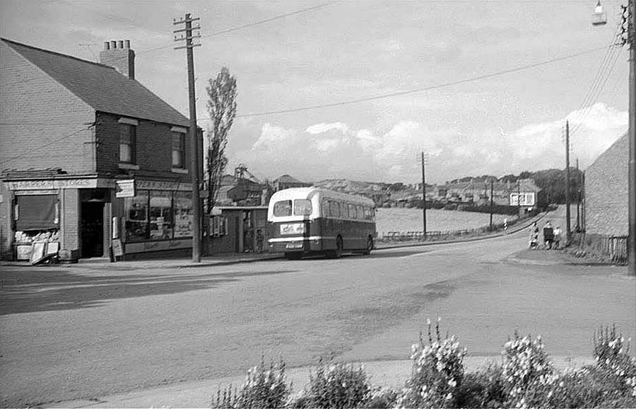
The No. 39 Bus to Newcastle, Worswick Street - Glebe Colliery, a view from Victoria Hotel
Washington Wagonway crossing Fatfield Road - Oxclose Road to Brady Square.
Usworth Colliery
Aerial View - 1964
AERIAL VIEW of USWORTH COLLIERY
1. The Old Coach Road from the top of Well Bank, High Usworth, leads directly to the entrance to Usworth Hall & Grounds.
The alternative is to continue to Waterloo Road. Turn left to the location of the now demolished community of Waterloo.
Turn right to pass the former Methodist Chapel, later Usworth Conservative Club; it's a short distance to the Colliery.
2. The Burn, having passed Don Gardens, Single Row and Quarry Row, turns north-east to skirt an Usworth Pit Heap before
continuing through the line of trees in Usworth Hall Grounds, en route to meet up with the River Don.
3. The Colliery can be accessed from two other routes: a) Manor Road from the New Inn Corner, and b) Edith Avenue from
Usworth Station Road. Both of these routes meet Waterloo Road at St. Michael's Church. See Map below.
[ Compilation of 10 Photographs. Courtesy of Washinghton History Society. ]

MAP of USWORTH COLLIERY - 1951
THE RAILWAY LINES LEADING TO THE COAL DEPOT NEAR DON GARDENS
The Railway Lines on the other side of the Colliery lead to The Leamside Line.
At this time Waterloo Road isn't continuous through the Pit Premises.
MEMORABLE 'CLOSURE PHOTOGRAPH', 1974
Waterloo Road, running from St. Michael's (formerly The Mission) Church to Waterloo, and the 'New Town' Sulgrave Road ( right ).
[ Contributed by Photographer and former Washington Grammar School pupil, Dr Stafford Linsley. ]
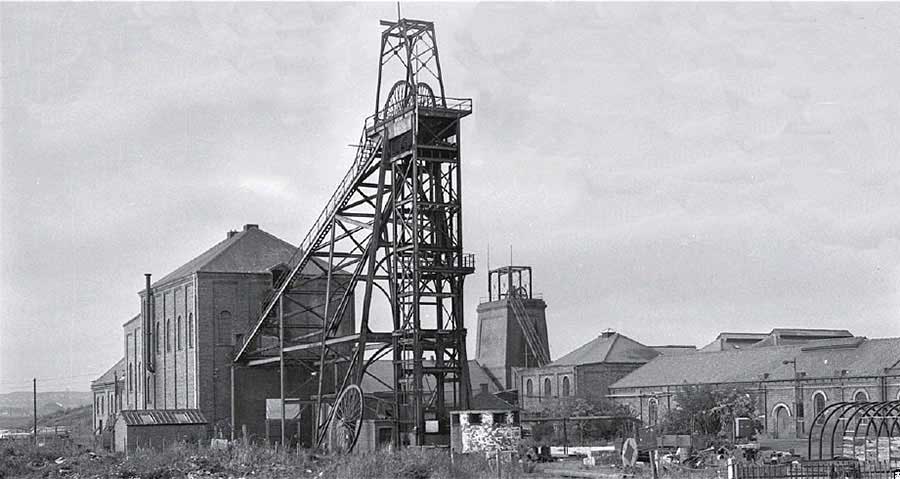
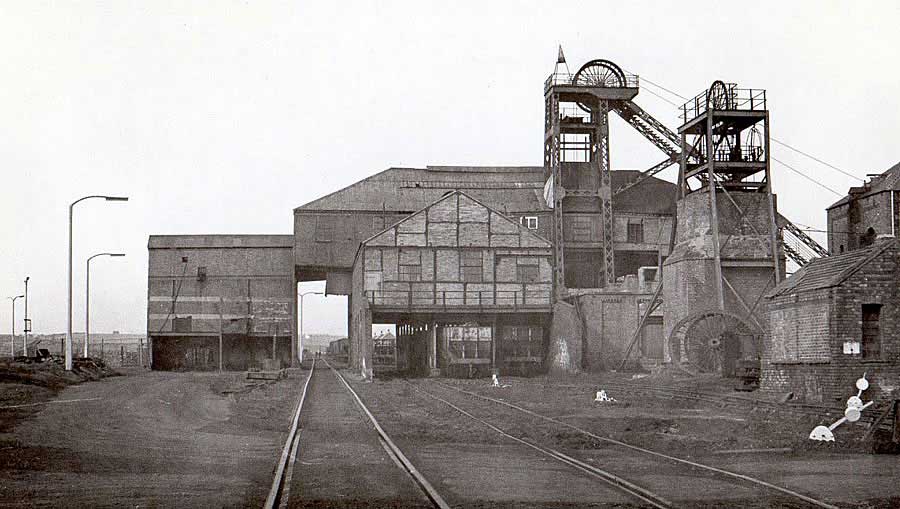
Downcast Shaft for Man-Riding: Frederick Pit
( Open to the Elements: Fresh Air drawn into Mine )
Upcast Shaft: Victoria Pit
( Sealed: Used Air drawn out of the Mine by the Colliery Fan )
Usworth Colliery also had a 3rd Shaft: Wellington Pit.
Waterloo Road: The approach to Usworth Colliery from The Old Coach Road, Usworth Hall or the Community of Waterloo.
Off picture, bottom-right, The Conservative Club.
Formerly a Methodist Chapel, later Usworth Conservative Club. Demolished c.1970.
Usworth Hall Grounds - right horizon. Waterloo - ¼ mile to the right.
Follingsby Colliery
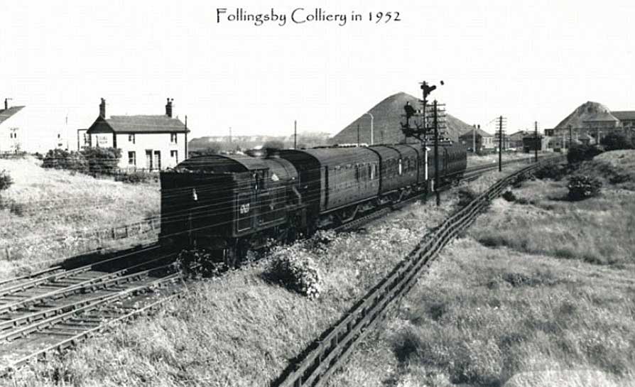
FOLLINGSBY COLLIERY
Note The Leamside Line Railway signal, right of Loco, just outside the perimeter of the Colliery.
This Railway Line, which passed Usworth Colliery in less than 2 miles, was the Main Line from Newcastle to London.
Electricians' Workshop (behind Loco, open door).
A Personal Memory
I was based in the above 'Lectric Shop at the start of my apprenticeship as a Colliery Underground Electrician.
I cycled from my home in Don Gardens, down Single Row / Quarry Row, then along the dirt path between Usworth Pit Heap and The Burn,
to reach the roads around Usworth Hall Grounds. I continued via the derelict Community of Waterloo, over The Leamside Line to pass through East House Farm
and over The River Don to the Railway Crossing on Follingsby Lane. That's where I pushed my bike up an incline on the east-side of the railway to enter the Colliery Grounds.
Jim
FOLLINGSBY LANE RAILWAY CROSSING
SW corner of Follingsby Colliery. Leamside Line crosses Follingsby Lane at telegraph pole.
Usworth Colliery: 1 mile ahead. Pelaw Junction: 1.8 miles back.
( This is where I entered the Colliery Premises. )
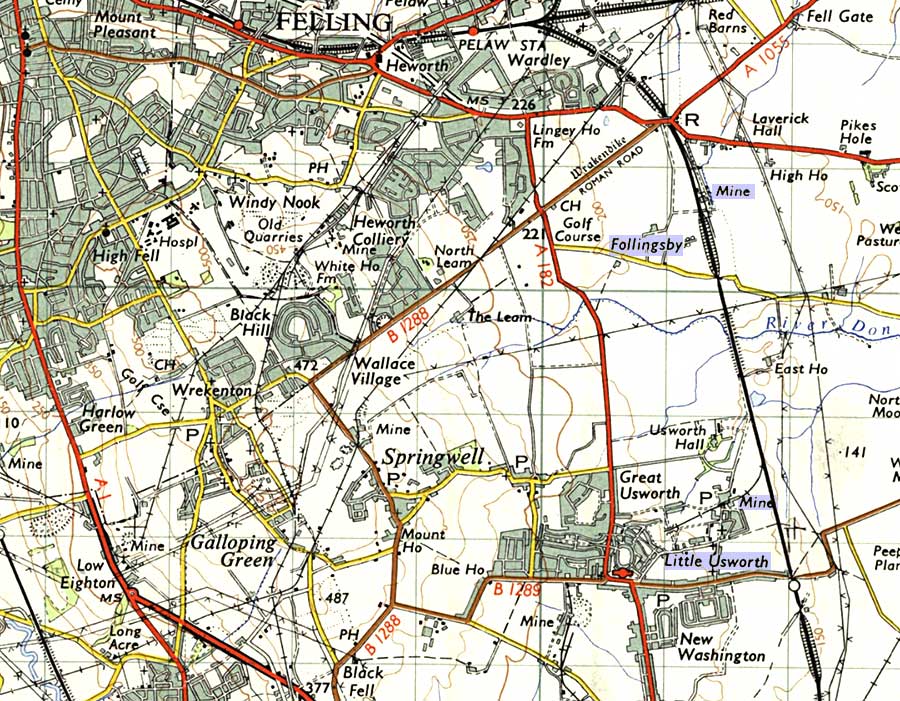
MAP of FOLLINGSBY COLLIERY,
USWORTH COLLIERY & THE LEAMSIDE LINE
( OS 7th Series 1952-61 )
THE LEAMSIDE LINE - FOLLINGSBY COLLIERY
Pelaw Railway Junction: bottom-left. Usworth Colliery & Usworth Station: a couple of miles past the Colliery, top-right.
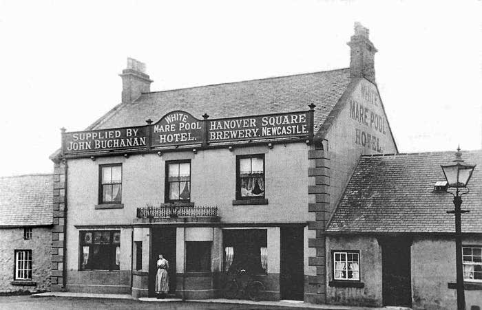
WHITE MARE POOL HOTEL
The White Mare Pool Hotel: later called 'The Dixielanders' - a venue for the Dixielanders' Concert Party.
Who remembers leaving Washington at The Flat Tops, turning right at Heworth Golf Club,
and passing The White Mare Pool on their way to a day out in South Shields?
{ Follingsby Colliery was on your right as you approached White Mare Pool. The Hotel was situated near the Road Bridge over The Leamside Line. )
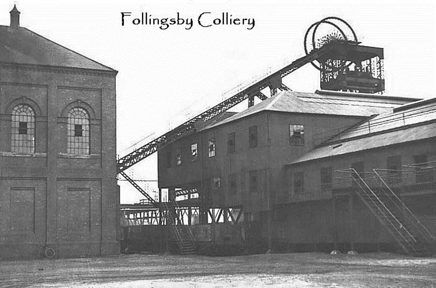
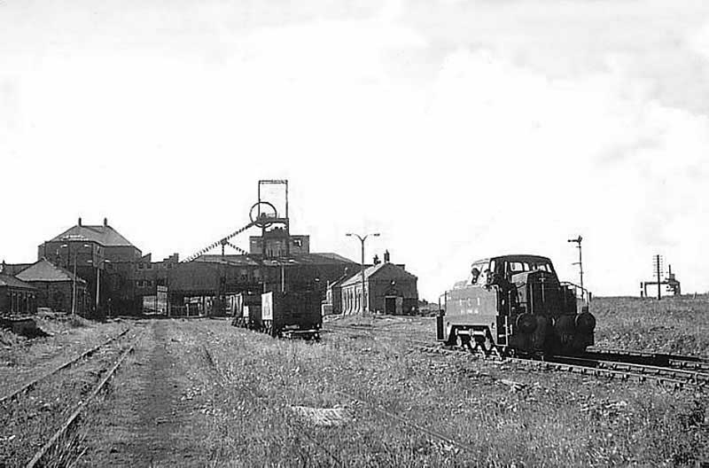
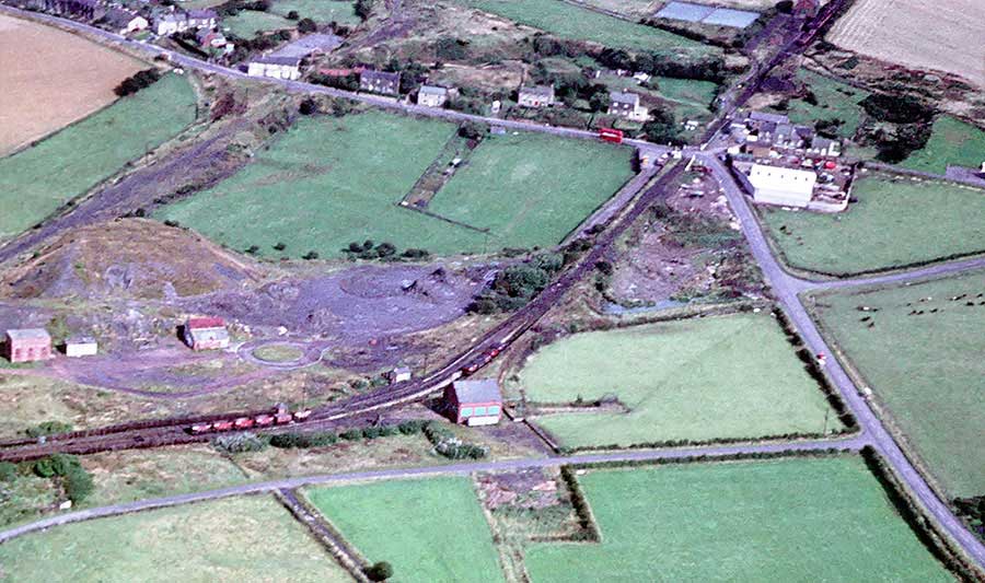
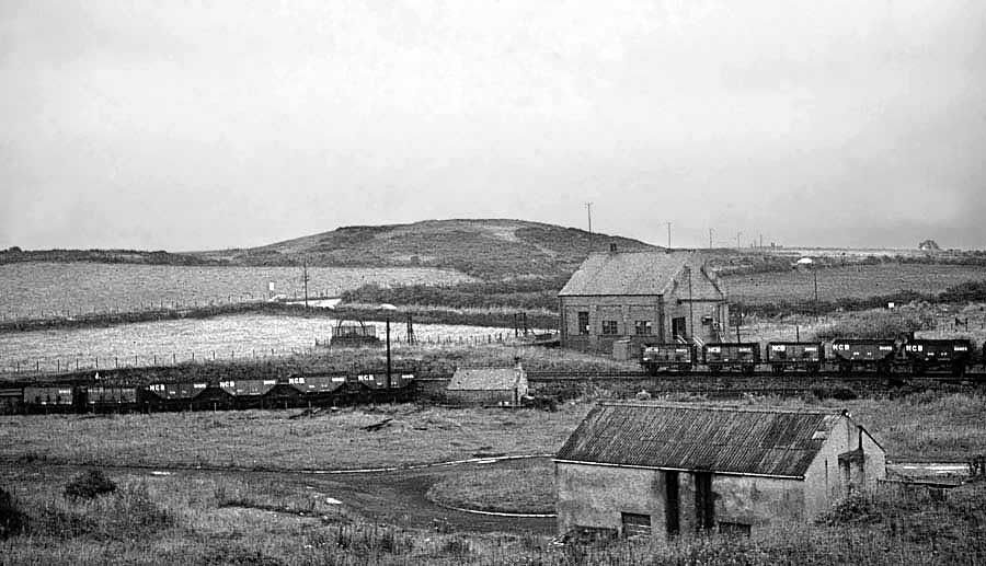
FOLLINGSBY COLLIERY
Late 60s / Early 70s: All coal mined at Usworth Colliery was hauled here, by underground English Electric battery locomotives.
It was then raised to the surface to be washed & graded in the Follingsby Coal Preparation Plant.
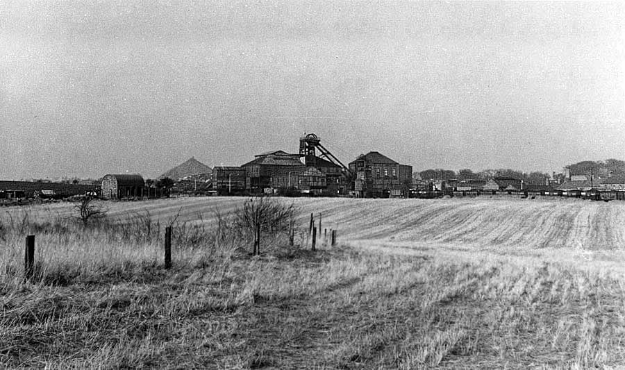
FOLLINGSBY COLLIERY FROM USWORTH STATION
Note one of the Usworth Colliery Pit Heaps - top left above the crossing gates.
Follingsby Colliery is in the distance, close to and right of the tracks.
Harraton Colliery
Aerial View - 1964
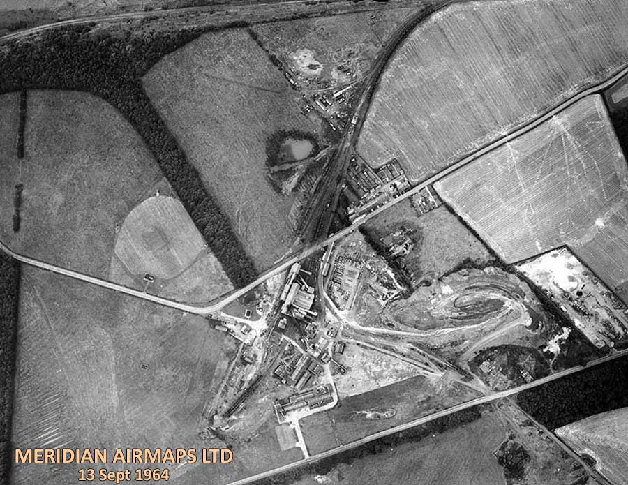
AERIAL VIEW of HARRATON COLLIERY
The Colliery lies between Vigo Lane (top) and Bonemill Lane.
[ Compilation of 6 Photographs. Courtesy of Washinghton History Society. ]
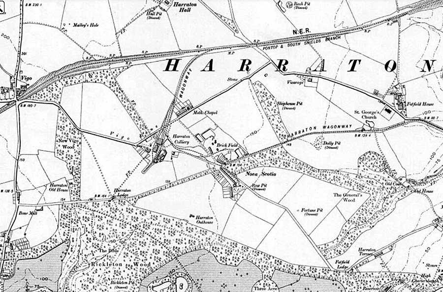
MAP of HARRATON COLLIERY - 1951
1. This Map shows Harraton Colliery's location relative to St. George's Church. See the Map below for more detail.
2. Note the Wagonway linking the Colliery to the Tyne Dock / Consett Railway. This Railway is now a public walkway.
3. Harraton Wagonway, connecting the Colliery to the Staithes at the River Wear, follows modern route of Bonemill Lane.
Old Map
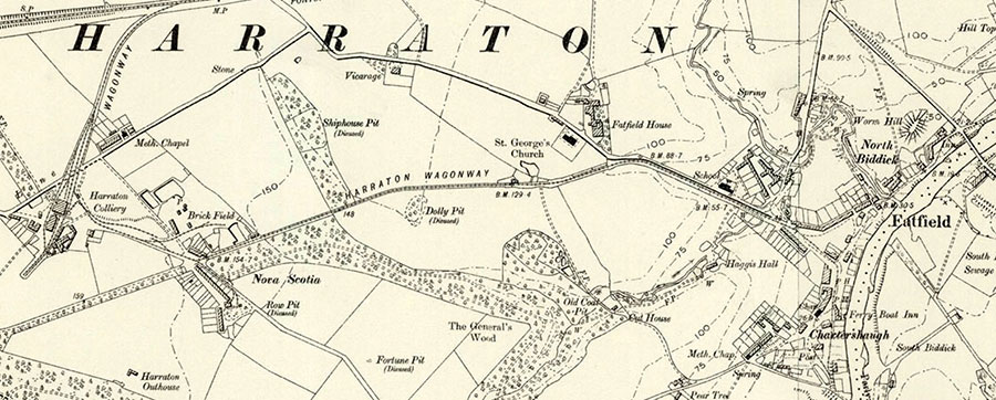
HARRATON COLLIERY - RIVER WEAR - FATFIELD BRIDGE
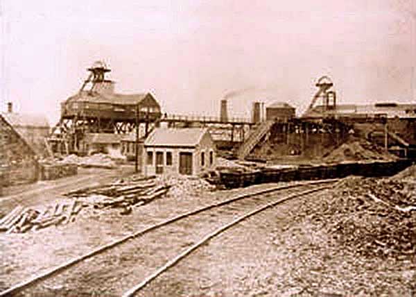
Harraton Colliery
Situated between Bonemill Lane and Vigo Lane.
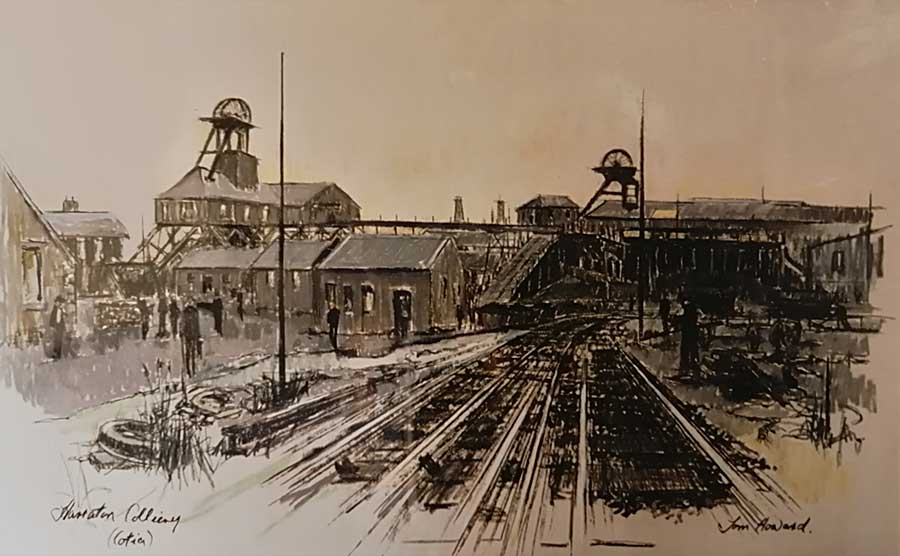
Harraton Colliery - aka 'Cotia.
( Sketch by Tom Howard )
Harraton Colliery: 'Cotia to the locals - from Nova Scotia (New Scotland).
( Harraton employed many Scottish miners. )
Harraton Colliery: The month of its closure - May 1965. It was demolished in August 1966.
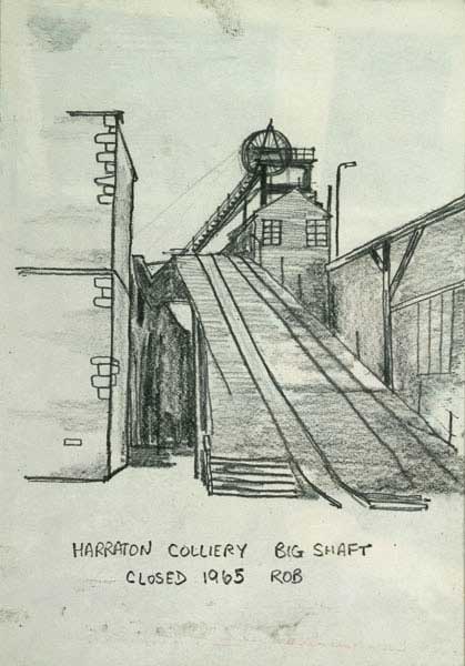
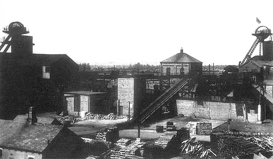
Harraton Colliery - aka 'Cotia.
( Sketch by ROB )
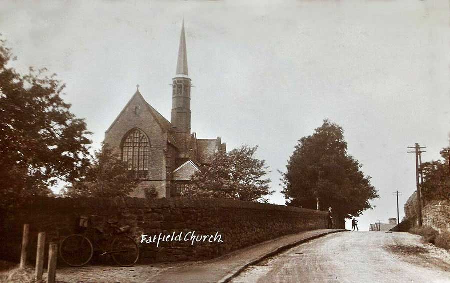
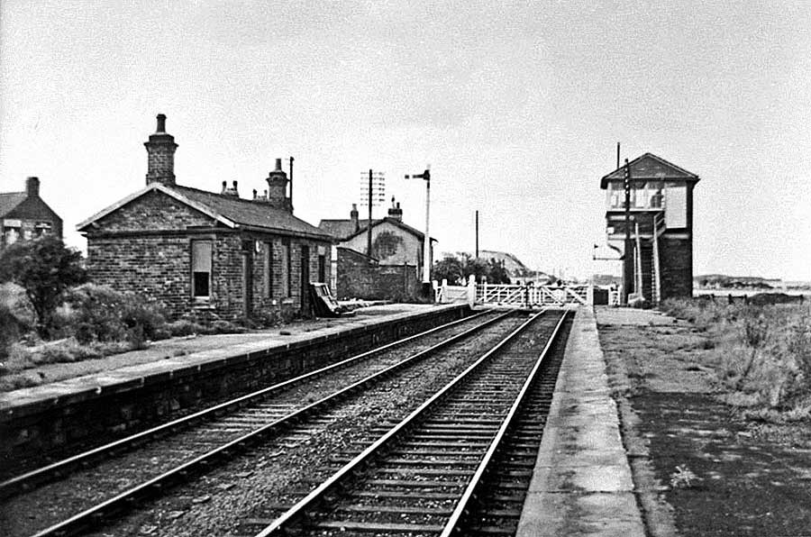
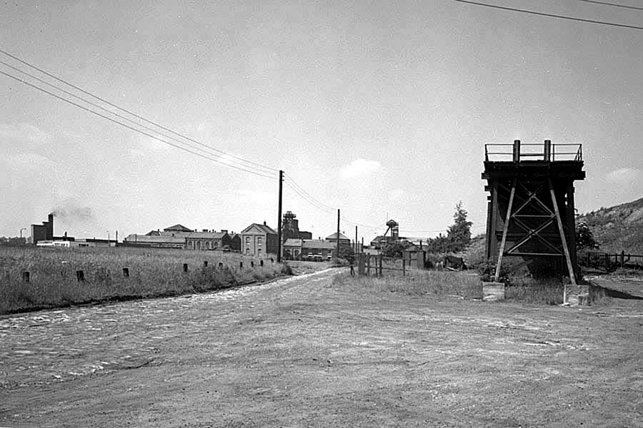
SAINT GEORGE'S CHURCH ON VIGO LANE
( A Miner Cycling to Work? )
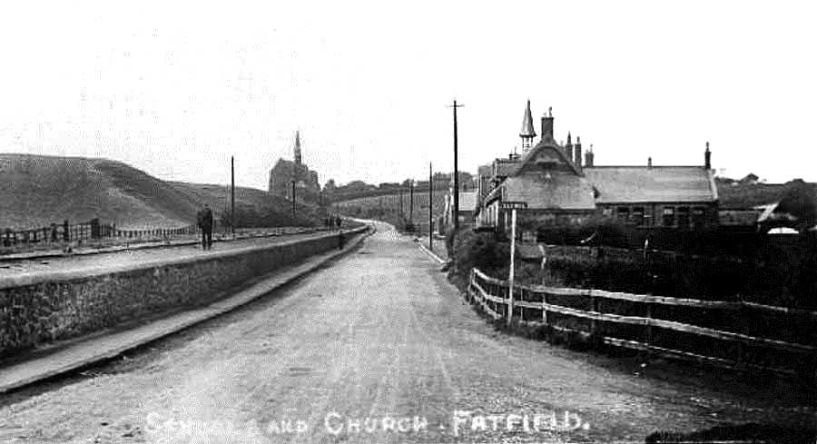
HARRATON WAGONWAY - ST. GEORGE'S CHURCH - BONEMILL LANE - FATFIELD SCHOOL - BIDDICK LANE
( The Road to Harraton Colliery. )
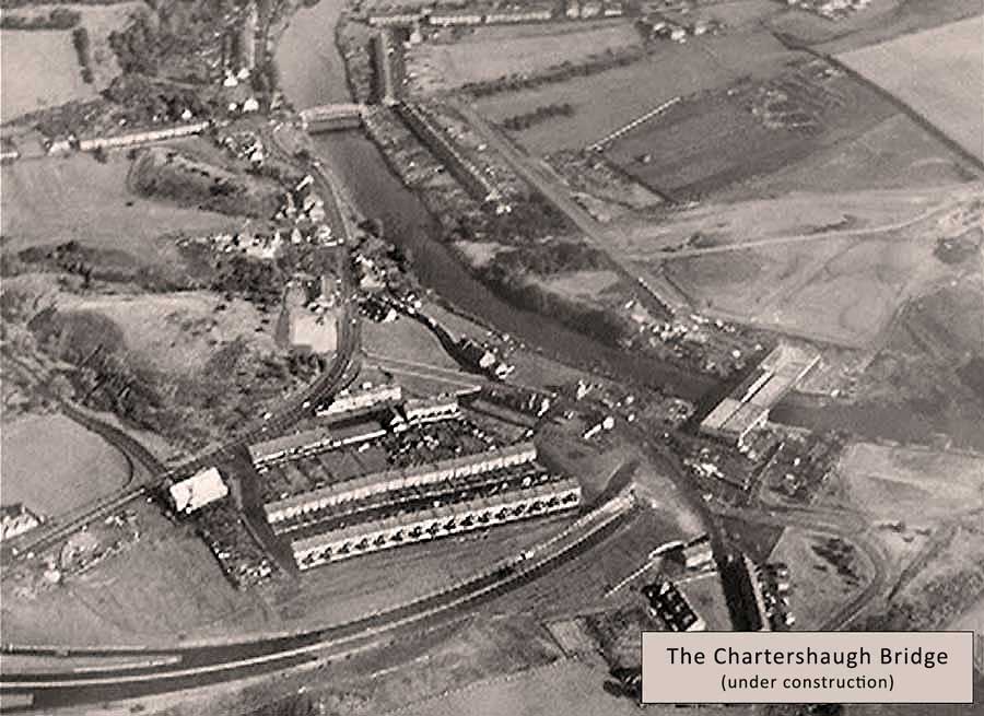
Chartershaugh Colliery
CHARTERSHAUGH COLLIERY
Havelock Arms: foreground, left. - Chartershaugh Bridge now crosses the River Wear this side of the Headgear.
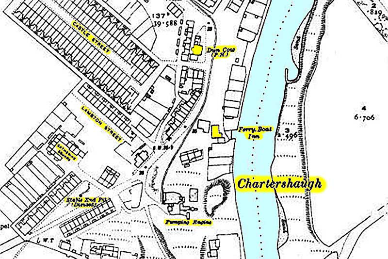
MAP of CHARTERSHAUGH COLLIERY
The Pumping Engine shown in the above Map is all that remains of the Colliery.
Castle Street - The Dun Cow Public House - The Ferry Boat Inn
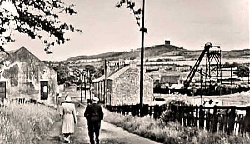
CHARTERSHAUGH COLLIERY and PENSHAW MONUMENT
Walking towards Fatfield Bridge, half a mile away.
[ See bottom-left of above Map. ]
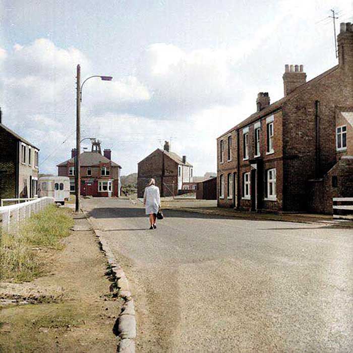
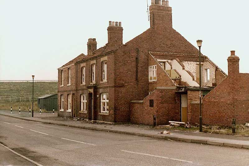
FERRY BOAT INN and DUN COW
The former Dun Cow Public House (right) and the Ferry Boat Inn (left).
Chartershaugh Pumping Station is behind the Ferry Boat Inn. This was the site of The Colliery.
In the later Picture, The Washington Highway can be seen heading down to the Chartershaugh Bridge / River Wear.
LOCATION OF CHARTERSHAUGH COLLIERY
Above the Label, near the River Wear.
North Biddick Colliery
( aka 'Butney' Pit )
NORTH BIDDICK COLLIERY
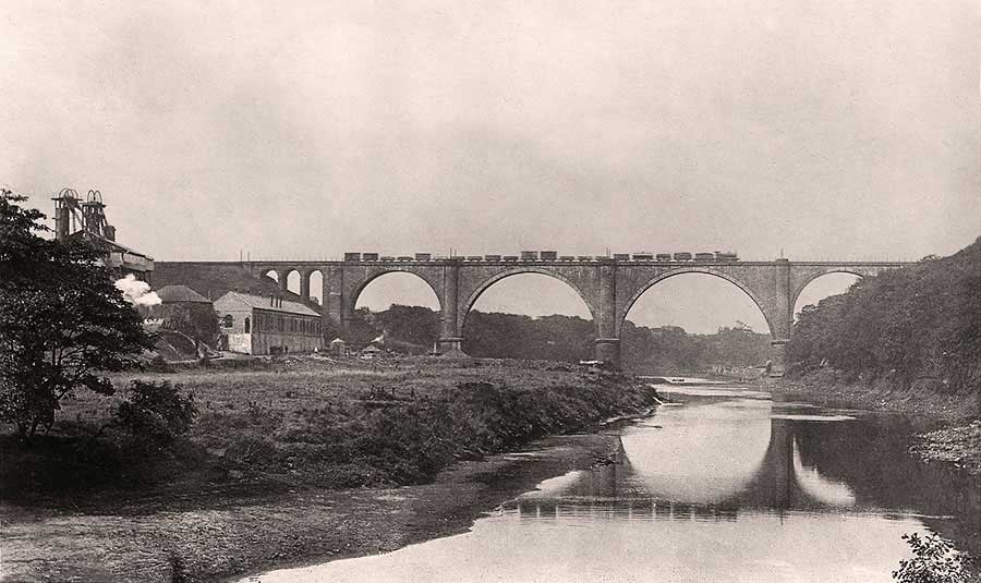
North Biddick Colliery & Victoria Bridge - looking downstream towards Coxgreen.
Victoria Viaduct was once the Main Line from Newcastle to London.
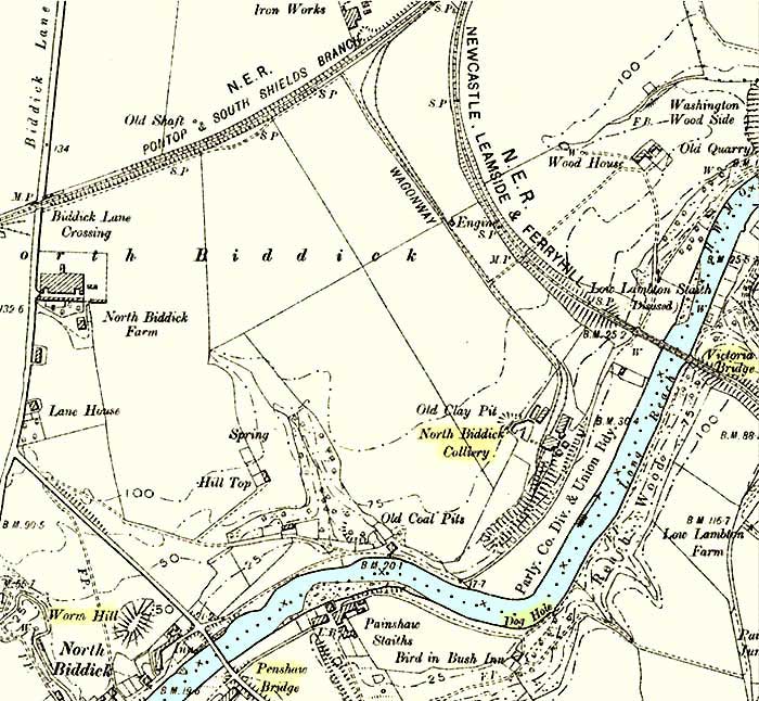
MAP of NORTH BIDDICK COLLIERY
North Biddick Colliery was located close to the north bank of the River Wear,
between Fatfield (Penshaw) Bridge and Victoria Bridge.
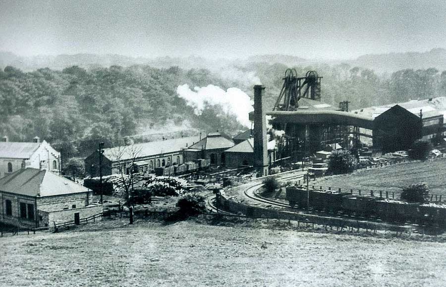
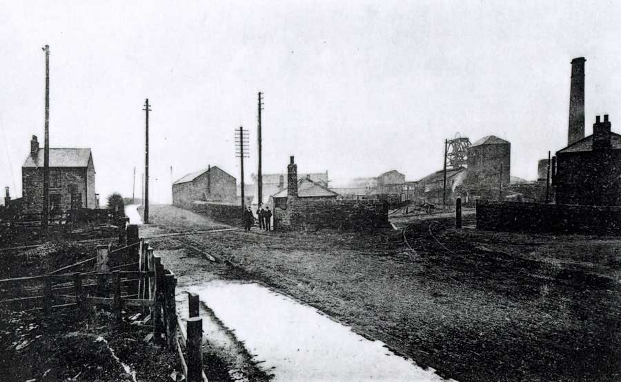
NORTH BIDDICK COLLIERY
View from The Leamside Line towards Dog Hole.
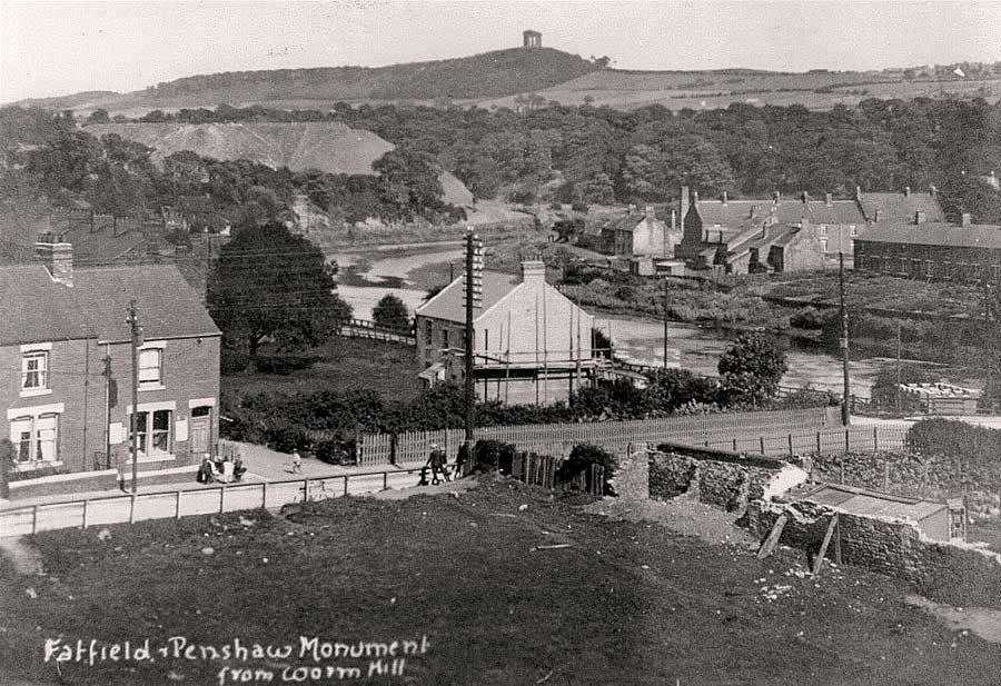
NORTH BIDDICK COLLIERY PIT HEAP and PENSHAW MONUMENT
Looking downstream from the Top of Worm Hill. Fatfield Bridge is just off-picture, right.
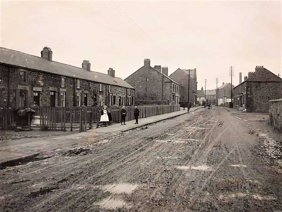
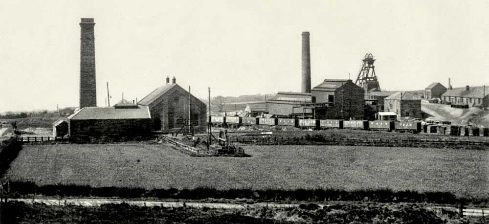
Springwell Colliery
SPRINGWELL COLLIERY
Springwell Colliery and the Bowes Railway Crossing on Springwell Road.
Looking towards Springwell House. See Map below.
BOWES RAILWAY MUSEUM at the former SPRINGWELL COLLIERY
Bowes Railway Crossing - Springwell Road.
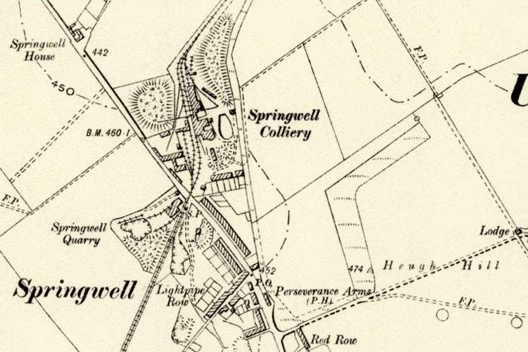
MAP of SPRINGWELL COLLIERY
THE PERSEVERANCE ARMS and SPRINGWELL COOPERATIVE SOCIETY
Note Springwell Colliery Chimney in the background.
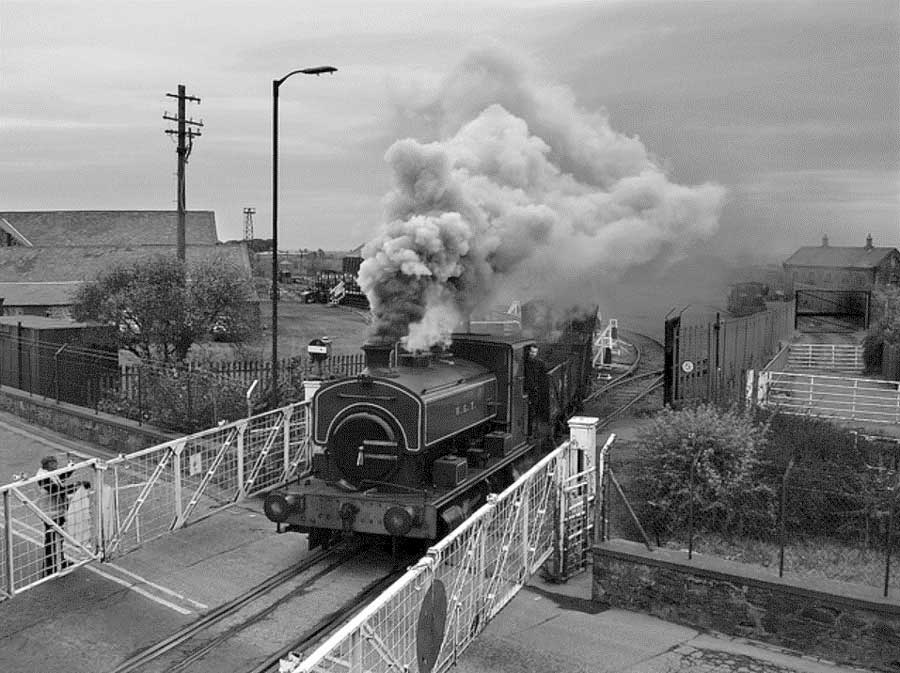
BOWES RAILWAY at SPRINGWELL COLLIERY - 1967
Springwell Colliery closed in 1932.
[ Contributed by Photographer / Industrial Historian / Author, Colin E. Mountford. ]
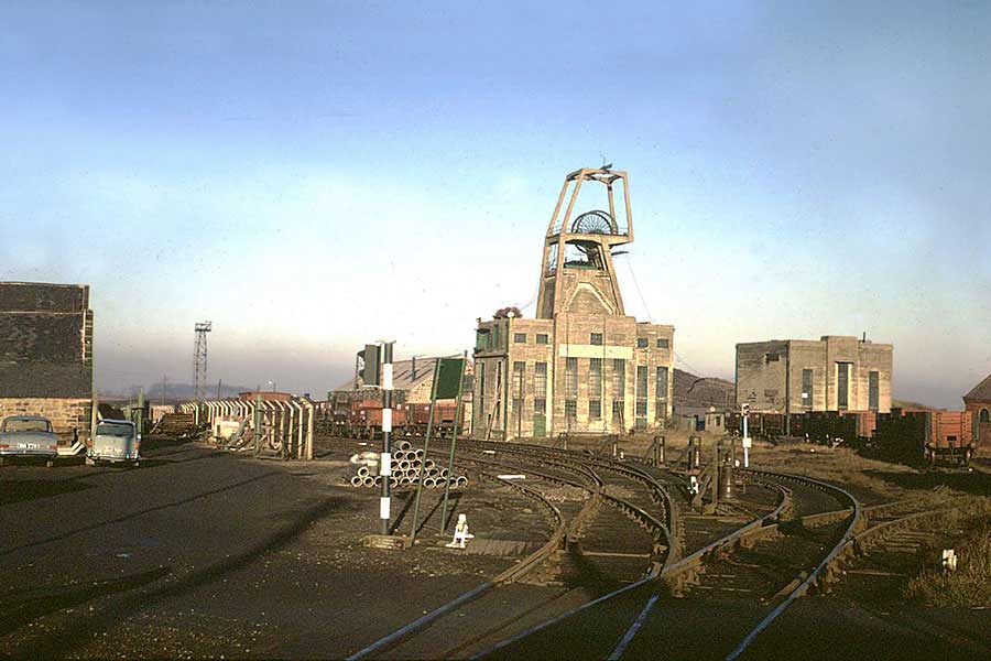
Mount Moor Colliery
MOUNT MOOR COLLIERY
Blackfell Hauler & Mount Moor Colliery, viewed from Sheddon's Hill.
The colliery opened c.1826 and closed in 1931.
[ Photographer: David Kitching. ]
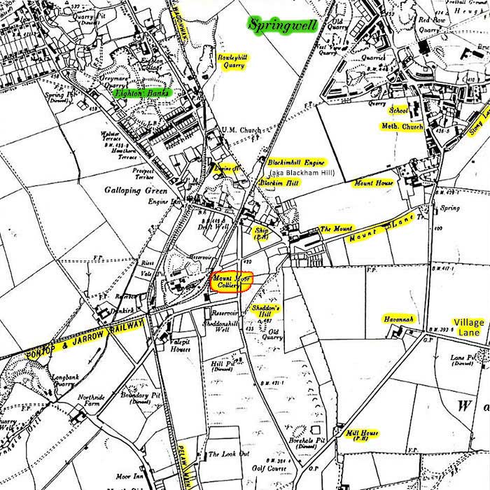
MAP of MOUNT MOOR COLLIERY
SITE of MOUNT MOOR COLLIERY
The Lambton Arms, later The Engine Room - Eighton Banks Railway Crossing - The Ship Inn
Sheddon's Hill, off-picture, bottom-right.
[ Thanks to a Piper Cherokee & Photographer, Dr Stafford Linsley. ]
SHEDDON'S HILL and BLACKFELL HAULER
From Site of Mount Moor Colliery.