Washington County Durham
HOME WHAT'S WHERE MORE BRIDGES
Memories of Washington
Fatfield Bridge
Fatfield Bridge
Early Ordnance Survey Maps describe it as Painshaw / Penshaw Bridge.
Because it connected North Biddick to South Biddick, it was also known as Biddick Bridge.
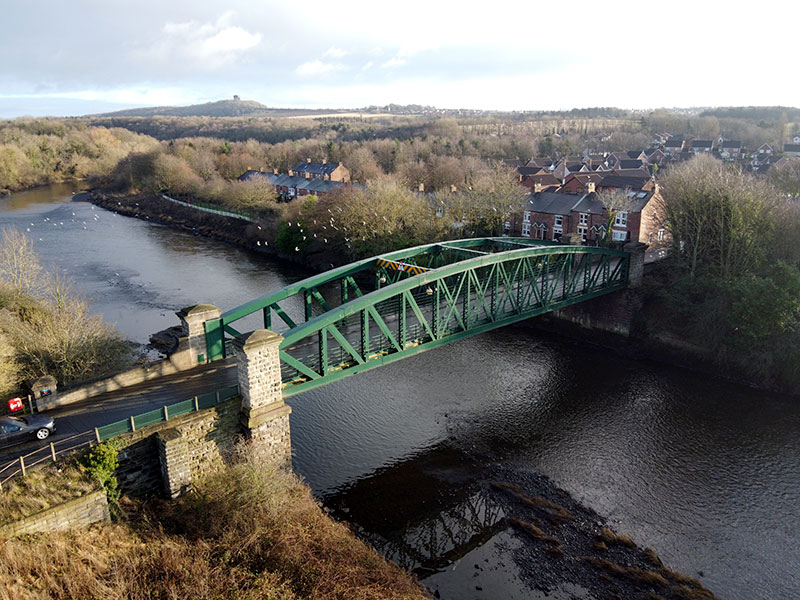
Fatfield Bridge, 25 December 2019.
[ Picture shared under Creative Commons Licence. Thanks to Photographer, Martin Le Roy. ]
FATFIELD BRIDGE
The oldest surviving Road Bridge over the River Wear
between the community of Chartershaugh and the North Sea.
Officially opened by John Lambton, Earl of Durham, January 29, 1890.
Castle Street - Fatfield Bridge - Victoria Viaduct - Penshaw Monument
NEARBY BRIDGES
Chartershaugh A182 Bridge - 1975. 500m upstream
Victoria Railway Bridge - 1838. 1km downstream
Coxgreen Footbridge - 1958. 2km downstream
Fatfield Bridge was by-passed by the A182 Washington Highway in 1975.
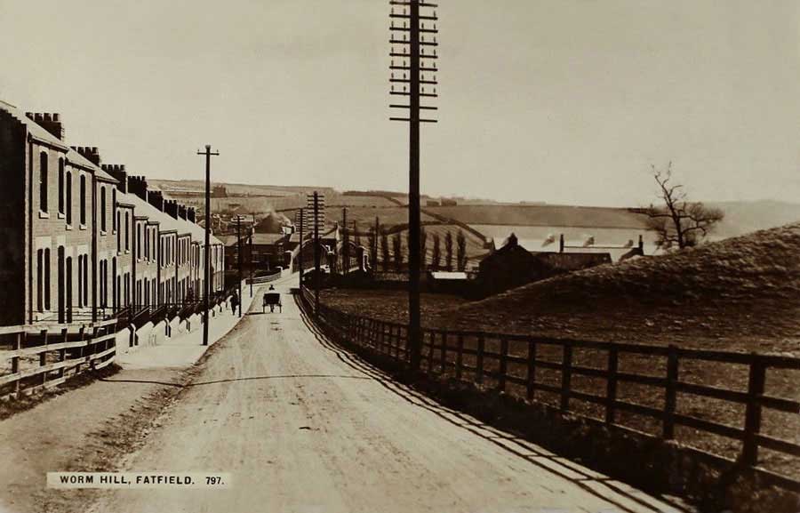
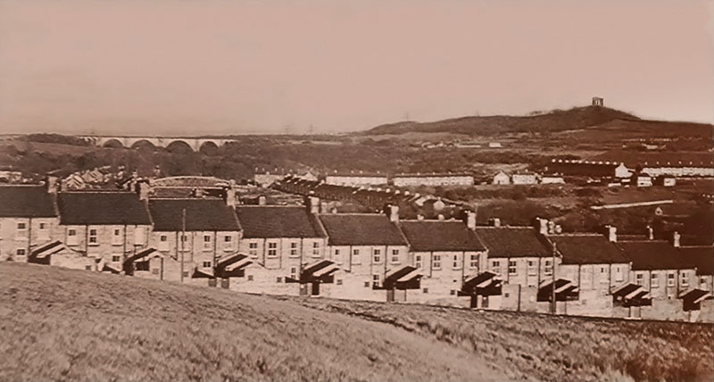
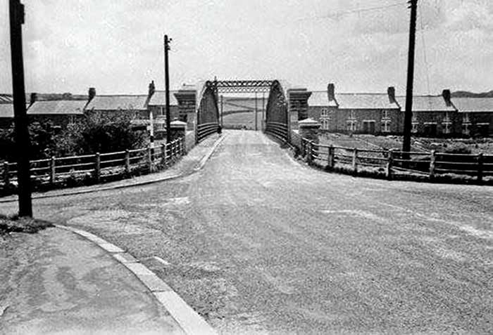
Worm Hill Terrace leading down to Fatfield Bridge. Worm Hill on the right-hand side.
View from Top of Worm Hill, 1925.
[ Foreground - Biddick Inn. North Biddick Colliery Miners' Hall, later The Gem Cinema - above the trees. ]
View from Worm Hill Terrace.
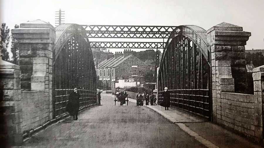
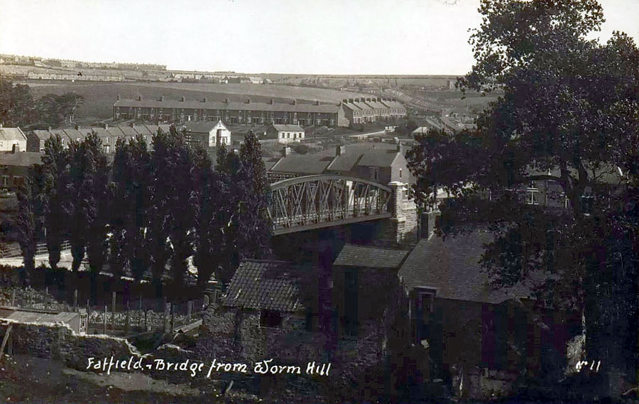
View from Penshaw side of Fatfield Bridge to Worm Hill Terrace, 1915.
SUNDERLAND HERALD ARTICLE
The following article was published soon after the official opening of Fatfield Bridge.
Transcription prepared by Mr Alan Vickers of Sunderland.
The bridge is situated on the river Wear, half a mile above the Victoria Railway Bridge, and half a mile below Biddick Ford, the limit of the River Wear Commissioners’ jurisdiction and the tidal flow. It connects on the south bank of the river Penshaw and Shiney Row villages and Newbottle, Houghton-le-Spring and Hetton lying beyond, with, on the north side, Fatfield village, the legendary “Worm Hill”, Washington and Usworth and on to Gateshead and Newcastle. At the Durham Quarter Sessions in 1887, three memorials were submitted, being from the Houghton-le-Spring and Sunderland District Highway Board and the Durham and Chester-le-Street District Highway Board and from 1,417 inhabitants of the adjacent localities asking the court to contribute towards the bridge, when a grant of £2,500 was agreed on from the county. As local authorities on the north side, the Durham Highway Board subsequently agreed to contribute £1,250 and the Gateshead and South Shields District Highway Board £450. A further sum of £1,020 was eventually raised by public subscriptions over the districts interested, Mr F. Stobart J.P., Biddick Hall, being treasurer and Mr P. Oswald, Harraton Hall, the secretary of that fund. The total cost of the bridge and approach roads is about £8,000 so that the remaining balance of £2,750 is defrayed by the Houghton-le-Spring Highway board, chiefly by means of a loan for 20 years under the powers of the Highway Act and involving rate of under ¼ d per £.
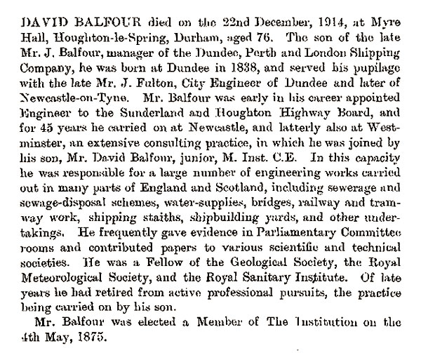
Financial and practical negotiations having been arranged, tenders were obtained in October, 1889 for the bridge and approach roads and work commenced in the following month. Messrs Head, Wrightson and Company, Stockton-on-Tees, secured the contract for the bridge structure, consisting of ironwork, masonry and pile foundations and Mr John Carrick, of Durham, the approach roads, Mr R. Hudson Junr., Sunderland, being the subcontractor for the masonry, piling and bridge roadway. The engineer for the works was Mr D. Balfour M.Inst, C.E., F.G.S. and the clerk of the works W.T. Fowls.
Foundation borings at each bank of the river to a depth of 30ft, taken by Mr F Coulson, Durham, indicated strata of sand, loam and gravel without intervening rock or clay until a strong shale was reached at 25ft, affording ample bearing for piles. Accordingly, the foundations consist of concrete overlying a pitch pine double platform supported on 12in piles driven to the depth of 25ft under the riverbed into hard shale. The abutments are of large rock-faced ashlar with main pillars 12ft high adjoining the approach parapet walls, the stone being wholly supplied by the Whitburn Coal Company from their Marsden Quarries, near South Shields. The iron structure consists of two curved main girders of wrought iron, each 155ft long, resting on large bedstones, due provision being made by steel rollers for expansion and contraction. Each girder has the upper and lower booms well braced by vertical struts and diagonal ties, having three overhead lattice bracings for wind pressure and which afford a clear height of 14ft for traffic. The flooring consists of cross girders 12ft apart, overlaid with longitudinal corrugated iron troughing covered with a bed of concrete and a finished surface of whinstone tar macadam – steam rolled. The nett span of the bridge is 145ft and a clear width of the carriageway and approach footway is 32ft and the net height of the bridge above water mark is 20ft, as required by the River Wear Commissioners. There are about 200 tons of ironwork in the bridge, which is constructed to bear a live load of 120lbs per square ft. and a safe rolling load of 20 tons and 7½ ft base, the ultimate computed strain being 80 tons. The iron was tested by Messrs D. Kirkaldy and Sons’ Test Works, London and found to bear at least 22 tons per square inch, tensile strain. On completion, the bridge structure was duly tested with a rolling centre load of 30 tons, the deflection found to be only 1/10 of an inch on a span of 145ft. The approach roads, altogether nearly a mile in length, are of 25ft width, substantially constructed and steam rolled, being enclosed with creosoted wood fencing. The whole works were designed with efficiency and economy.
Many Thanks to Mr Vickers and 'North East England Bridges' Website:
www.bridgesonthetyne.co.uk
Well Worth A Visit!
DAVID BALFOUR
Bridge Designer and Engineer in Charge
1838 - 1914
Virtual Library
The Institution of Civil Engineers
BBC NEWS WEBSITE
21 April 2013
Sunderland's Penshaw to Fatfield bridge reopens
Sunderland's oldest river crossing has reopened after repairs costing £600,000.
During the final part of a six-month renovation project, the Penshaw to Fatfield bridge's stone pilasters were repaired.
The bridge across the River Wear links (Penshaw) Station Road on the south to Worm Hill Terrace on the north side.
The oldest crossing overseen by Sunderland City Council, the bridge dates back to the 1890s.
Work, which began in September, involved stripping the road surface down to the bridge deck and installing new waterproofing, resurfacing, steelwork repairs and a full repaint. New traffic signals have also been installed.
Councillor James Blackburn, Sunderland City Council's portfolio holder for city services, said: "It's great to see our oldest river (Road) crossing restored to its former glory."
"This is the most comprehensive refurbishment the bridge has seen since its construction in the 1890s. The work should help ensure that it stays in reliable condition for many years to come."
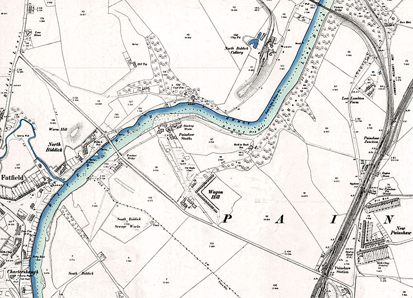
Chartershaugh - Penshaw Bridge - Victoria Bridge
[ O.S. 25 Inch Map, 1892 - 1914 ]
View Downstream
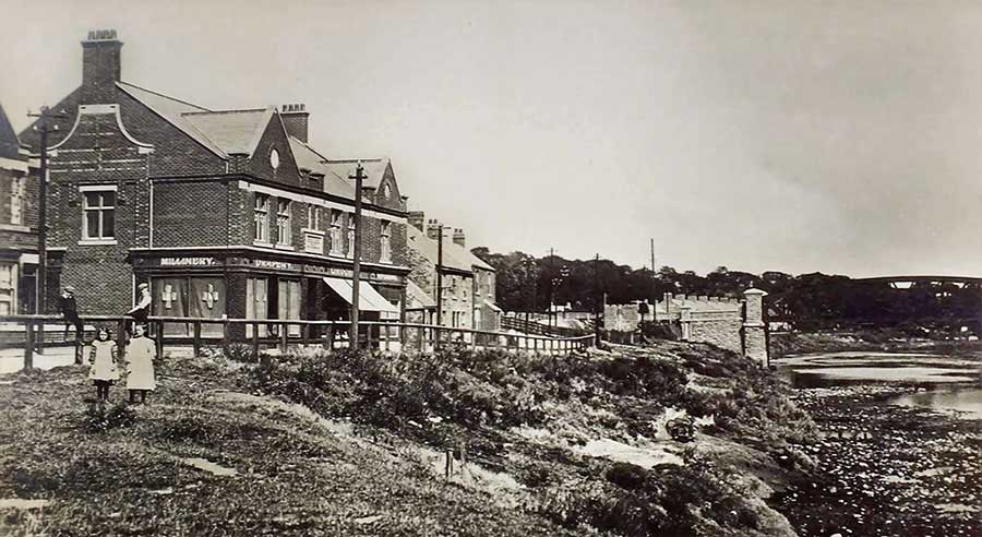
The Coop on Bonemill Lane.
Fatfield Bridge.
View Downstream from close to the Co-op. Note Penshaw Monument.
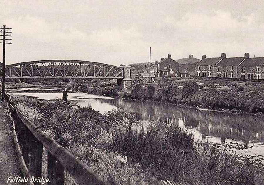
Postcard: Fatfield Bridge, c.1955.
View Downstream
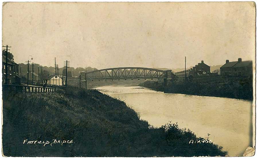
Fatfield Bridge
The Year following the Opening Ceremony which took place on Wednesday, 29th January 1890.

Biddick / Fatfield / Painshaw / Penshaw / Pensher Bridge
[ What's in a Name? How about Girdle Cake Bridge? Maybe not! ]
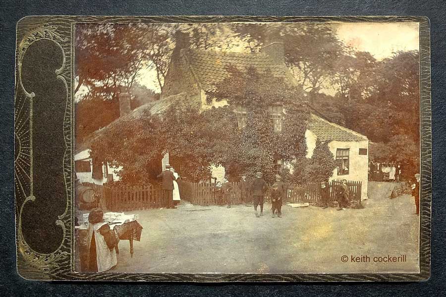
Girdle Cake Cottage and Tea Rooms (Pre-1900)
This is not a postcard, it's an original photographic print. The Photo is attached to an embossed backing card.
Some printer's finger marks are just visible on the road in the bottom-right corner.
( Image & information contributed by owner, Keith Cockerill. )
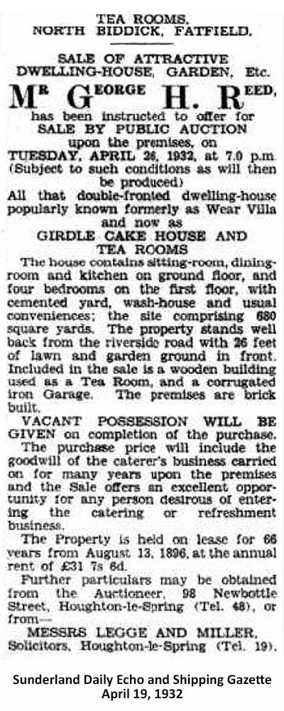
Girdle Cake Cottage For Sale
• • ◊ • •
The view from close to Girdle Cake Cottage, formerly known as Wear Villa.
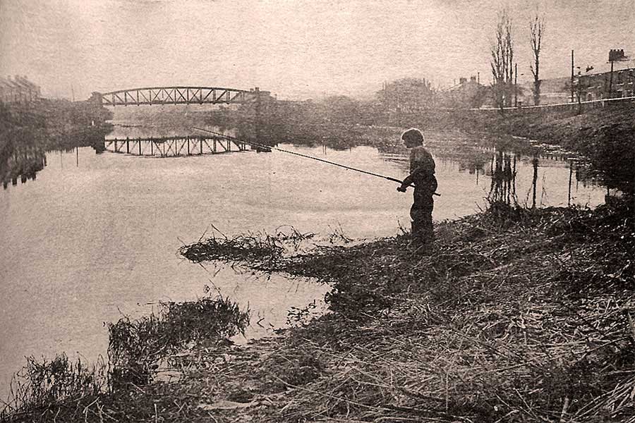
Colin Malcolm, aged 11, of Mount Pleasant, fishing in the River Wear.
[ Press Cutting, Sunderland Echo: Wednesday, 24th March 1971 ]
• • ◊ • •
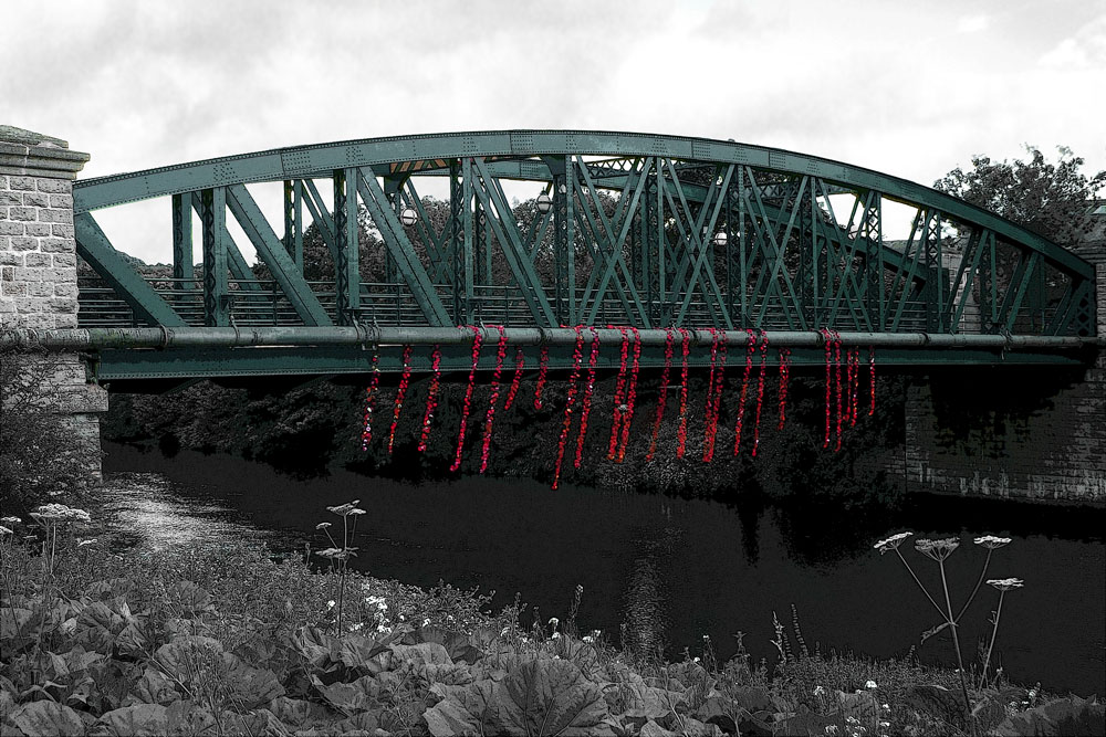
Fatfield Bridge, 1st July 2016
Members of the Wessington War Memorials Project knitted over 2,000 woollen poppies and used them
to adorn Fatfield Bridge in commemoration of the First Day of The Battle of The Somme.