Washington County Durham
HOME WHAT'S WHERE MORE BRIDGES
Memories of Washington
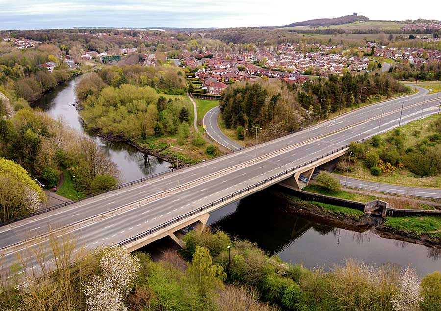
Chartershaugh Road Bridge
Chartershaugh Road Bridge
( A182 Washington Highway )
CHARTERSHAUGH BRIDGE - FATFIELD BRIDGE - VICTORIA BRIDGE - PENSHAW MONUMENT
[ Picture shared under Creative Commons Licence - 12 April 2020. Thanks to Photographer, Martin Le Roy. ]
VIEW DOWNSTREAM: CHARTERSHAUGH BRIDGE to VICTORIA BRIDGE
Spot the graffiti left by a (Sackless) Sunderland supporter! Not the obsolete Old-English word ... the current Geordie one.
[ Photo: Thanks to Adrian Lupton. ]
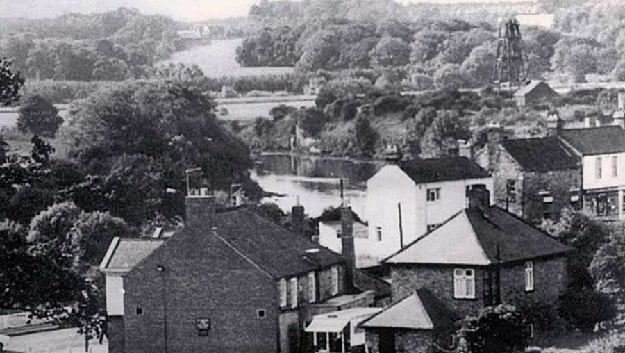
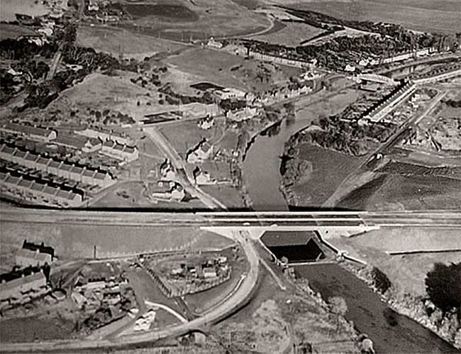
Havelock Arms on Bonemill Lane (foreground, left of centre) - Chartershaugh Colliery Headgear (top-right of picture).
Chartershaugh Bridge crosses the River Wear this side of the now demolished Headgear.
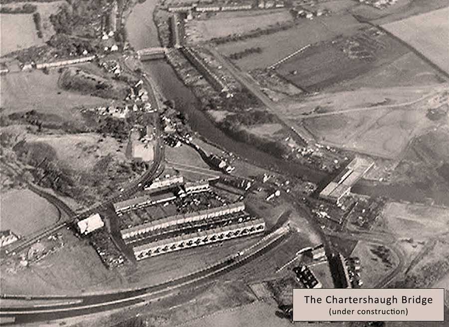
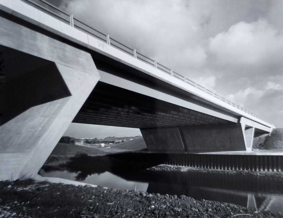
The Partially Completed Chartershaugh Bridge, near Castle Street
Construction Completed
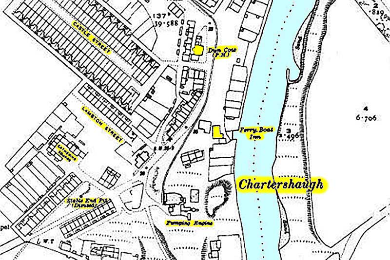
The Dun Cow Pub and The Ferry Boat Inn at Chartershaugh (c.1920). Note Castle Street.

The Ferry Boat Inn (left) - The Dun Cow Public House (right)
Note Chartershaugh Colliery Headgear.
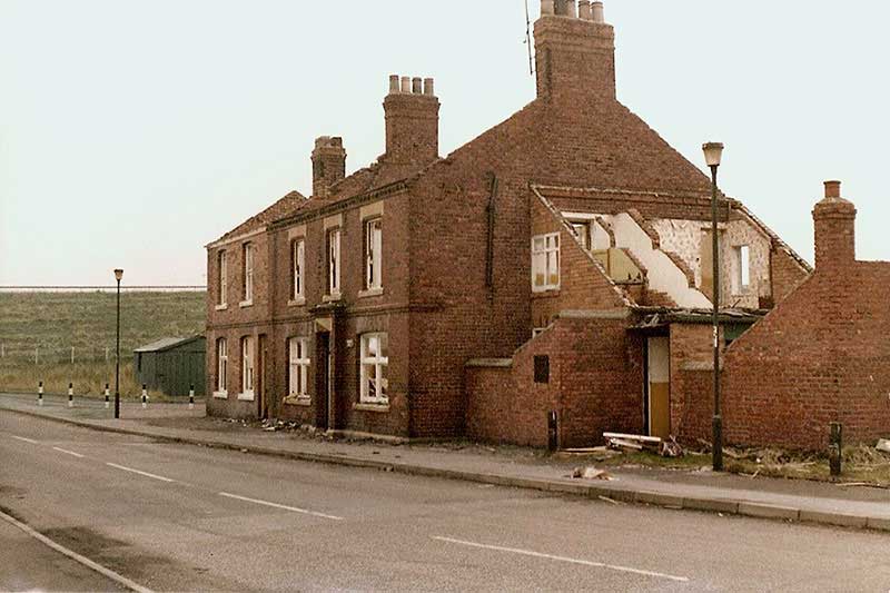
The former Dun Cow Public House at Chartershaugh.
Note the Washington Highway heading down to Chartershaugh Bridge / River Wear.
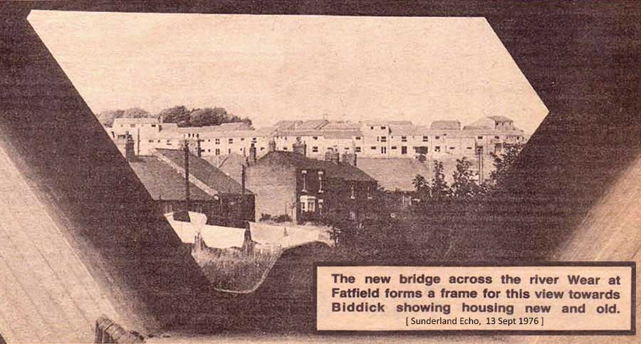
Sunderland Echo - 13 September 1976
Chartershaugh Bridge was opened in 1975
( A182 Washington Highway )
Chartershaugh, Chatershaugh, Chater Haugh, Chaytor's Haugh etc. etc. What's in a Name?
[ Chaytor was probably a Landowner. Haugh is an area of flat fertile soil produced by flowing flood water from a River. Hence Chaytor's Haugh. ]
Additional Information To Consider:
The Chaytor family were 'minor aristocracy' from Croft on the Tees, with lands in north Yorkshire, Westmoreland and Durham, including an estate at Butterby, near Sunderland Bridge. Their family home, Clervaux Castle, was demolished in 1951. Might these have been the owners of the original pit at Chartershaugh? The Durham Mining Museum says it dates back to 1680 though by 1753 it was owned by William Peareth.
[ Courtesy of Washington History Society ]