Washington County Durham
HOME WHAT'S WHERE CONSTRUCTION OF BRIDGE ANOTHER STROLL
Memories of New Washington
Peareth Hall Road
A Stroll Down
Peareth Hall Road
Springwell, Guide Post Inn to Great (High) Usworth, Red Lion Inn
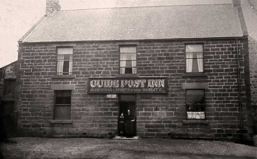
Peareth Hall Road begins opposite the Guide Post Inn on Springwell Road.
The Two Ladies are looking down Peareth Hall Road.
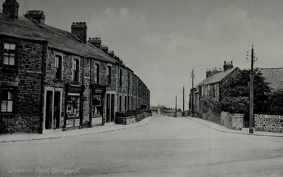
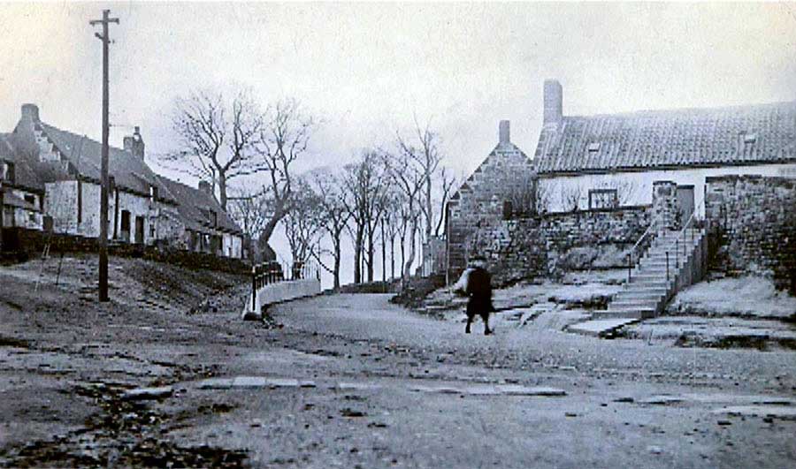
Makepeace Terrace - looking down Peareth Hall Road from The Guide Post Inn
[ What's Where; Misc; Postcards; Keith Cockerill. ]
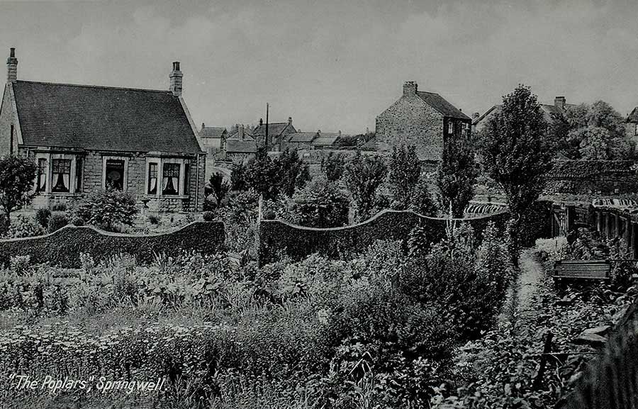
The Poplars at the Junction of Stoney Lane and Peareth Hall Road.
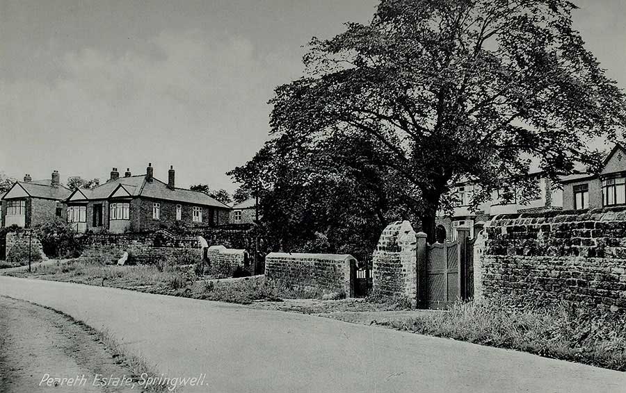
Looking back up Peareth Hall Road from Stoney Lane.
[ What's Where; Misc; Postcards; Keith Cockerill. ]
Peareth Hall Road - between Stoney Lane Junction (left) and Great Usworth (right).
[ What's Where; Misc; Postcards; Keith Cockerill. ]
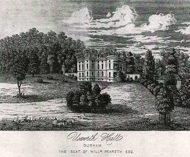
This is NOT Usworth Hall! This is Usworth House, aka Peareth Hall.
[ See What's Where; Maps; Halls & Castles. ]
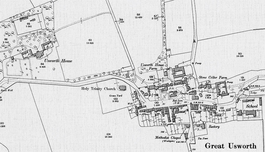
Map showing the location of Usworth House / Peareth Hall and the Village of Great Usworth
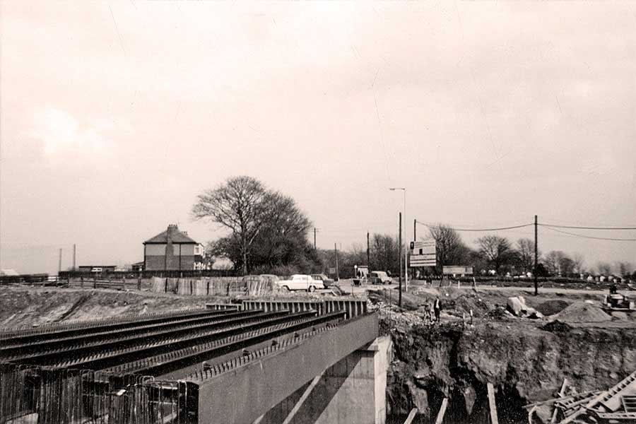
Construction of the Future A194m Motorway Bridge between Peareth Hall and Holy Trinity Church
The former site of Usworth House, aka Peareth Hall, off-picture, bottom left. The Church & Cemetery, centre right.
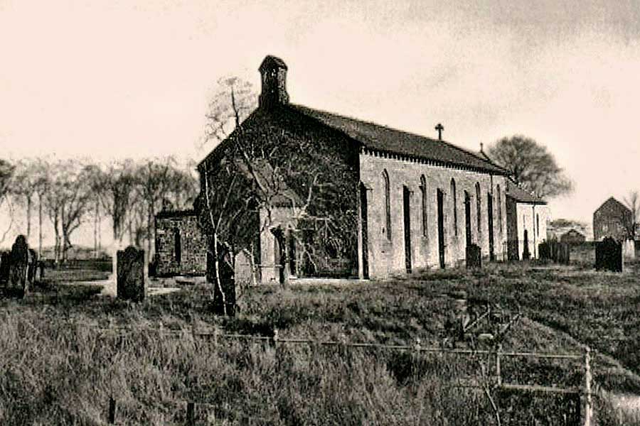
Holy Trinity Church, Great Usworth. Peareth Hall Road is just visible on the left.
The Tithe Barn can be seen centre-right.
Great Usworth: Candy Bank on Peareth Hall Road.
Up the bank the road curves left before passing Holy Trinity Church.
[ Who remembers the Gents Urinal halfway up the Bank, on the right? Sadly, the Ladies had to wait! ]
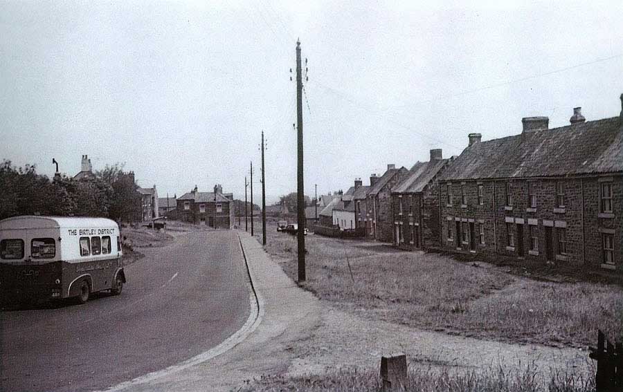
Having driven down Candy Bank, passing the Tithe Barn, a Birtley Cooperative Society Van heads towards
the Red Lion (behind bushes) and the Blue Bell - which is adjacent to the former site of the New Found Out Inn (closed 1932).
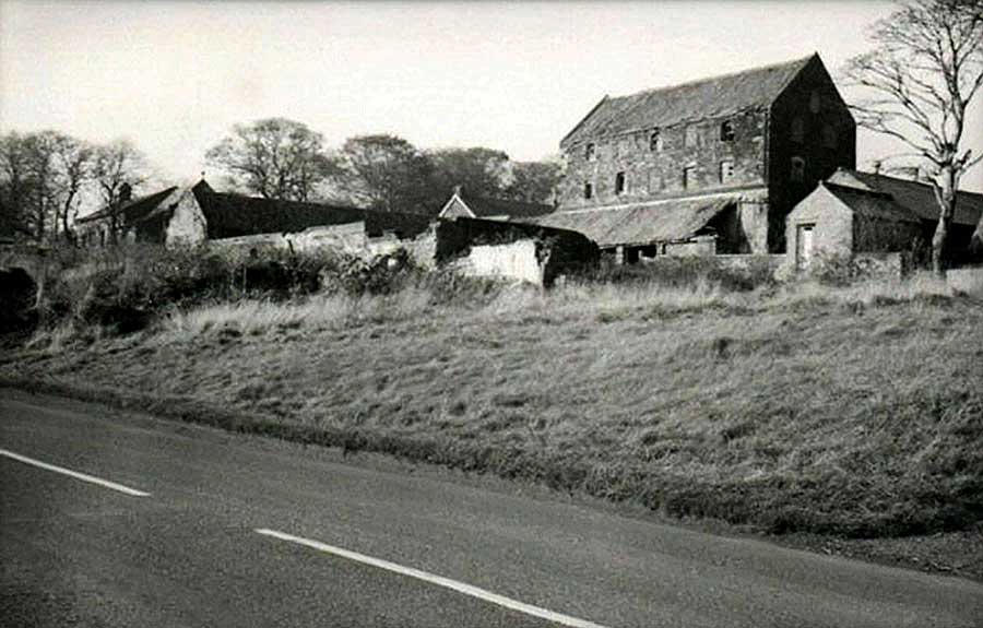
The Tithe Barn set back from Peareth Hall Road. Holy Trinity Church is on the left.
Tithes were taxes (one tenth of the annual produce) which were levied to support the local Church & Clergy.
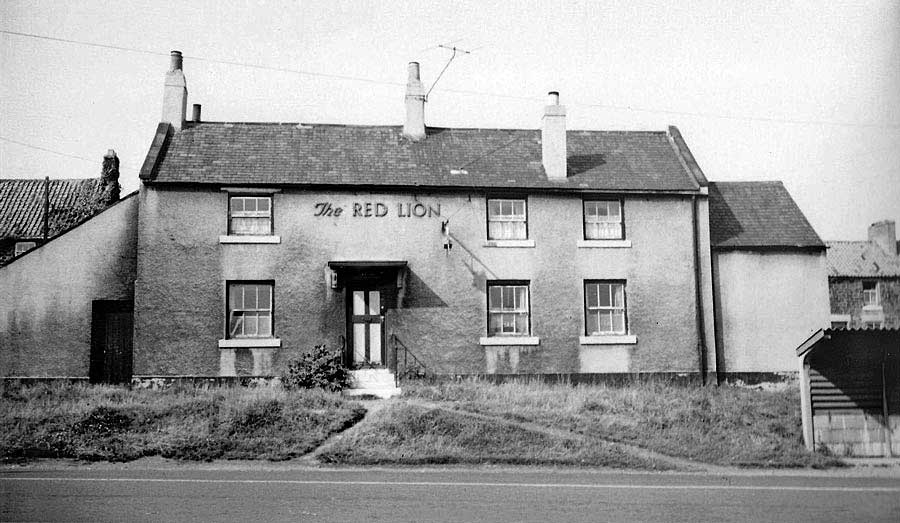
The Red Lion public house on Peareth Hall Road.
The Red Lion. Note Holy Trinity Church, just left of pub chimneys.
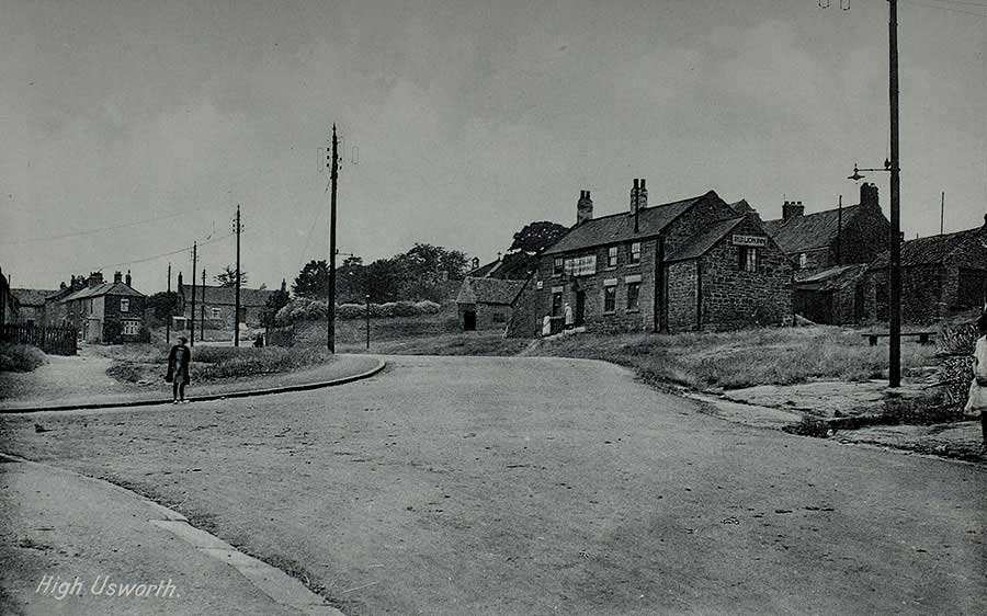
Candy Bank: straight ahead. Well Bank Road: left. Old Coach Road (leading to Heworth Road): foreground.
[ What's Where; Misc; Postcards; Keith Cockerill. ]
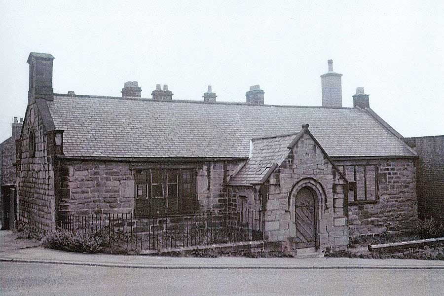
Susan Peareth's School at the Top of Well Bank. See Map below.
Founded & financed, for local poor children, by the Lady from Usworth House, Mrs Susan Peareth (1814).
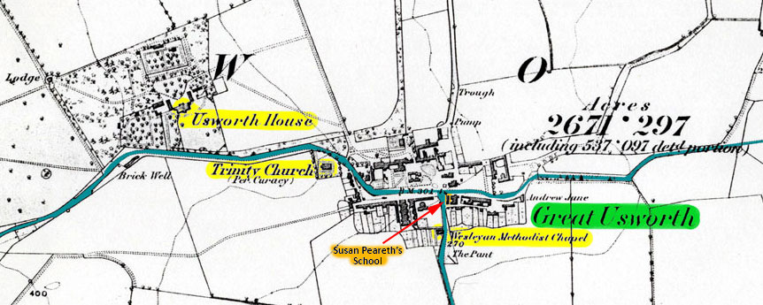
Map showing the location of Peareth Hall (Usworth House) and Susan Peareth's School
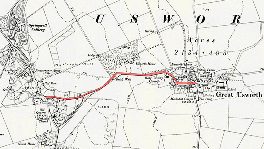
Map Highlighting Peareth Hall Road
Well Bank Road (heading South) and Old Coach Road (heading East) connect with
Peareth Hall Road at Susan Peareth's School.
[ Note Article: Construction of A194M Motorway Bridge under Peareth Hall Road - See Top Menu. ]