Washington County Durham
HOME WHAT'S WHERE MINING COLLECTION 3
Memories of Mining
Views of The 'F' Pit Heaps
- Village Lane
- Mill House
- High Usworth
- Blue House Lane
- Heworth Rd
- WGS
- Glebe Pit
- Usworth
- Penshaw
- Aerial
- Map
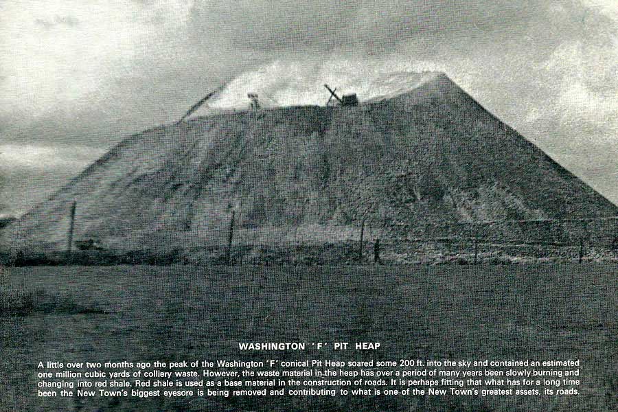
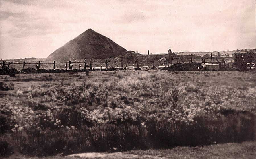
Washington 'F' Pit Heaps
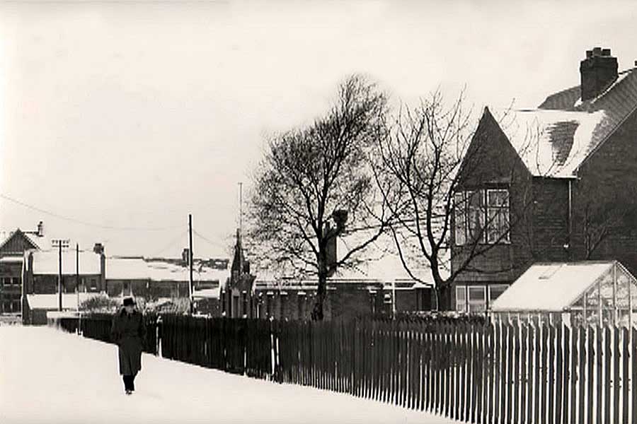
From Village Lane
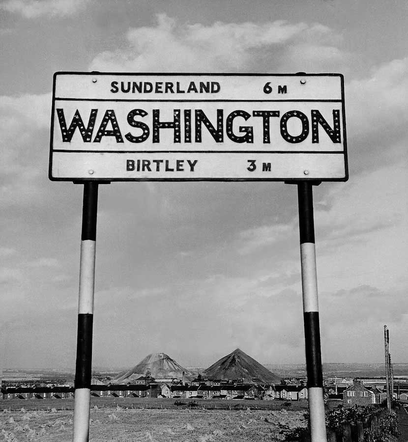
TOP OF VILLAGE LANE
( Late 1950s )
Havannah Terrace - Havannah Bank (Terrace Gable End, bottom-right) - Blackfell Army Camp (off-picture, right).
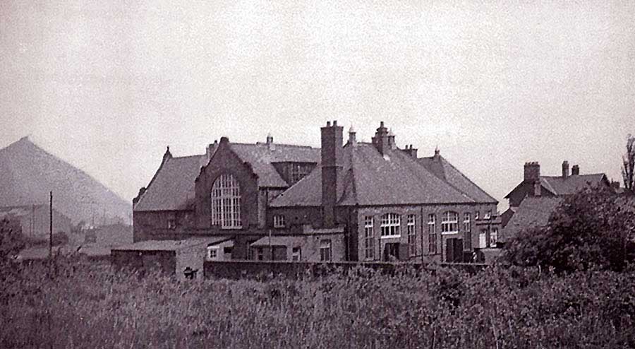
BRANDY ROW SCHOOL
Colliery Manager's House on the right.
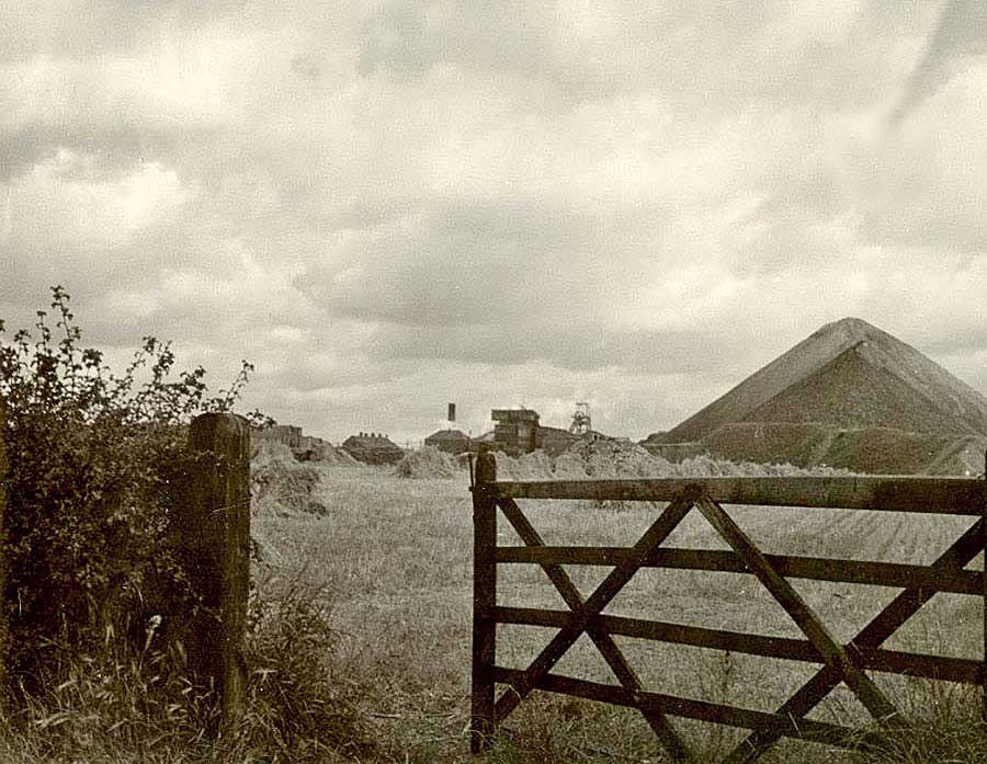
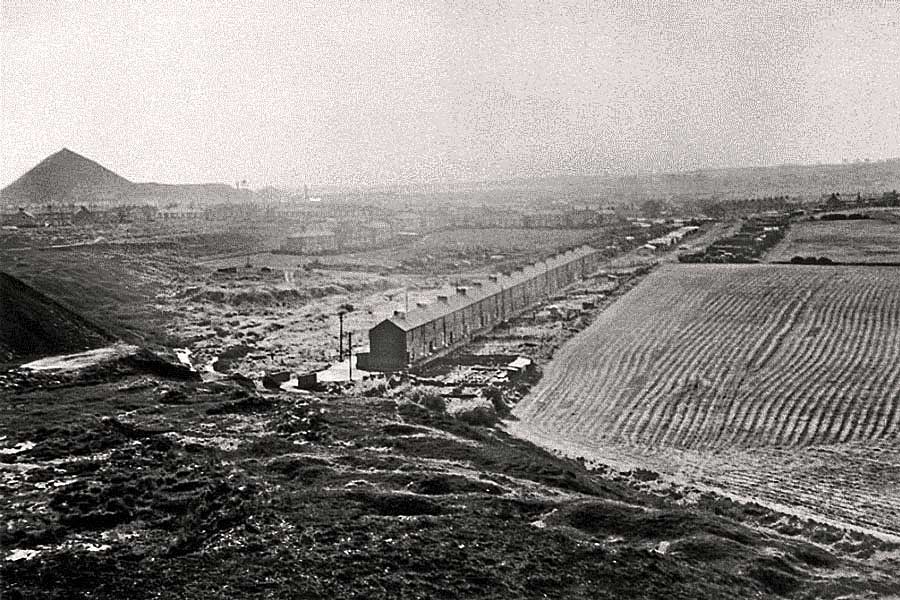
HALFWAY DOWN VILLAGE LANE
Across a Corn Field from Village Lane, not far downhill from Lily Terrace.
Note the Tippler on the small, darker Pit Heap.
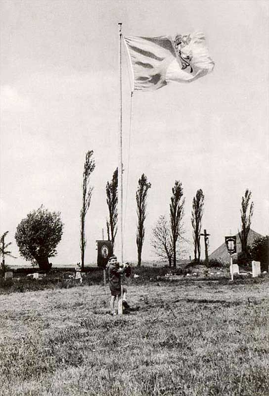
OUR LADY'S CHURCH, VILLAGE LANE
Colliery Chimney and 'F' Pit Heap from the Churchyard.
WASHINGTON VILLAGE
Looking up Spout Lane from the Bottom of Village Lane.
Cross Keys Inn on the right.
PATHWAY leading from WASHINGTON VILLAGE to USWORTH STATION ROAD
Known to locals as the Stile Inn Fields. The Path (off-picture, right) ran from
Washington Arms (↙) passing Gardeners' Club & Stile Inn (↗).
That's Church View in the background.
{ See Addendum below. }
• • ◊ • •
ADDENDUM
START of WALK to STILE INN from WASHINGTON VILLAGE

PATHWAY ENTRANCE leading to STILE INN FIELDS and STILE INN
The Ladies and Children are about to pass between The Auld Cop Shop and the Washington Arms.
( Photo: 1965 )
HEADING NORTH
PATHWAY from the AULD COP SHOP and WASHINGTON ARMS
I'm almost certain this is the Path I walked many times
in late 50s / early 70s. What do you think?
( Many Thanks Larissa. )
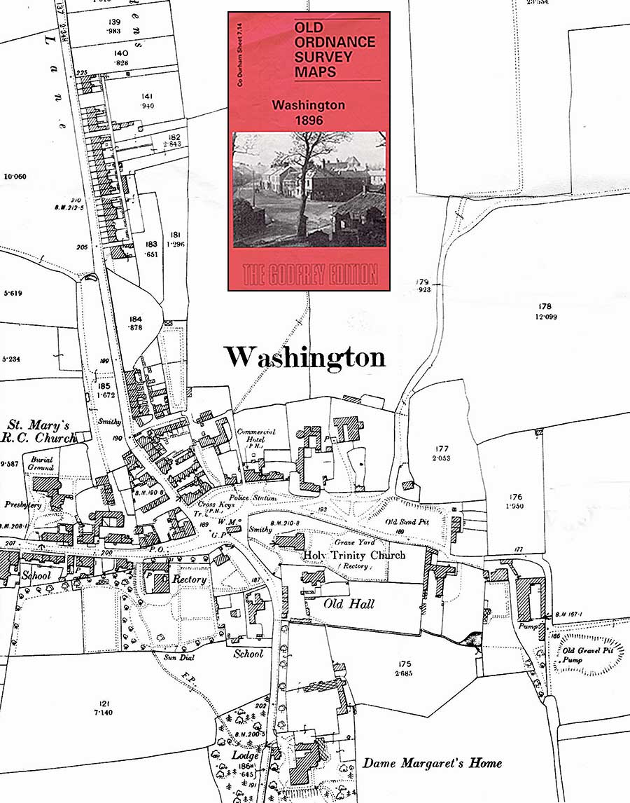
WASHINGTON VILLAGE - 1896
Note the Footpath at the top-centre (North) of the Map.
It heads South, bordering the Stile Inn Fields on its West side, before taking
a 45 degree turn towards the Police Station and Commercial Hotel (later, the Washington Arms).
It then joins the above Photo Path heading down to The Village Green, Police Station and Commercial Hotel.
NEARING END OF WALK
USWORTH GARDENERS' CLUB
Left to Right: Usworth Working Men's Club, Woodland Terrace and Usworth Gardeners' Club.
Stile Inn: off picture, left. Is that man bound for The Village via The Stile Inn Fields?
END OF THE WALK
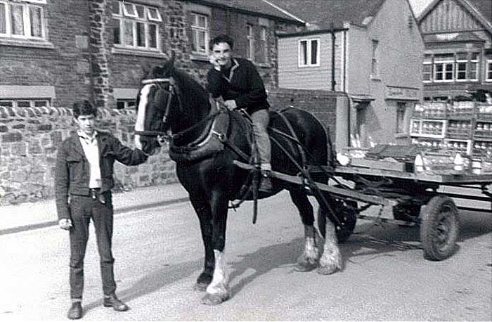
DESTINATION
Stile Inn Side Street - The Stile Inn - The Original Usworth Top Club
Peter Peverley, with Ronnie Smith on the milk cart horse.
END OF WALK - STILE INN from WASHINGTON VILLAGE via THE STILE INN FIELDS
USWORTH TOP CLUB - USWORTH STATION ROAD - THE STILE INN
The Walk ends at the Side Street opposite the Top Club.
Washington 'F' Pit Heaps
From The Mill House
FROM NEAR THE MILL HOUSE
Blackfell Army Camp & Washington 'F' Pit Heap - May 1965
[ Courtesy of Tyne & Wear Archives & Museums ]
Washington 'F' Pit Heaps
From High Usworth
TOP OF WELL BANK
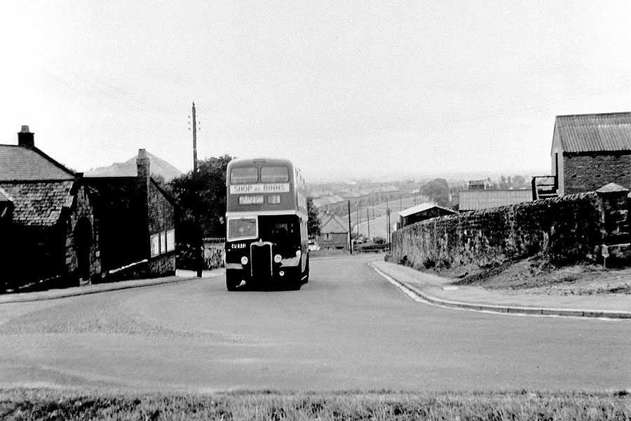
No. 25 Bus - Brady Square to Newcastle, Worswick Street - passing the Entrance to Susan Peareth's School.
Note The'F' Pit Heap, the side road to The Blue Bell, and Place Farm on the right.
BOTTOM OF WELL BANK
North Avenue is behind High Usworth School.
Note the junction of Well Bank Road and the top of The Drive - halfway along Eskdale Crescent.
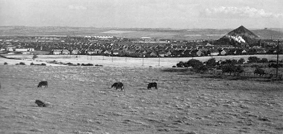
HIGH USWORTH
Same Day as Above Picture.
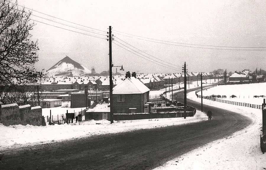
FROM PEARETH HALL ROAD - 1953
The flat Fields, used for future Donwell Village, viewed from close to Holy Trinity Church.
Note: Well Bank Road and Two 'F' Pit Heaps. Can you see Penshaw Monument?
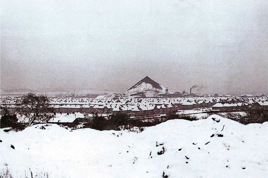
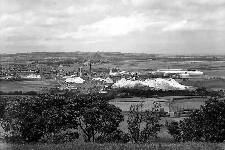
FROM PEARETH HALL ROAD
The lighter Fields, used for future Donwell Village, viewed from close to Springwell.
Note: Well Bank Road, Tube Investments and Penshaw Monument.
Washington 'F' Pit Heaps
From Blue House Lane
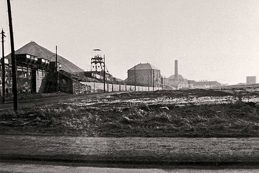
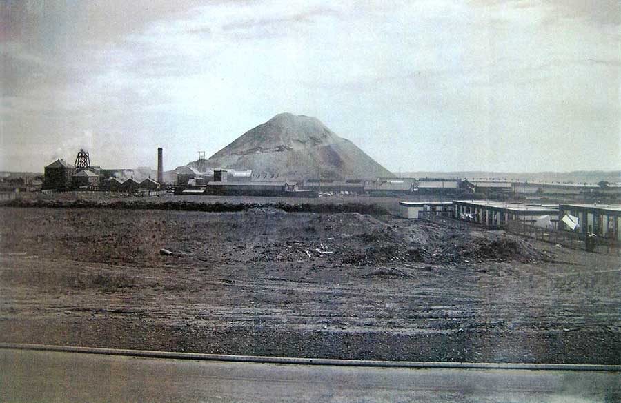
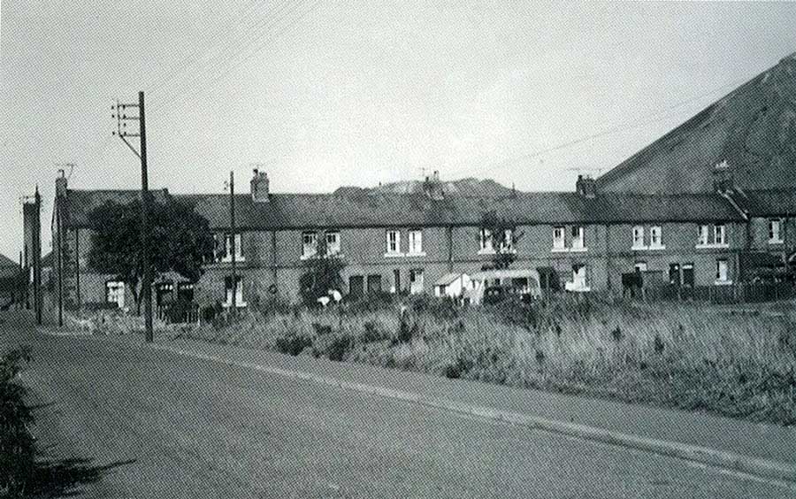
' THE PIT ROAD ENDS '
The Junction of Washington 'F' Pit Road with Blue House Lane - just off picture (left) - May 1965
The large Winding House contains today's Washington 'F' Colliery Museum and the 'Pit Road' became Albany Way.
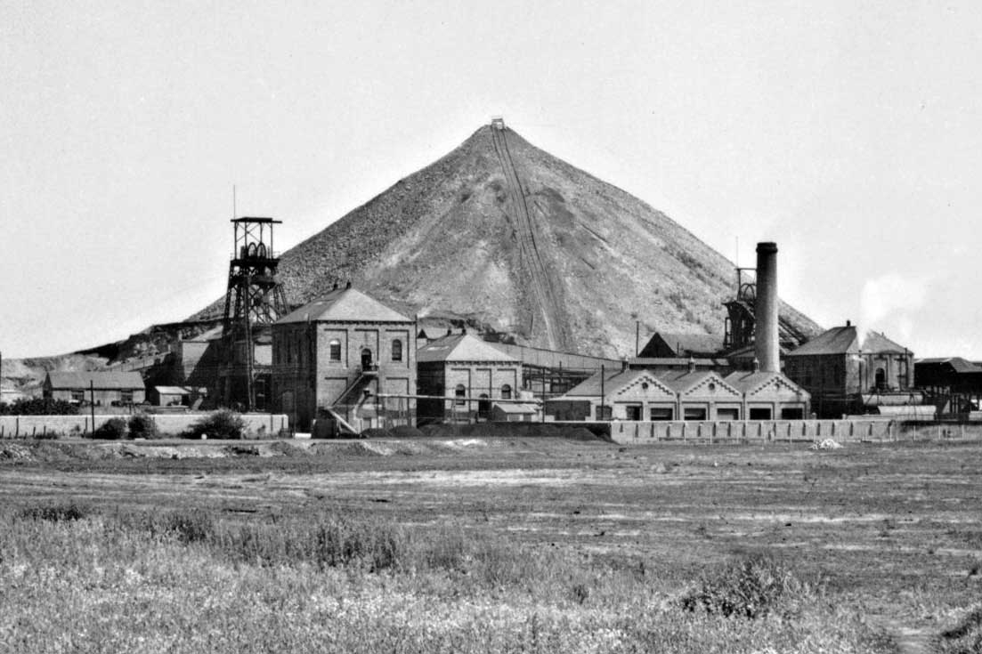
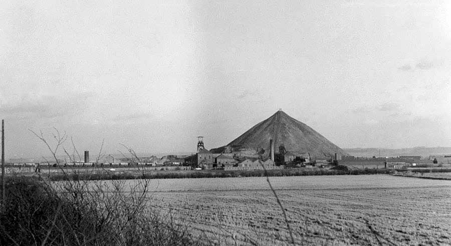
WASHINGTON 'F' COLLIERY
Washington 'F' Pit Heap - looking across the fields from Blue House Lane.
Two Winder Houses and the Tippler track up the Pit Heap.
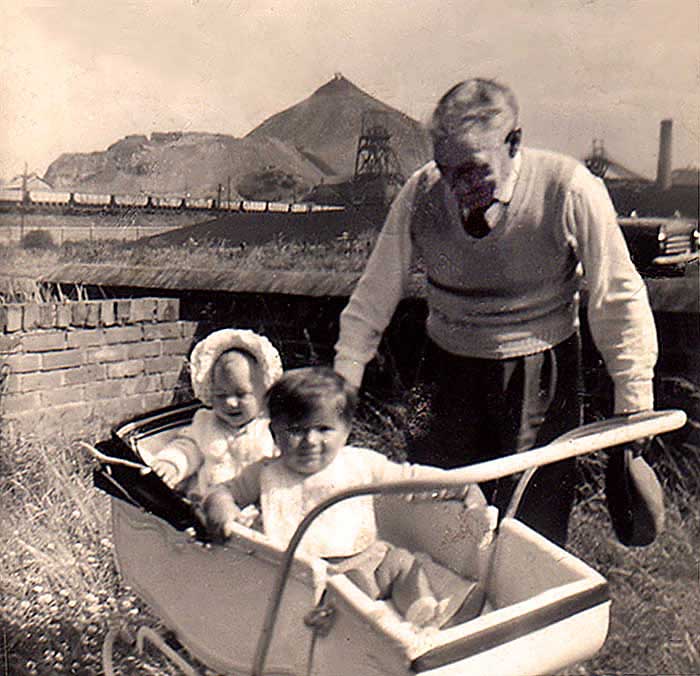
AGED MINERS' MEMORIAL HOMES
Tom Corrigan & Grandkids in the Garden of his House on Blue House Lane - 1961
[ Courtesy of Maureen James. ]
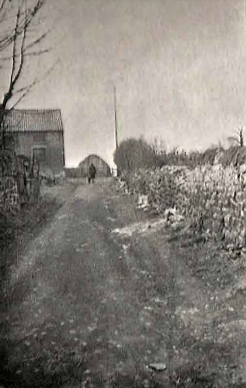
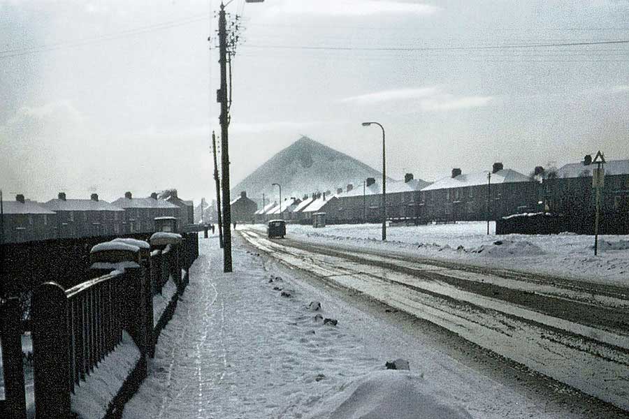
FURTHER UP BLUE HOUSE LANE
Looking towards Concord and The Pit Road Ends. Work is beginning on Albany Village.
'The Pit Road Ends' was a local name for the junction where the 'F' Pit Road joined Blue House Lane.
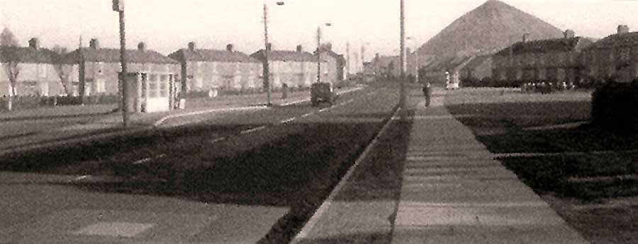
MORE DISTANT VIEW
Washington Brickyard Chimney (far left) - The Pit Baths (far right)
Village Lane and Brandy Row School (off-picture, right)
VIEW FROM HAVANNAH ROAD
( Close to Blue House Lane / Well Bank Road Roundabout )
View across the future Albany Village. Work has begun to remove the remaining Pit Heap.
FURTHER UP BLUE HOUSE LANE
( Close to Blue House )
Note the Footpath crossing the fields from Well Bank Road (left) to Village Lane & Raft Yard (right).
GRANARY ROW
( On The Pit Road - now Albany Way - looking towards Blue House Lane. )
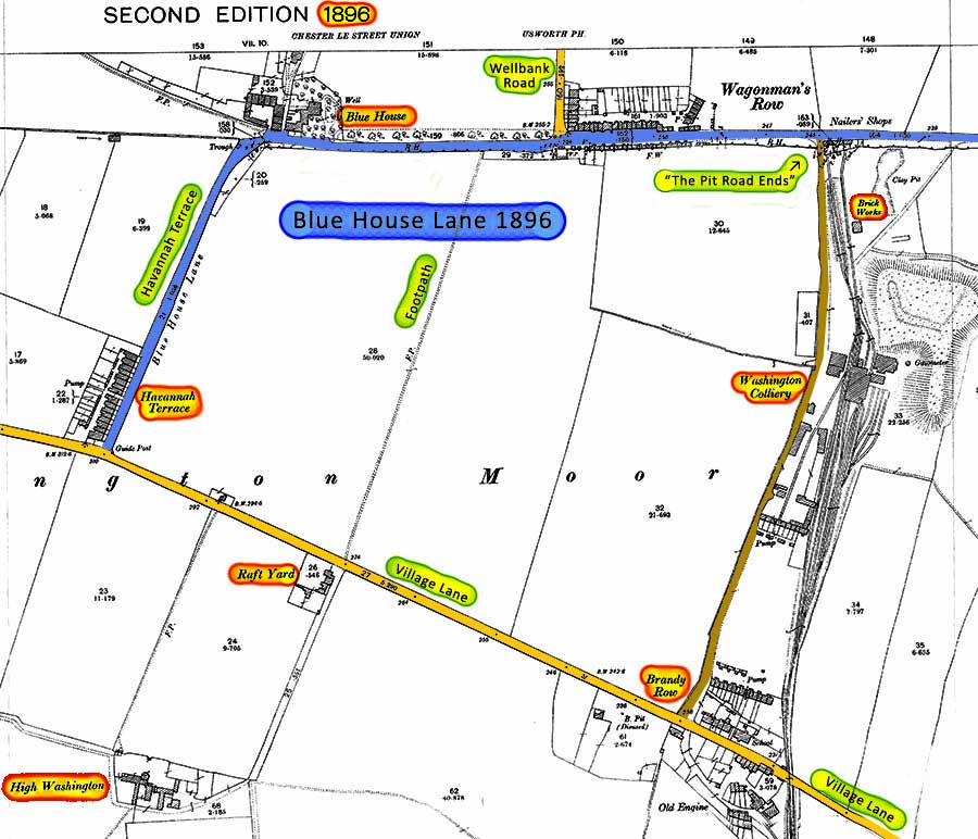
WASHINGTON 'F' PIT and MAJOR ROADS
( 1896 )
Washington 'F' Pit Heaps
From Heworth Road
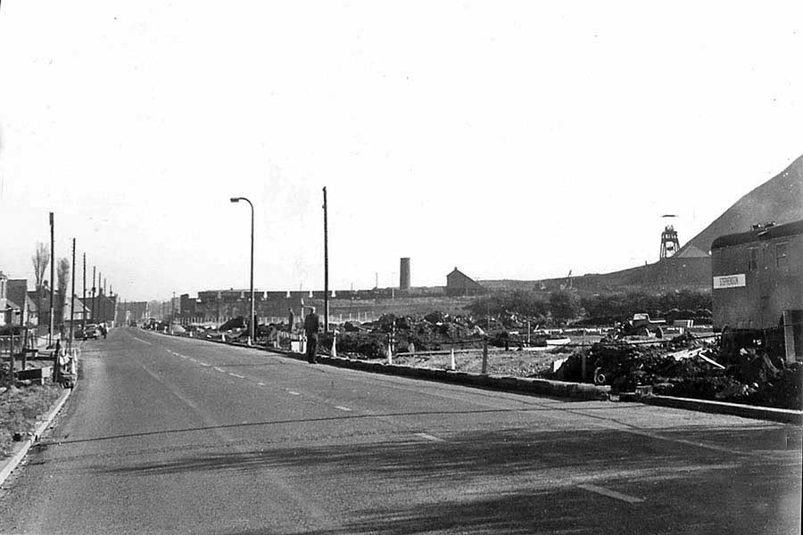
HEWORTH ROAD
The 'F' Pit Heap as seen from Heworth Road. Note the (waste stone) Tippler at the top - 1963
The junction with The Drive is to the right of the Van.
HEWORTH ROAD
On the left, Heworth Crescent ending at Heworth Road Shopping Terrace.
Among the shops: Handy (Woods) Shop - known to locals as Handy Wood's - and Lottie's Fish & Chips.
"Evening Rosie, two Papers and a Packet of Chips, please ... and plenty Batter!"
The men seated, centre-right are at the bottom of The Drive.
Washington 'F' Pit Heaps
From Grammar School Playing Fields
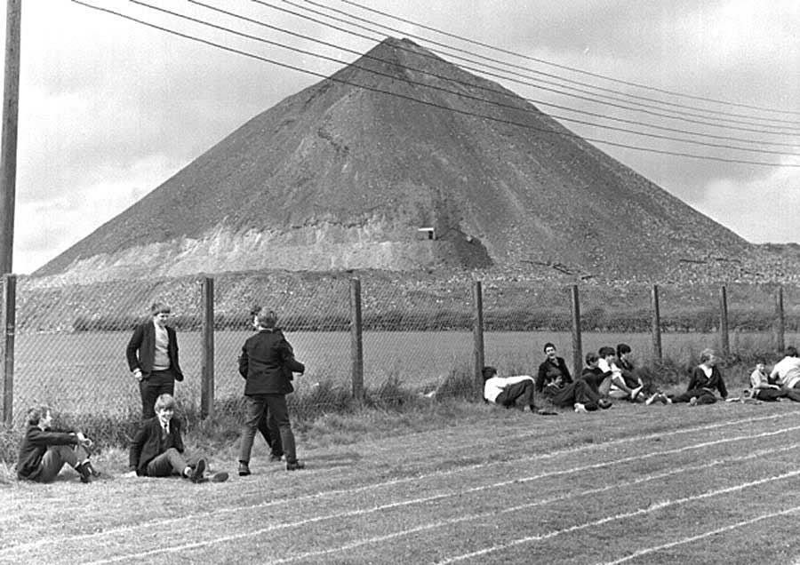
WASHINGTON GRAMMAR SCHOOL
Running Track ready for Summer Sports - Athletics, Cricket, Netball etc - May 1968
WASHINGTON GRAMMAR SCHOOL
The partially removed Washington 'F' Pit Heap together with the Grammar School Science Block.
Viewed from somewhere near the (future) Spout Lane pedestrian underpass.
Washington 'F' Pit Heap
From The Comrades Playing Fields
Removal In Progress
( Autumn 1968 )
WASHINGTON NEW TOWN REVIEW - No.4 ( Autumn 1968 Edition )
'F' Pit Heap from THE COMRADES Playing Fields.
Washington 'F' Pit Heaps
From Fatfield Road
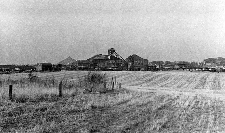
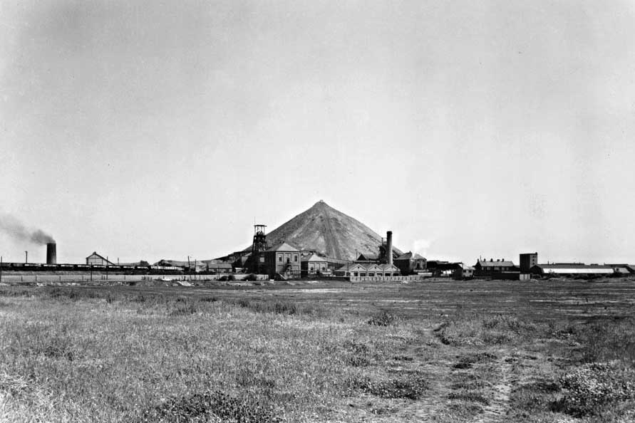
WASHINGTON GLEBE COLLIERY
From Fatfield Road, near the Victoria Hotel.
Washington 'F' Pit Heaps
Looking up Woodland Terrace
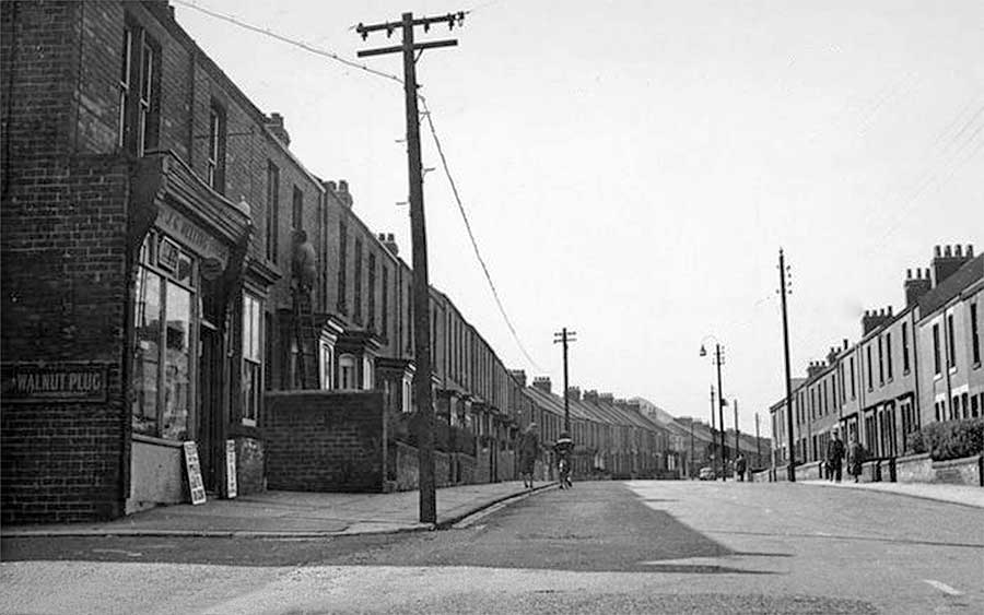
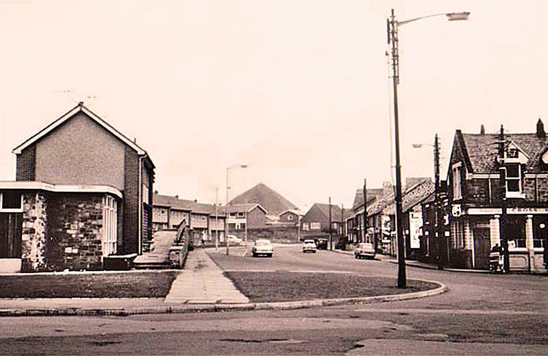
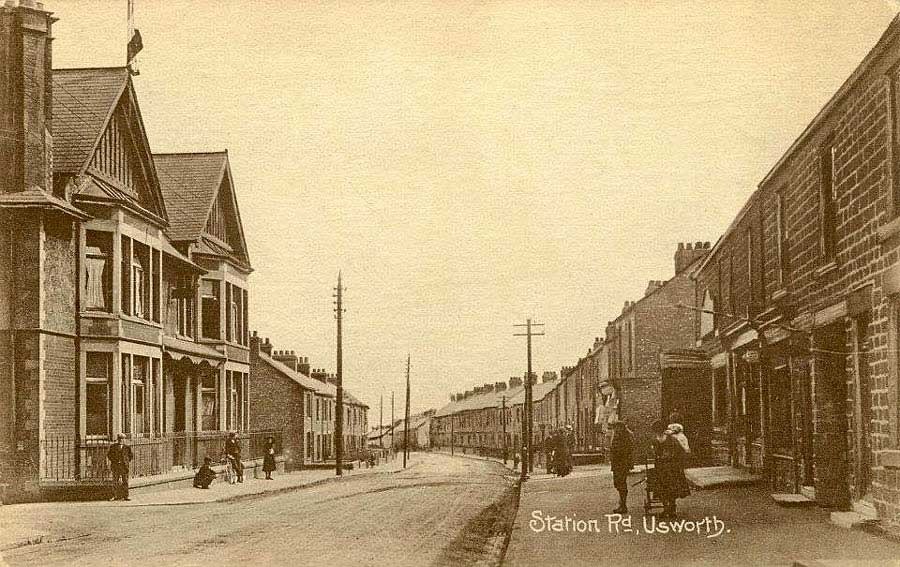
USWORTH STATION ROAD
Woodland Terrace (left) and Elliot Terrace (right)
Looking towards The Stile Inn, Front Street and The 'F' Pit Heap.
The Kings Cinema is located off-picture, bottom-right-hand corner of photograph.
( c. 1955 )
[ Did you notice the Window Cleaner? ]
Looking over Shafto Terrace
SHAFTO TERRACE
View from close to Usworth Gardeners' Club - a couple of hundred yards up The Stile Inn side street.
Looking over Shafto Terrace, Spout Lane and 'The Comrades' playing fields.
Note the Showmen's Camp Site behind Front Street.
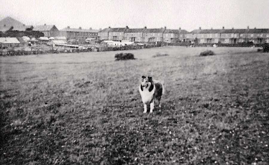
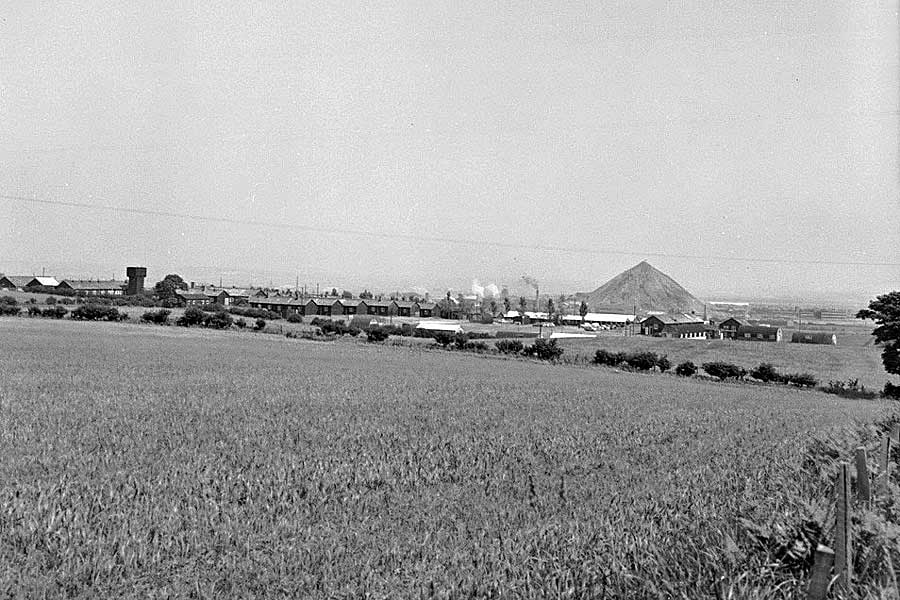
From Usworth Pit Heap
USWORTH PIT HEAP / SINGLE ROW
Washington 'F' Pit Heap (top-left) and partially removed heap, as seen from Usworth Pit Heap.
The Burn flowed between Don Gardens and Single Row, then turned 90 degrees to follow the Pit Heap to Usworth Hall.
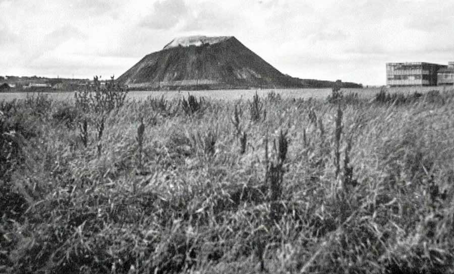
Washington 'F' Pit Heaps
From Penshaw Side of River Wear
PENSHAW MONUMENT
Washington Chemical Works - 1965
Note Coxgreen Station - bottom right corner.
[ Courtesy of Tyne & Wear Archives / Museums ]
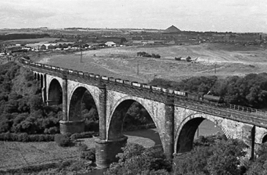
VICTORIA BRIDGE
The Leamside Line curves south from Washington Station as it approaches Victoria Bridge.
Note the 'F' Pit Heap on the horizon.
Washington 'F' Pit Heaps
Aerial View - 1964
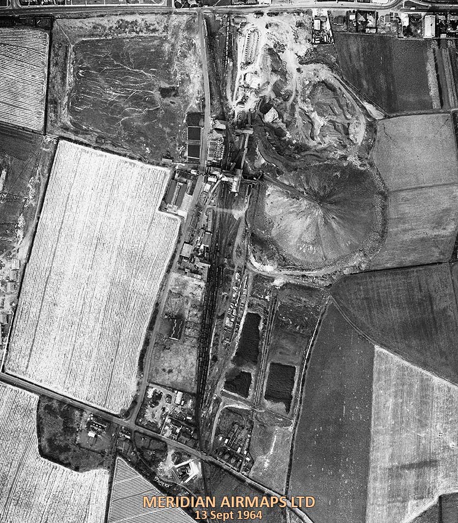
AERIAL VIEW of WASHINGTON 'F' COLLIERY
Blue House Lane from the Junction with Wellbank Rd to the junction with Victoria Rd, near the Ritz Cinema.
The Pit Road ( centre / vertical ) to Brandy Row School at the junction with Village Lane.
[ Compilation of 6 Photographs. Courtesy of Washinghton History Society. ]
Washington 'F' Pit Heaps
Location of the View Points in the Preceding Tabs
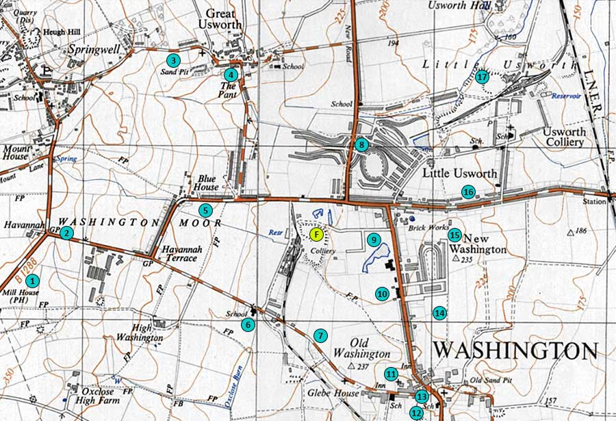
MAP: 1937-61
F. Site of Washington 'F' Colliery Pit Heaps
1. The Mill House, West of Blackfell Army Camp
2. Top of Village Lane - Washington Road Sign
3. High Usworth, Peareth Hall Road
4. High Usworth, Well Bank
5. Blue House / Blue House Lane
6. Brandy Row School, Village Lane
7. Village Lane, East of Colliery Wagonway
8. Heworth Road, between The Drive & The Oval
9. Comrades' Playing Fields - Shafto Terrace (Right)
10. Washington Secondary, later Grammar School
11. Our Lady's Church Cemetery
12. Washington Glebe Colliery
13. Bottom of Village Lane - Washington Village
14. Looking across 'The Stile Inn Fields'
15. Looking across Shafto Terrace
16. Usworth Station Road, near The Kings Cinema
17. Usworth Pit Heap, looking over Single Row