Washington County Durham
HOME WHAT'S WHERE JOHN ROBSON'S JOURNAL MINING COLLECTION 2
Memories of Springwell
Colliery & Village
- Springwell Colliery
- Blue Plaque / Key Events
- Spring Well
- Bowes Railway - Famous Visitors
- Cold War Bunker
- WW2 Decoy Site
A Brief History of Springwell Village & Colliery
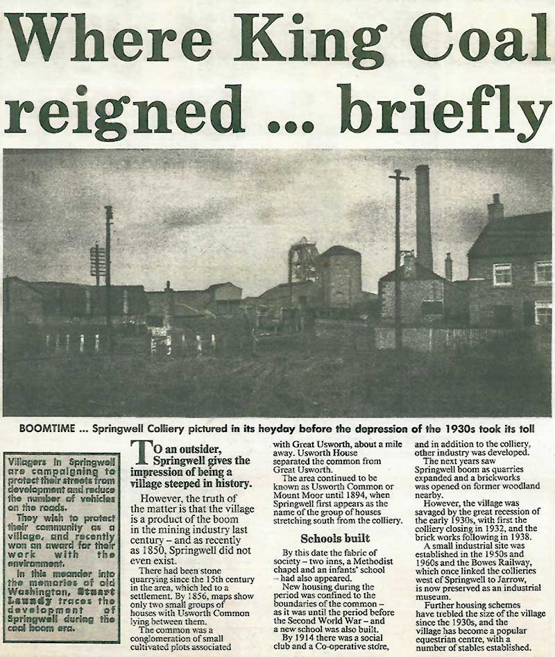
[ Written by Stuart Laundy ]
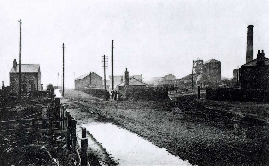
Springwell Colliery and the Bowes Railway Crossing on Springwell Road
[ Looking towards Springwell House. See Map below. ]
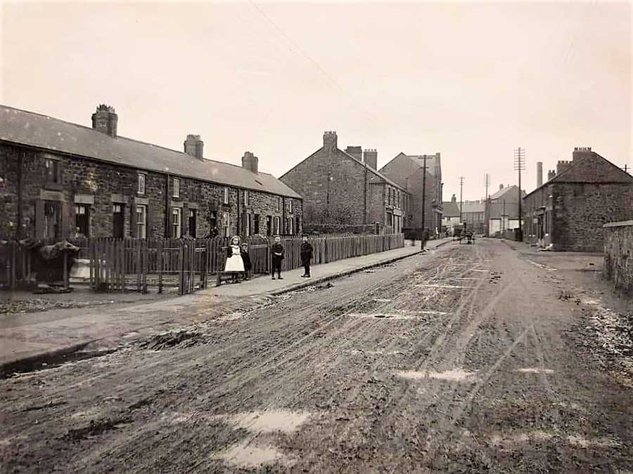
Springwell Road - Perseverance Arms & Coop Building, centre picture - Note the Colliery Chimney.
[ Looking towards the Bowes Railway Crossing. ]
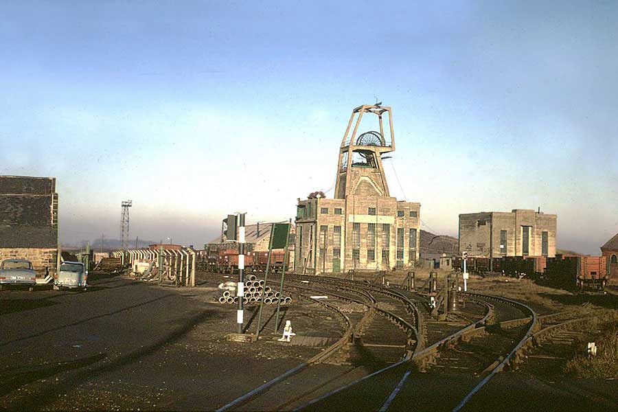
Bowes Railway at Springwell Colliery - 1967. This colliery closed in 1932.
[ Thanks to Photographer / Industrial Historian / Author, Colin E. Mountford. ]
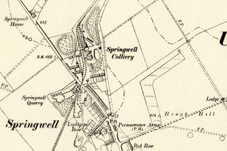
Map showing Bowes Railway passing through Springwell Colliery.
The Blue Plaque
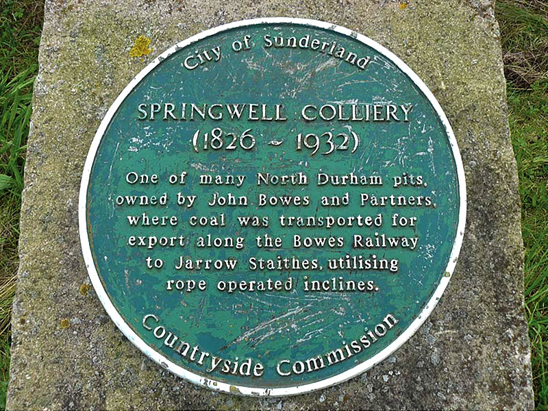
Located on a small Stone Pillar in the main car park of Bowes Railway Museum.
Brief History of Springwell Colliery
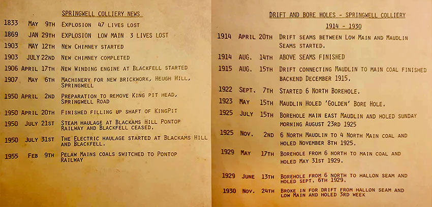
From 1833 to 1930
[ Origin of information not known. ]
* When you've finished exploring this Article, you'll find much more written Springwell History from John Robson's Journal. *
[ See Top Menu. ]
Springwell Colliery Chimney

Built: 12th May to 22nd July, 1903.

Demolished: 1st June 1935.
The Spring Well
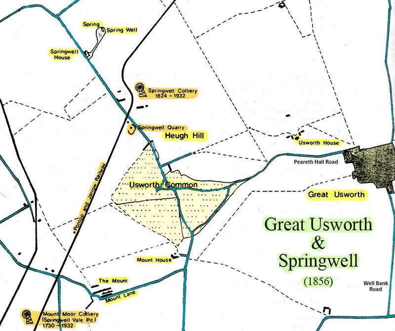
1856 Map
The Location of Spring Well
The Queen Mother
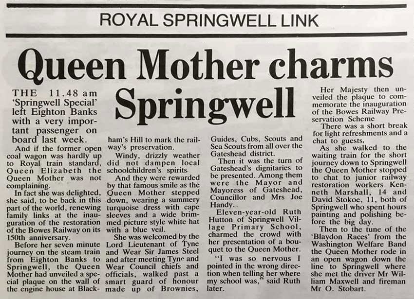
This unidentified Press Cutting describes the events that took place on 15th July 1976.
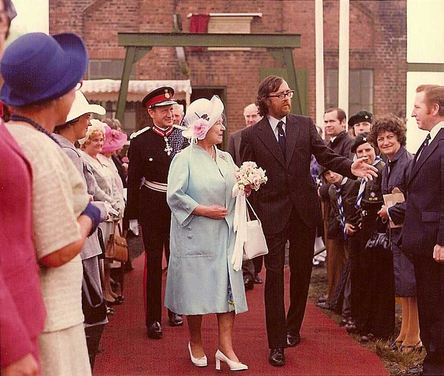
HM Queen Elizabeth, The Queen Mother, opening the Preserved Bowes Railway, 15th July 1976.
Dr Stafford Linsley (with HM) and Sir James Steel.
[ Picture courtesy of former Washington Grammer School pupil, Dr Linsley. ]
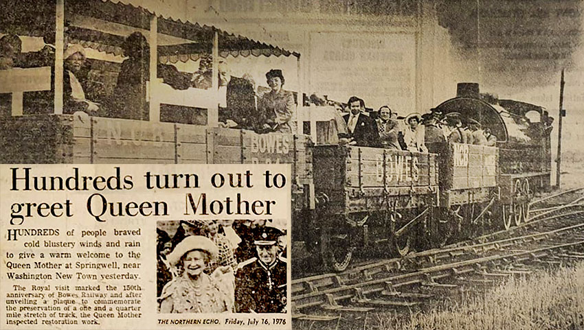
The Queen Mother takes a short steam train journey from Blackham's Hill to Springwell.
[ Edited version of Northern Echo article. ]
• • ◊ • •
Fred Dibnah
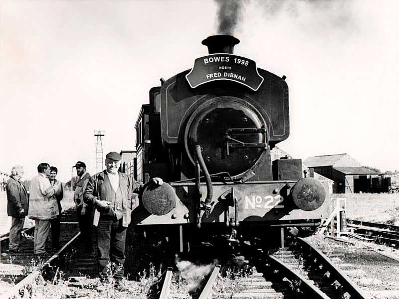
Fred Dibnah visiting Bowes Railway Museum at the former Springwell Colliery.
[ Want more details about Bowes Museum? Open a New Page: Bowes Railway Museum ]
• • ◊ • •
George & Robert Stephenson
[ Highly Likely! ]
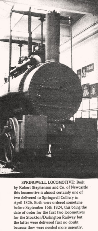
One of Two Locomotives built by Robert Stephenson and Co.
for Springwell Colliery. Delivered in 1826.
[ Thanks to Leon Morgan ]
Springwell Bunker
![]()
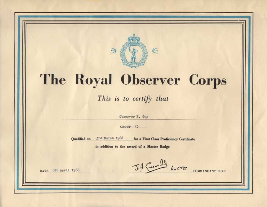
Royal Observer Corps
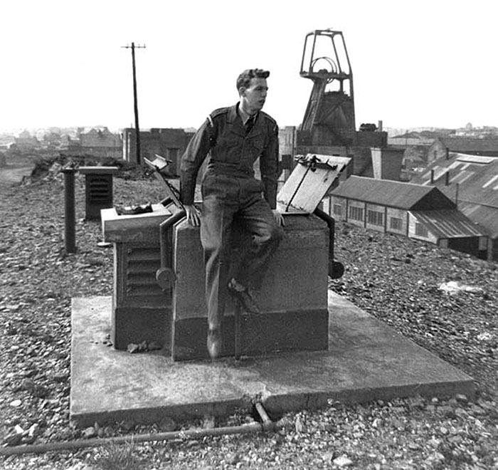
Washington's Ernie Guy pictured at Springwell Bunker - 23rd April 1961
Observer Tommy Cairns (centre)
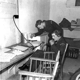
Inside the Springwell Bunker
Officially called the Springwell Observation Post, Springwell Bunker was a blast-proof structure built underground in an old spoil heap at Springwell Colliery. It was manned by civilian volunteers of the Royal Observer Corps (ROC). This bunker was one of many underground observation posts that formed part of Britain's defences during the Cold War. It opened in May 1959 and was equipped with high-tech surveillance equipment. The bunker remained operational until October 1968 and was demolished soon after its closure.
ROC Observer Ernie Guy (pictured above) says, Being in the bunker wasn't glamorous work. There were usually four of us down there in cramped conditions 12ft underground.
We boiled in the summer and froze in the winter. There were beds down there but they were never used. It was just in case there was a nuclear strike and we were stuck inside.
[Quote from Sunderland Echo - 4th December 2000]
The ROC was active from 1925 to 1996 and was set up to provide Aircraft Recognition / Reporting. With the onset of the Cold War, its role changed to providing Nuclear Warfare Analysis and Fallout Warnings.
The Royal Observer Corps motto was Praemonitus Praemunitus - Forewarned is Forearmed.
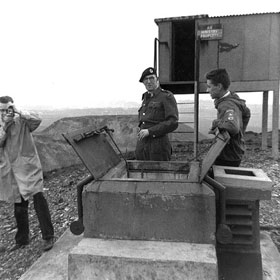
Photographs of Springwell Observation Post, taken during exercise 'Double Blank' on 23rd April 1961.
[ Displayed on this Website courtesy of Mr Guy, Member of Washington History Society. ]
• • ◊ • •
ROC TEST CERTIFICATE
![]()
The above Certificate was awarded to ROC Members who had passed an annual Aircraft Recognition Test at Master Level. It came with a blue Spitfire Badge which could be sewn onto the shoulder of a uniform blouse.
I received mine after our post was stood down, so I never had the chance to show it off. I had to return my uniform! Although nuclear fallout reporting became the main task of ROC posts, aircraft recognition was still practised and ROC members could attend an annual aircraft recognition test.
Successful members were awarded the above Certificate and were entitled to wear the blue Spitfire Shoulder Badge.
ROC Certificate, Spitfire Badge and Information: Courtesy of Ernie Guy.
• • ◊ • •
The Precise Location of Springwell Bunker: NZ 2856 5901
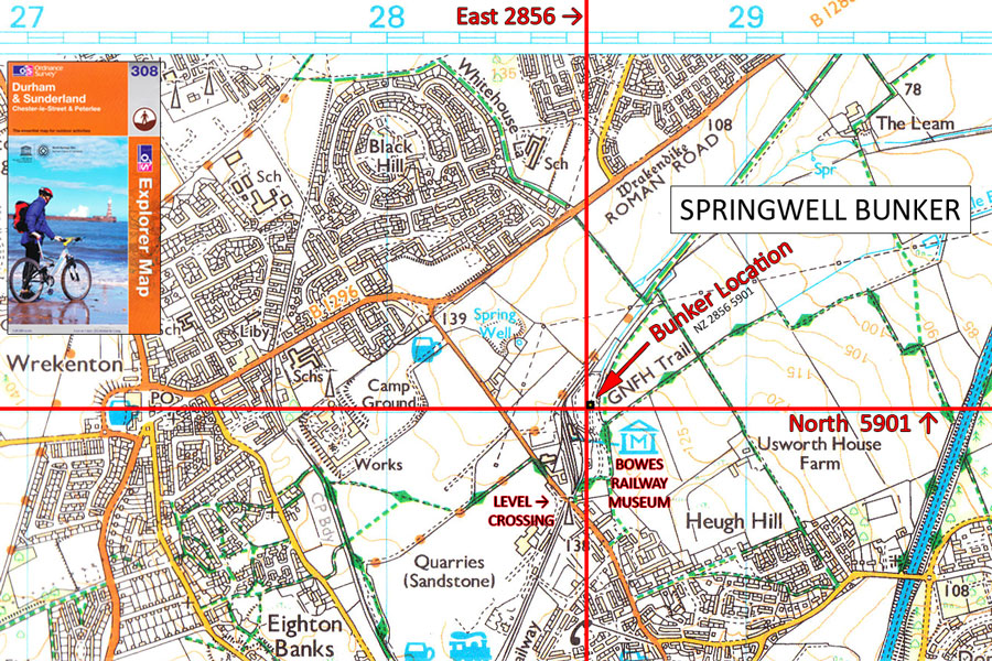
Ordnance Survey Explorer Map No. 308
The eight-figure National Grid Reference NZ 2856 5901 locates Springwell Bunker within a 10m x 10m square on the above map.
Approximate Location of Springwell Bunker
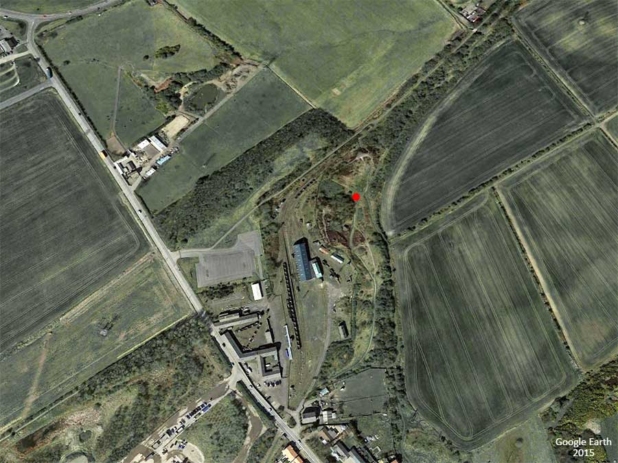
Aerial View of the former Springwell Colliery, now Bowes Railway Museum - Courtesy of Google Earth
The red dot is positioned very close to the now filled-in Springwell Observation Post - manned by the Royal Observer Corps in the 1960s.
Personal Observation:
I wandered around the old pit heap, on Thursday, 5th January 2017, hoping to take a photograph of the area around the demolished Observation Post.
This site has changed greatly over the last 50 years. The muddy footpaths are OK but the terrain now resembles an old battlefield.
It features many hills and hollows {some with steep sides), large blocks of rubble, and there's rubbish all over the place.
I couldn't find any evidence of the bunker's location. Thinking of paying a visit? My advice is: think again!
N.B. Bowes Railway Museum is completely separate from the pit heap and well worth a visit.
Springwell Civil Decoy Site - World War II
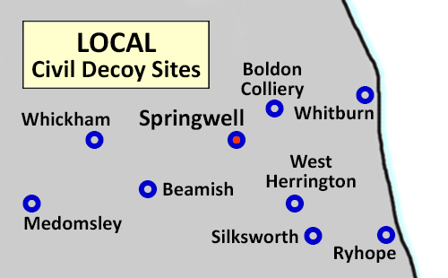
Civil Decoy Sites near Washington
INSTALLATIONS PROTECTED BY DECOY SITES
Beamish ... Low Fell Marshalling Yard
Boldon Colliery ... Tyneside Docks
Medomsley ... Consett Iron Company
Ryhope ... Sunderland Docks
Silksworth ... Silksworth Coke Ovens / Marshalling Yard
Springwell ... North Bank of Tyne / Naval Dock Yards
West Herrington ... Sunderland Forge
Whickham ... Blaydon Colliery / Marshalling Yard
Whitburn ... Tyneside Docks
During World War II the North East's defences included a Civil Decoy Site near Springwell. It was built close to the flight path that German bombers would have to take on their way to the Naval Docks on the River Tyne. Decoy Sites were usually located in open fields and were used to simulate real targets such as Factories, Railway Marshalling Yards, Iron Works and Docks. The idea was to fool enemy aircrew into dropping their bombs and incendiary devices before they reached their planned target. The deception was carried out with the ingenious use of carefully placed electric lights and fires. In the darkness these lights and fires could be made to simulate the 'protected' target. Civil Decoy Sites were run by the ARP or Civil Defence. Springwell Site was active c.1941-43 and is now part of the George Washington Golf Course.
This would explain local stories of horses and cows in the High Usworth area being killed by German bombs.
• • ◊ • •
The Location of Springwell Civil Decoy Site: NZ 301 592
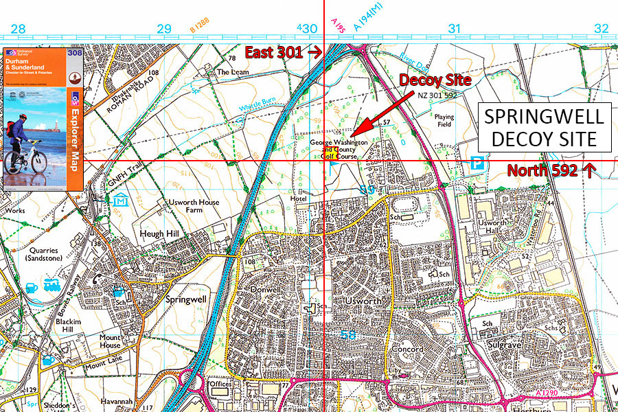
Ordnance Survey Explorer Map No.308
[ The six-figure National Grid Reference NZ 301 592 locates Springwell Decoy Site within a 100m x 100m square on the above map. ]
The Location of Springwell Civil Decoy Site Control Centre
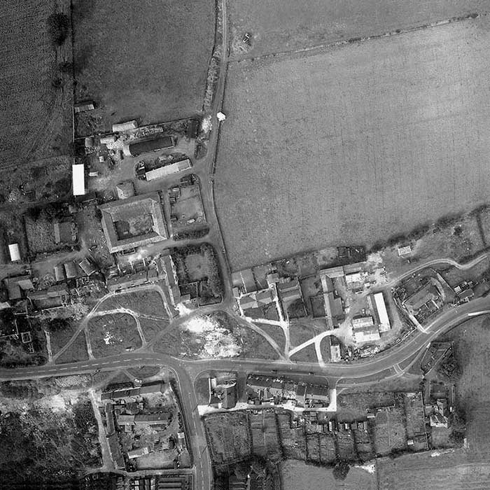
Aerial View of High Usworth Village showing Farms, Pubs, Old School House etc. - Sept. 1964
The recently built Coach Road Estate is just off-picture, bottom-right.
[ From a Washington Development Corporation Document ]
Note the small Group of Buildings - top of picture - to the right of The Lonnen (vertical track).
That was the Control Bunker for the World War 2, Bombing Decoy Site.
[ The Lonnen passed through the word 'Hotel' at the centre of OS Map. ]
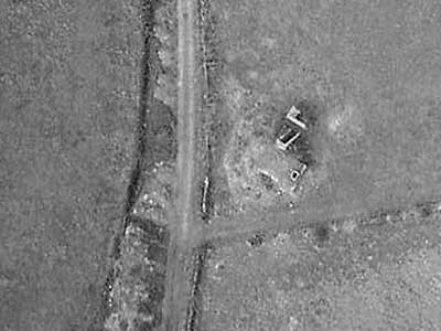
Close-up of the grassed-over Decoy Site Control Bunker
showing Entrance, Blast Wall and Escape Hatch.
[ Thanks to Washington History Society Member, Ernie Guy, for the above images and information. ]