Washington County Durham
HOME WHAT'S WHERE MORE FARMS
Memories of Washington
High Usworth Farms
High Usworth Farms
Stone Cellar Farm
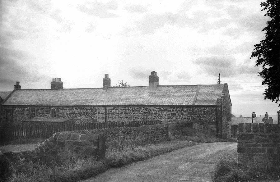
STONE CELLAR FARM
J. Shaw's Stone Cellar Farm at High Usworth (1960s). Note the 'F' Pit Heap and Headgear.
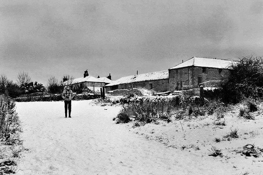
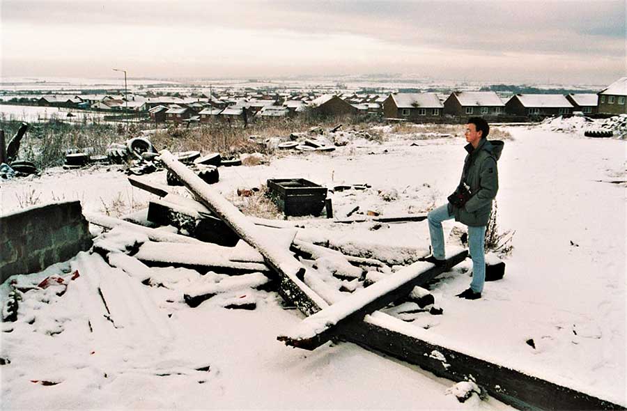
STONE CELLAR FARM - WINTER 1986
Ernie Guy, Member of Washington History Society, standing in front of the Farm House at Stone Cellar Farm.
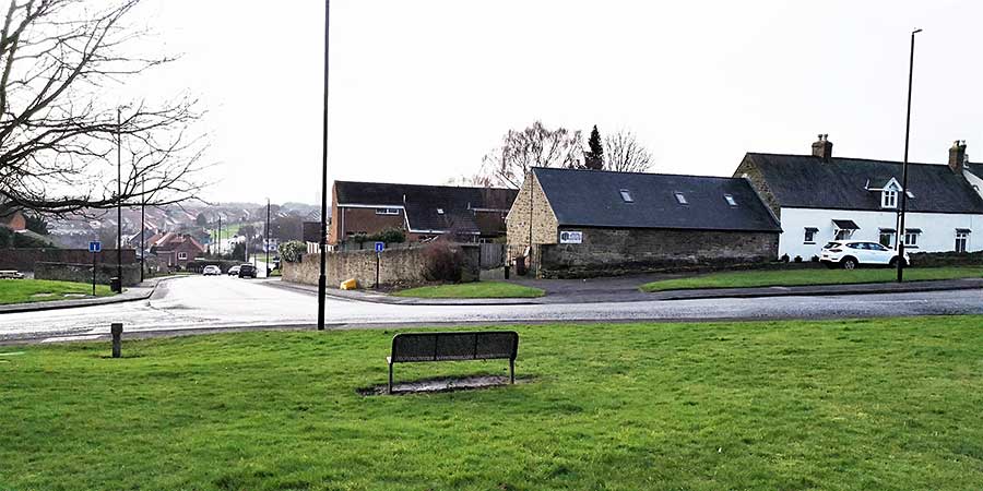
High Usworth Village Green, Blue Bell Inn & Well Bank are on the other side of the Farm Buildings.
Stone Cellar Farm was demolished a few months later. The Farm House still exists.
[ Photographer: Ernie's son, Ian Guy, 1986. ]
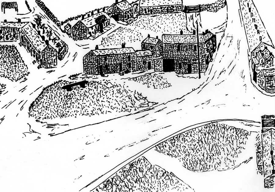
STONE CELLAR FARM
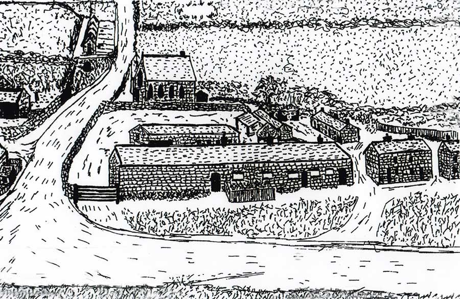
The Lonnen (top-left) - Stone Cellar Farm - Jackson's Buildings
Old Coach Rd (aka Front Street, 'heading up') - New Found Out Inn - Blue Bell
Susan Peareth's School - Wellbank Road (heading right) - Peareth Hall Rd (bottom-left)
[ Courtesy of Washington History Society ]
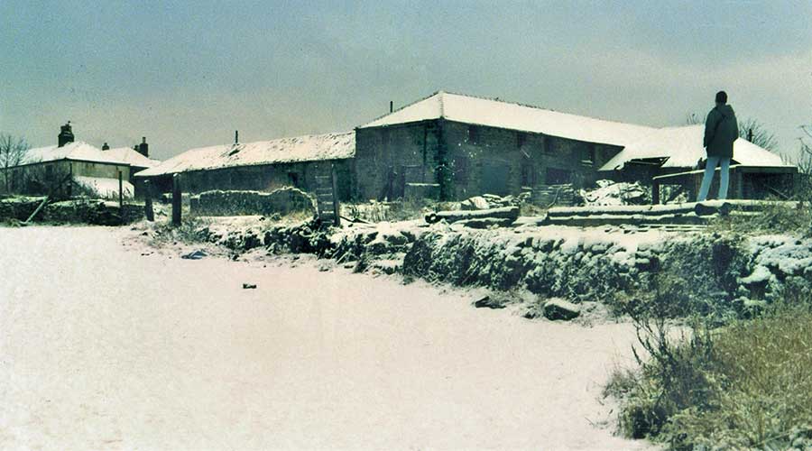
STONE CELLAR FARM
Ian Guy at Stone Cellar Farm
[ Photographer: Ernie Guy, 1986. ]
Place Farm
PLACE FARM
Looking down Well Bank - The Former Place Farm
The Red Lion was off-picture, to the right.
[ Photographer: Ernie Guy, 16th January 2020 ]
PLACE FARM
Susan Peareth's School - The Rectory - Well Bank - Methodist Chapel - Place Farm - Peareth Hall Rd
[ Courtesy of Washington History Society ]
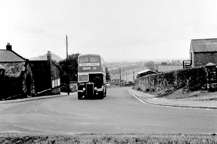
No. 25 BUS
SUSAN PEARETH'S SCHOOL - PLACE FARM
(Brady Square to Worswick Street, Newcastle)
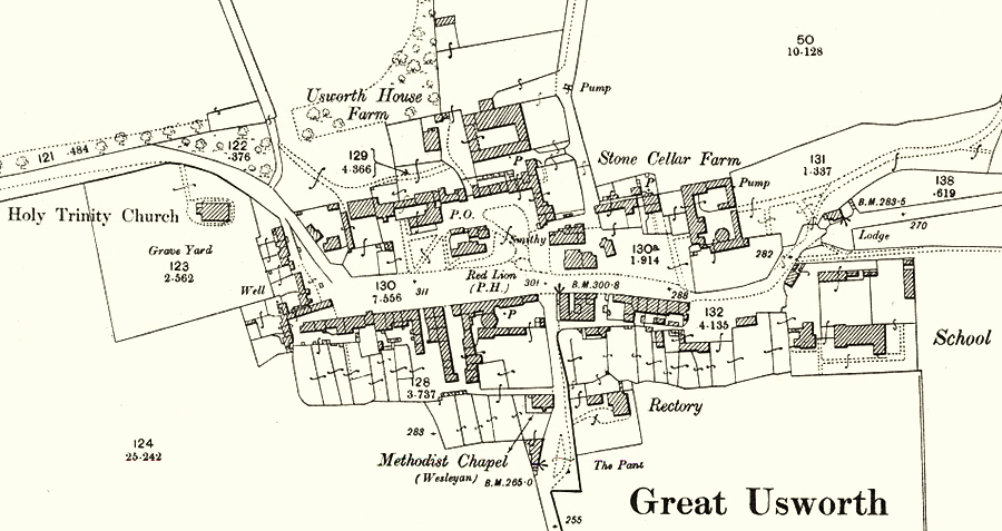
Maps of Great Usworth
HIGH USWORTH FARMS
Extract from Leo Bottoms' Book: On The Doorsteps Of Washington
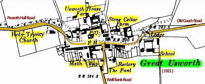
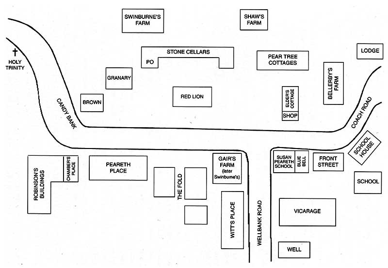
USWORTH HOUSE FARM, PLACE FARM & STONE CELLAR FARM
Usworth House (off-picture-left) became better known as Peareth Hall.
Place Farm is between P.H. - The Red Lion - and Well Bank.
[ See: What's Where; Maps etc; Halls & Castles ]
Extract from O.S. 25 Inch Map, 1892-1914.
STONE CELLAR FARM
Ian Guy with his back to the north side of Stone Cellar Farm
Ian is looking north east. On his right, the Old Coach Road passes in front of Coach Rd Estate.
He's looking at fields that at are now covered by new housing estates and the George Washington Hotel / Golf Course.
[ Info & Photo: Thanks to Photographer Ernie Guy, Ian's Dad - 1986. ]
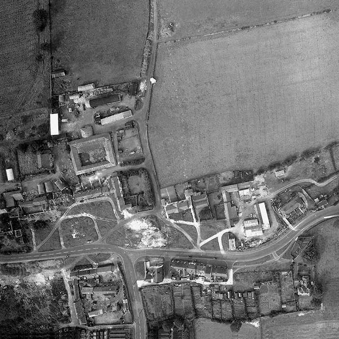
Aerial View of High Usworth Village showing Farms, Pubs, Old School House etc. - Sept. 1964
The recently built Coach Road Estate is just off-picture, bottom-right.
[ From a Washington Development Corporation Document ]
• • ◊ • •
Note the small Group of Buildings - top of picture - to the right of The Lonnen (vertical track).
That was the Control Bunker for the WW2 Bombing Decoy Site.
[ More at: What's Where / Misc / Springwell Bunker. ]